collaboration

Looq AI and the Canadian Hydrographic Association Join Canada’s National Geomatics Expo

Canada’s National Geomatics Expo 2024 is set to bring together leaders and innovators in geospatial technology, and this year, we’re…

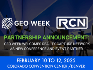
Geo Week and Reality Capture Network Announce Strategic Partnership

Geo Week and Reality Capture Network Announce Strategic Partnership

Reality Capture Network will host a dedicated conference track at Geo Week in Denver, CO Portland, Maine – July 10,…

GIS SAIT Industry Night March 20th, 2024

SAIT GIS Students Industry Night – March 20th, 2024

Calgary – The SAIT Bachelor of Applied Technology: Geographic Information Systems (BGIS) Student Club is thrilled to extend an invitation…

The GoGeomatics Expo Welcomes On Board CIDCO & ICIS

We are happy to announce that The Interdisciplinary Centre for the Development of Ocean Mapping (CIDCO) and The Integrated Cadastral…

Reveal

Reveal Presents Building Unified Utility Models for Major Civil Infrastructure Projects: SUMSF 2023

Reveal’s CEO and founder, Sam Wiffen, held a livestream presentation on Tuesday, May 16, during SUMSF 2023. The topic of…

TopoDot - How to Choose the Best Point Cloud Processing Software

TopoDOT: How to Choose the Best Point Cloud Processing Software

Originally published by Mike Cook on September 2, 2021. You got a point cloud, great! Now what? You need a…

Bim and Digital Twins Digest for September 22, 2022

Montreal Conference 2022 Expects Large International Crowd,Open BIM has Advantages Over Closed BIM,New Testing Options Offered at Windsor’s VR Cave,Digital…

Cansel Offers NavVis VLX Wearable Mobile Mapping Systems to Canadian Geospatial Market

Get ready, engineers, surveyors, and geospatial professionals. A new wearable mobile mapping system is coming to Canada, NavVis VLX. NavVis…

buildingSMART International Standards Summit – Montreal 2022

For the first time since 2014, the buildingSMART International Standards Summit will be held in North America from October 18,…

NYC’s Underground Infrastructure Interoperability is discussed at SUMSF

The UNUM project shows the benefits of infrastructure collaborations. At a March 23, 2022, SUMSF live stream presentation, participants were…

Deploy Software Solutions Fills in the Communication Gap When Needed Most

Improving Communication Between Citizens and Authorities During Disasters During GeoIgnite, Winter Geo livestream on March 2, 2022, Nick Kellet, Founder…

New Teledyne Geospatial combines world-leading expertise of CARIS & Optech to deliver comprehensive solutions for land and sea

Vaughan, Ontario, CANADA – September 14, 2021 – Teledyne announces the launch of a geospatial group with the unification of its…