• facebook
  • Twitter
  • Linkedin
  • Youtube
  • Linkedin Group
  • Post a Job
  • Post an Ad
  • Post an Event
  • Post a Directory Listing
  • Post a Press Release
  • Media Kit
  • My Account
  • Login
GoGeomatics
  • MAGAZINE
    • BIM & GIS
    • Community
    • Conference news
    • Earth Observation
    • Education & Careers
    • GEOAI
    • Announcements
    • Reality Capture & Lidar
    • Science
    • Technology
  • Directories
    • ASSOCIATION
    • INDUSTRY
    • EDUCATION
    • Open Data
  • EVENTS
    • GeoIgnite Events
    • Events Calendar
    • GoGeomatics Meetups
  • Services
    • Advertising
    • Marketing
    • Post a Job
    • Post an Ad
    • Post an Event
    • Post a Press Release
    • Post a Directory Listing
    • Media Kit
    • Web Design
  • Find a Job
  • Volunteer
    • Start a GoGeomatics Group
    • Editors & Writers Group
  • About Us
    • About Us
    • Contact Us
    • Frequently Asked Questions
  • Videos
Homedesign

design

|||||||
Community

Operational GIS Jobs in the Canadian Military

7 November 2016 Richard Davenport | aerial

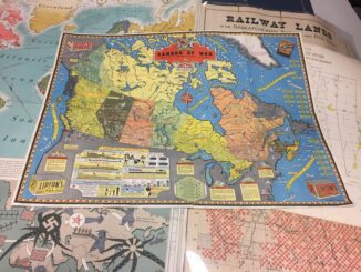
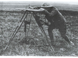
Whether its businesses, governments or for personal use, Geomatics offers everyday solutions to the worlds questions. The Canadian Armed Forces is no exception. These highly trained and dedicated Geo Techs  are members of the Military […]

Newsmakers & Press Releases

New Brunswick: CARIS Announces release of HIPS and SIPS™ 10

1 November 2016 GoGeomatics Newsmakers | 2016

Fredericton, NB, Canada – November 01, 2016 – Teledyne CARIS™ is pleased to announce the release of HIPS and SIPS™ 10. This release introduces exciting new capabilities for automation, efficiency, and usability through the integration of […]

No Picture
Newsmakers & Press Releases

NB 911 Bureau Receives Esri Canada Award of Excellence in GIS

26 October 2016 GoGeomatics Newsmakers | 2012

FREDERICTON, Esri Canada User Conference – October 25, 2016 – Esri Canada today presented the NB 911 Bureau, a branch of the New Brunswick Department of Justice and Public Safety, with an Award of Excellence […]

||||||
Community

Canadian Cartography: GoGeomatics Edmonton Visits the University of Alberta Map Library & Collections

21 October 2016 Jon Murphy | africa

Last night the Edmonton GoGeomatics Group had the chance to explore the amazing collection of historic maps at the University of Alberta (U of A).  Larry Laliberte, the U of A GIS Librarian, introduced the […]

||||
Education & Careers

Canadian Surveyors “Remark” on History with Elk Pass Boundary Restoration Survey

17 October 2016 Association of British Columbia Land Surveyors | 2012

The Alberta-British Columbia Boundary Commission has just completed a monument restoration survey to restore a number of deteriorated provincial boundary monuments in the Elk Pass area of the Rocky Mountains. The work was undertaken by […]

||
Education & Careers

UAVs in Canada – Key Exposures to Loss and Ways to Protect Yourself

3 October 2016 Association of Ontario Land Surveyors | 2014

This article was written by Mark Sampson for the Association of Ontario Land Surveyors. Mark’s contact details are at the bottom of the article and here is a direct link. Drones are referred to interchangeably […]

|
Technology

LiDAR in Canada: Conversation with Dr. Chris Hopkinson Research Chair Remote Sensing University of Lethbridge

6 September 2016 Robert Maher | 3D

The author Bob Maher (BM) and Chris Hopkinson (CH) both worked as scientists at the Appied Geomatics Reearch Group (AGRG) between 2004-2011. Five years later, it was time to catch up. Chris is currently Research […]

No Picture
Newsmakers & Press Releases

Airobotics Selects SimActive’s Photogrammetry Software for its Automated Industrial Drone Solution

30 August 2016 GoGeomatics Newsmakers | 2016

Montreal, Canada, August 30th, 2016 – SimActive Inc., a world-leading developer of photogrammetry software, is pleased to announce that Airobotics has chosen Correlator3D™ for its drone platforms. The software will be used to derive mapping […]

Posts pagination

« 1 … 3 4 5 … 29 »

Events

Notice
There are no upcoming events.

View All Events

Services

  • Post a Job
  • Post an Ad
  • Post an Event
  • Post a Directory Listing
  • Post a Press Release
  • Media Kit
  • My Account
  • Login

Jobs

Post a Job
  • Canada Maps and Poster Gallery Volunteer Leads — GeoIgnite 2026
    remote
  • GIS & Data Analytics Lead
    Beaumont, AB
  • Lead Surveyor, Projects/Arpenteur-géomètre principal, projets; arpenteuse-géomètre principale, projets
    North Bay, Thunder Bay
  • Senior GIS Developer
    Calgary, AB
View All Jobs
  • Directories
    • Associations Directory
    • Industry Directory
    • Education Programs
    • Open Data
  • Volunteer
    • Start a GoGeomatics Group
    • Editors & Writers Group
  • About Us
    • GoGeomatics Media Kit
    • Who We Are
    • Contact Us
    • FAQ’s
    • Advertising
    • Marketing
  • Subscribe
GoGeomatics
GoGeomatics is the largest and most popular communications hub promoting the Canadian geospatial community. The business was incorporated in 2011. GoGeomatics hosts over 100 fun, free, location technology networking events each year in cities across Canada.

© 2025 GoGeomatics

  • facebook
  • Twitter
  • Linkedin
  • Youtube
  • Linkedin Group