digital

Wanted – A GNSS Puck

“I want it! I want it! I want it!” – “Magic Bus” – The Who The Glass Floor. There is…

Brian Maloney Presented with Esri Canada’s Roger F. Tomlinson Lifetime Achievement Award

Inaugural recipient receives award for outstanding achievement and contribution to the field of GIS   TORONTO, Esri Canada User Conference…

The Changing Face of Geomatics – Learning Opportunities

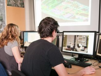
In Nova Scotia in 2000, we formed the Applied Geomatics Research Group (AGRG) at the Nova Scotia Community College. The…

Canadian Geomatics Industry Darling Wins Another Contract

EDC Provides Hispasat with Euro 123 M to Purchase a Satellite from Vancouver’s MDA Export Development Canada (EDC) today announced…

UNB Prof. Emmanuel Stefanakis Authors Book on GIS

A new textbook on geographic information systems by GGE’s Professor Emmanuel Stefanakis has just been published by CreateSpace. Entitled Geographic…

Satellite-Based Earth Observation Market Analysis – Trends and Forecast

Satellite-based Earth Observation (EO) is a process of using remote-sensing technique to gather information on the chemical, physical and biological…

First images taken with Exelis system on DigitalGlobe’s WorldView-3 satellite released

DigitalGlobe has released the first images taken with the Exelis-built (NYSE: XLS) integrated, super-spectral imaging system on the WorldView-3 satellite,…

PCI Geomatics to Host International Reseller and Business Partner Meeting, October 20-23, 2014

RICHMOND HILL, Ontario – PCI Geomatics, a world leading developer of remote sensing and photogrammetric software and systems, will be…

Day of Geography Set to be an International Online Event

There’s a brand new geography event in the works, and the best part is you don’t even have to leave…

Indigenous mapping initiatives powered by Google

Indigenous communities across Canada are engaged in intensively mapping their lands, waters, resources and knowledge. These maps have unparalleled importance…

PCI Geomatics Releases Linux Versions of Geomatica 2014

RICHMOND HILL, Ontario, Canada – PCI Geomatics, a world leading developer of geo-imaging software and systems, announced the release of…

Robert E Lee

Gettysburg: What Could Lee See?

In an age devoid of modern communications methods and digital maps, military generals often made tactical decisions based on what…