Facebook

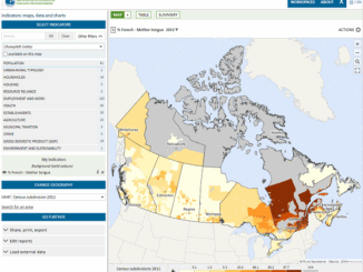
Géoclip – A geostatistical observatory software product

The Géoclip observatories are web applications for statistical mapping to promote the analysis of territorial data sets. A Géoclip observatory…

Canadian Geography & Geo-Literacy: The GeoNiagara Radio Show is on the air

The GeoNiagara Radio Show seeks to engage and inform educators, students and the broader community about the relevance and importance…

Graph Databases – Recent development in Neo4j may help accommodate the Geospatial Community

Graph Databases and GIS & Technology (GIS&T) In the era of big data, graph databases are becoming very popular as…

GIS in Public Health: Kingston GoGeomatics Social Thursday, January 19

Free GIS & Public Health  Talk in Kingston Thursday, January 19, 2017 6:00 PM Sir John A Public House 343…

Interview with Ted Mackinnon: Promoting Canadian GIS & Geomatics on Twitter

GoGeomatics has been actively using Twitter to reach out to the geospatial community since 2009. We have written and hosted…

NB 911 Bureau Receives Esri Canada Award of Excellence in GIS

FREDERICTON, Esri Canada User Conference – October 25, 2016 – Esri Canada today presented the NB 911 Bureau, a branch…

GoGeomatics Canada Women

Day of Geography 2016

Monday, November 14, 2016 marks the third annual Day of Geography, presented by Geospatial Niagara, Canada’s contribution to Geography Awareness…

How Canadian Remote Sensing Was Made Commercially Successful & Exportable

This piece started as a note on some of my experience as an international consultant in remote sensing specifically and…

Making a Crow Attack Web Page With Open Source GIS Tools

Of all the pleasant events that happen in spring, crow attacks rank at the bottom of the pile. Crows become…

Government of Yukon Wins 2016 Esri Special Achievement in GIS Award

SAN DIEGO, Esri User Conference—June 29, 2016—Esri Canada congratulates the Government of Yukon for receiving the 2016 Esri Special Achievement…

Canadian Municipalities Unlock Their Data with Esri’s ArcGIS Open Data

TORONTO—April 25, 2016—Esri Canada today announced that more than 20 Canadian municipalities have adopted ArcGIS Open Data.  Esri’s cloud-based geographic…

1 2 3 5