Magazine
Canadian Geospatial Digest – March 9th, 2026
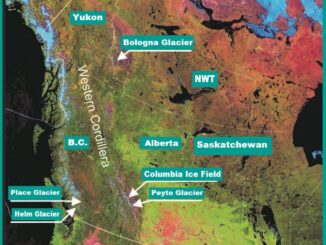
Medicine Hat drone company gets $1.1M federal loan for weather and combat testing NWT publishes new flood maps for five communities One data centre or one million homes? Mapping Ontario’s proposed hyperscaler boom N.S. resident […]