BIM & GIS
The Story Beneath the Map
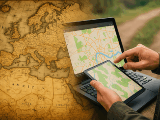
People open maps on their phones every day to check a route, locate a place, or understand what surrounds them. It feels simple, but a long history stands behind that moment. The journey to modern […]
People open maps on their phones every day to check a route, locate a place, or understand what surrounds them. It feels simple, but a long history stands behind that moment. The journey to modern […]
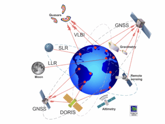
Canada’s failure to invest in modern geodetic infrastructure has left it dependent on foreign systems to run satellites, guide ships, synchronize power grids, and safeguard sovereignty — an invisible weakness in the infrastructure that holds […]
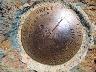
North America is undergoing a significant shift in how geographical positions are defined. Both Canada and the United States are moving away from NAD83 (North American Datum of 1983), a system introduced in the 1980s […]
GoGeomatics is excited to announce that the Southern Alberta Institute of Technology (SAIT) is once again joining the GoGeomatics Expo 2025 as a Gold Sponsor. A regular supporter of the Expo, SAIT has demonstrated its […]
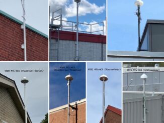
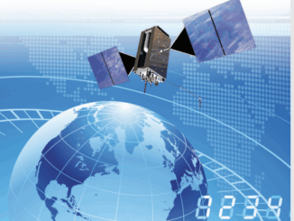
When Montréal switched on its Real-Time GNSS Network (RTN), it marked a milestone in Canadian geodesy. By deploying its own standards-compliant GNSS infrastructure, Montréal stands among the pioneering Canadian cities offering centimeter-level positioning accuracy across […]
This article includes insights from Dr. Simon Banville, Senior Advisor for GNSS Products and Analysis at Natural Resources Canada and the technical lead behind this update. Canada’s Precise Point Positioning (PPP) tool has just undergone […]
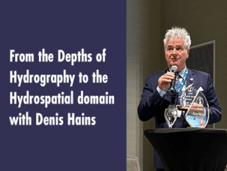
In Part 1, we explored the legacy of Dr. Sam Masry and the importance of the Sam Masry Award, which was recently awarded to Denis Hains. Here is the link to Part 1. Lire la […]

From 24 to 26 September 2024, Messe Stuttgart will be the beating heart of the geospatial community. INTERGEO, a world-leading event for geodesy, geoinformation and land management, gathers together experts and visionary minds from all […]