• facebook
  • Twitter
  • Linkedin
  • Youtube
  • Linkedin Group
  • Post a Job
  • Post an Ad
  • Post an Event
  • Post a Directory Listing
  • Post a Press Release
  • Media Kit
  • My Account
  • Login
GoGeomatics
  • MAGAZINE
    • BIM & GIS
    • Community
    • Conference news
    • Earth Observation
    • Education & Careers
    • GEOAI
    • Announcements
    • Reality Capture & Lidar
    • Science
    • Technology
    • Between the Poles
  • Directories
    • ASSOCIATION
    • INDUSTRY
    • EDUCATION
    • Open Data
  • EVENTS
    • GeoIgnite Events
    • Events Calendar
    • GoGeomatics Meetups
  • Services
    • Advertising
    • Marketing
    • Post a Job
    • Post an Ad
    • Post an Event
    • Post a Press Release
    • Post a Directory Listing
    • Media Kit
    • Web Design
  • Find a Job
  • Volunteer
    • Start a GoGeomatics Group
    • Editors & Writers Group
  • About Us
    • About Us
    • Contact Us
    • Frequently Asked Questions
  • Videos
Homegeospatial infrastructure

geospatial infrastructure

Geospatial Intelligence

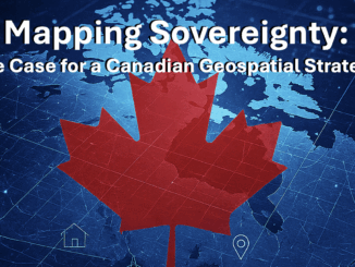
Running on Borrowed Time: Why Canada’s GPS Dependence is a $1 Billion-a-Day Risk

3 March 2026 Anusuya Datta | Arctic

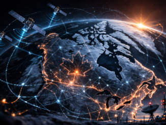
From Arctic geometry gaps to sovereignty exposure, can Canada afford continued dependence on external GNSS systems? The strategic silence in Ottawa has finally broken. For decades, Canada’s reliance on the American Global Positioning System (GPS) […]

Conference news

GeoIgnite 2026 & Canada’s Evolving Sovereign Geospatial Infrastructure

22 February 2026 GoGeomatics Canada | Arctic Sovereignty

Canada’s infrastructure conversation is changing. Industrial policy is tightening. Procurement modernization is accelerating. Canadian security independence and defence capability are receiving renewed attention. Supply chain resilience and trusted digital systems are now operational priorities. Within […]

Magazine

Geodetic Infrastructure and Canada’s Long-Term Solutions

5 February 2026 George Petropoulos | Digital Sovereignty

Canada currently lacks a sovereign Global Navigation Satellite System (GNSS) and several core components of modern geodetic infrastructure needed to ensure reliable positioning, navigation, and timing (PNT). Canada now depends heavily on foreign satellite systems […]

BIM & GIS

BigGeo Joins GoGeomatics Expo 2025 as a Silver Sponsor

23 October 2025 GoGeomatics Canada | BigGeo

BigGeo is joining the GoGeomatics Expo 2025 as a Silver Sponsor. The flagship three-day event, which connects Canada’s geospatial, geomatics, and construction communities, will take place November 3-5, 2025, at the Big Four Roadhouse in […]

digital sovereignty
Community

Before It’s Too Late: Carina Butterworth on Reclaiming Canada’s Digital Sovereignty Through Education

16 October 2025 Carina Butterworth | business

Dr. Tracey Lauriault’s recent interview, Before It’s Too Late: Canada’s Data Sovereignty Crisis, struck a chord with me. Her message about the risks of losing control over Canada’s geospatial data — and the need to […]

Earth Observation

Canada’s Geodesy Void and the Hidden Risks to Economy, Defence, and Sovereignty

13 October 2025 Anusuya Datta | Canada

Canada’s failure to invest in modern geodetic infrastructure has left it dependent on foreign systems to run satellites, guide ships, synchronize power grids, and safeguard sovereignty — an invisible weakness in the infrastructure that holds […]

Canada Geospatial Strategy
BIM & GIS

Canada Has an AI Strategy. Why Not a Geospatial One?

8 October 2025 Anusuya Datta | Arctic

Canada has shown it can move fast when it decides something matters. Artificial intelligence is the proof. The Pan-Canadian AI Strategy, launched in 2017, was the world’s first funded national AI strategy. It built a […]

WSP
BIM & GIS

Digital Delivery and Procurement Reform: A Conversation with WSP on Canada’s Infrastructure Ambitions

17 September 2025 Anusuya Datta | AI

This interview is part of our GoGeomatics series on Canada’s infrastructure moment — exploring how record investments in infrastructure, civil preparedness, and critical systems will reshape how projects are delivered. Canada has committed 5% of […]

Posts pagination

1 2 »

Events

Notice
There are no upcoming events.

View All Events

Services

  • Post a Job
  • Post an Ad
  • Post an Event
  • Post a Directory Listing
  • Post a Press Release
  • Media Kit
  • My Account
  • Login

Jobs

Post a Job
  • Operations Spatial Data Assistant (Contract)
    Vaughan
  • GIS Analyst
    Saint John, New Brunswick
  • GIS Student Intern
    Elmsdale, Nova Scotia
  • Canada Impact+ Research Chair – Professor (Or Associate Professor)
    Lethbridge, Alberta
View All Jobs
  • Directories
    • Associations Directory
    • Industry Directory
    • Education Programs
    • Open Data
  • Volunteer
    • Start a GoGeomatics Group
    • Editors & Writers Group
  • About Us
    • GoGeomatics Media Kit
    • Who We Are
    • Contact Us
    • FAQ’s
    • Advertising
    • Marketing
  • Subscribe
GoGeomatics
GoGeomatics is the largest and most popular communications hub promoting the Canadian geospatial community. The business was incorporated in 2011. GoGeomatics hosts over 100 fun, free, location technology networking events each year in cities across Canada.

© 2026 GoGeomatics

  • facebook
  • Twitter
  • Linkedin
  • Youtube
  • Linkedin Group