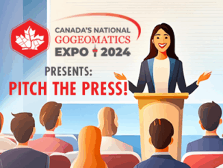
• facebook
  • Twitter
  • Linkedin
  • Youtube
  • Linkedin Group
  • Post a Job
  • Post an Ad
  • Post an Event
  • Post a Directory Listing
  • Post a Press Release
  • Media Kit
  • My Account
  • Login
GoGeomatics
  • MAGAZINE
    • BIM & GIS
    • Community
    • Conference news
    • Earth Observation
    • Education & Careers
    • GEOAI
    • Announcements
    • Reality Capture & Lidar
    • Science
    • Technology
  • Directories
    • ASSOCIATION
    • INDUSTRY
    • EDUCATION
    • Open Data
  • EVENTS
    • GeoIgnite Events
    • Events Calendar
    • GoGeomatics Meetups
  • Services
    • Advertising
    • Marketing
    • Post a Job
    • Post an Ad
    • Post an Event
    • Post a Press Release
    • Post a Directory Listing
    • Media Kit
    • Web Design
  • Find a Job
  • Volunteer
    • Start a GoGeomatics Group
    • Editors & Writers Group
  • About Us
    • About Us
    • Contact Us
    • Frequently Asked Questions
  • Videos
Homegeospatial technology

geospatial technology

|||
Technology

Geospatial Technology Guiding the Development of Autonomous Vehicles

11 January 2024 Jake MacLean | apple maps

Driver-less cars, also known as autonomous vehicles or self-driving cars, are vehicles that are equipped with sensors, cameras, and other technologies that enable them to navigate and operate without the need for human input or […]

Technology

GoGeomatics Picks the Most Important Canadian Geomatics Stories of 2023

2 January 2024 Volunteer Editors and Group Writers | advanced mapping

The GoGeomatics volunteer editors and writers have selected the most significant stories from 2023 to share and highlight as we transition into 2024. Our group consists of volunteer geomatics professionals from across Canada who convene […]

Technology

Canadian Geospatial Digest December 11, 2023

11 December 2023 Volunteer Editors and Group Writers | Aerial technology

The wildfire-fighting drones of the future. Restoring salmon habitat: An interactive map The maps selected for the 2024 Esri Canada Map Calendar Autonomous plant stand counting with Croptomistic Visualizing climate change in the Canadian Arctic […]

Technology

Canadian Geospatial Digest November 13, 2023

13 November 2023 Volunteer Editors and Group Writers | AI and computer vision

The prospect of space mining is growing more likely, and Canada may be a key player Black and grizzly bears might be detected by the same AI radar that detects polar bears Winter activities in […]

Technology

International Geospatial Digest July 17th, 2023

17 July 2023 Volunteer Editors and Group Writers | accessibility

Singapore Land Authority Utilizes Bentley Systems for Digital Twin and 3D Mapping Addressing the Slow Adoption of Technology in Developing Countries Unlocking the Potential of Smart Cities with Geospatial Analytics and AI Technologies GIS-Based Tactile […]

Technology

Celebrating Earth Day with Conventional and Unconventional Applications of Geospatial Technology: Part 2

26 April 2023 Jake MacLean | 3D modeling

3 Unconventional Earth-friendly Applications of Geospatial Technology After talking about some of the more conventional methods of implementing geospatial technology to help our planet in part 1, today’s article will focus on some more unconventional […]

|||||
Technology

Maxar’s Global Technology Shift from 2D to 3D

26 May 2022 GoGeomatics Canada | 2D

Maxar Endeavours to use Space and Earth Intelligence for the future of Geospatial Intelligence “Imagery is the foundation of our business.” During the keynote presentation at  Canada’s National Geospatial Conference, GeoIgnite “Winter Geo,” on March […]

|||||
Technology

Sparkgeo uses geospatial technology to analyze water hazards caused by BC wildfires

10 March 2022 Natalia Domarad | British Columbia

Western Canadian wildfire season is quickly approaching. The increase in wildfire season length, wildfire frequency, and burned area makes it dangerous and difficult to live in and around these regions. Wildfire smoke can drastically reduce […]

Posts pagination

« 1 … 11 12 13 »

Events

Notice
There are no upcoming events.

View All Events

Services

  • Post a Job
  • Post an Ad
  • Post an Event
  • Post a Directory Listing
  • Post a Press Release
  • Media Kit
  • My Account
  • Login

Jobs

Post a Job
  • BIM Specialist
    Burnaby, BC
  • GIS Analyst
    Virden MB
  • GIS Analyst Student – Summer 2026
    Saint John NB
  • GIS Analyst & Developer
    Nanaimo, BC
View All Jobs
  • Directories
    • Associations Directory
    • Industry Directory
    • Education Programs
    • Open Data
  • Volunteer
    • Start a GoGeomatics Group
    • Editors & Writers Group
  • About Us
    • GoGeomatics Media Kit
    • Who We Are
    • Contact Us
    • FAQ’s
    • Advertising
    • Marketing
  • Subscribe
GoGeomatics
GoGeomatics is the largest and most popular communications hub promoting the Canadian geospatial community. The business was incorporated in 2011. GoGeomatics hosts over 100 fun, free, location technology networking events each year in cities across Canada.

© 2026 GoGeomatics

  • facebook
  • Twitter
  • Linkedin
  • Youtube
  • Linkedin Group