Health Care

Canadian Geospatial Digest Aug 21, 2023

Canadian Geospatial Digest August 21, 2023

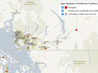
BC First Nations adopts indigenous names for Protected Areas Maps Canada’s National Cycling Map City of Ottawa 3D geospatial endeavors…

The Linkable Open Data Environment (LODE): Supporting Geospatial Analysis with Open Data

Over the past 2 years Statistics Canada’s Data Exploration and Integration Lab (DEIL) has launched and developed the Linkable Open…

Your Global Geospatial Briefing for April 29th: Geospatial Mapping in Nursing; By Design; GWF workshop; 5G and Blockchain; OGC

FDNY geospatial mapping used to reach opioid overdose cases Nurses and nursing students are using local, real-time maps of opioid…

Who are The Canadian Association of Geographers (CAG)?

Since 1951, the Canadian Association of Geographers (CAG) is a non-profit, charitable organization that is committed to the dissemination of…