Community
A Dollar and a Dream: Honouring GeoIgnite 2025 Speakers and Advisors with a Symbol of Canadian Resilience
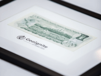
At GeoIgnite 2025, every keynote brought insight, and every panel sparked action — but one small gesture carried a story all its own. As a token of appreciation, GoGeomatics Canada presented framed Canadian one-dollar bills […]