• facebook
  • Twitter
  • Linkedin
  • Youtube
  • Linkedin Group
  • Post a Job
  • Post an Ad
  • Post an Event
  • Post a Directory Listing
  • Post a Press Release
  • Media Kit
  • My Account
  • Login
GoGeomatics
  • MAGAZINE
    • BIM & GIS
    • Community
    • Conference news
    • Earth Observation
    • Education & Careers
    • GEOAI
    • Announcements
    • Reality Capture & Lidar
    • Science
    • Technology
    • Between the Poles
  • Directories
    • ASSOCIATION
    • INDUSTRY
    • EDUCATION
    • Open Data
  • EVENTS
    • GeoIgnite Events
    • Events Calendar
    • GoGeomatics Meetups
  • Services
    • Advertising
    • Marketing
    • Post a Job
    • Post an Ad
    • Post an Event
    • Post a Press Release
    • Post a Directory Listing
    • Media Kit
    • Web Design
  • Find a Job
  • Volunteer
    • Start a GoGeomatics Group
    • Editors & Writers Group
  • About Us
    • About Us
    • Contact Us
    • Frequently Asked Questions
  • Videos
Homeremote sensing

remote sensing

Technology

Canadian Geospatial Digest for October 7th, 2024

7 October 2024 Volunteer Editors and Group Writers | 2023 report

An Era Ends with the Retirement of the Canadian Digital Elevation Model (CDEM) State of the Canadian Space Sector 2023 Autonomous Food Delivery at the Toronto Zoo Uncovering the Legacy of Indigenous Residential Schools through […]

Technology

Harnessing Earth Observation for Environmental and Industrial Sustainability in Canada

3 October 2024 Anusuya Datta | Canada space Agency

The 2023 State of the Canadian Space Sector Report highlights significant growth in Earth Observation (EO) technologies. In 2022, EO generated $349 million, accounting for 7% of total space sector revenues, marking a 29% increase […]

Technology

Canadian Geospatial Digest for September 23rd, 2024

23 September 2024 Volunteer Editors and Group Writers | 2021 Canadian Census

An online map tracks Climate-related disaster cost. University of New Brunswick researchers participate in AI-based projects Living Lakes Canada Maps helped wildfire fighters Eating disorder mapped using GIS Language map for Toronto: 54 languages mapped […]

Community

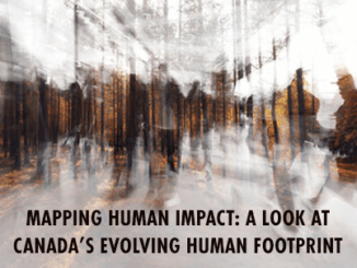
Mapping Human Footprint: Uncovering the Hidden Impact on Ecosystems in Canada

20 September 2024 Anusuya Datta | Alberta Biodiversity Monitoring Institute (ABMI)

As human activities increasingly transform ecosystems, the pressure on biodiversity across Canada is growing. The diverse geography of the second-largest country in the world — from the icy expanses of the Arctic to bustling urban […]

Other

Canada’s 2023 Wildfires Released More Carbon in 5 Months Than Annual Fossil Fuel Emissions of Russia or Japan

13 September 2024 Anusuya Datta | Canada Wildfire Impact

We know Canada experienced its most destructive wildfire season ever in 2023, which single handedly drove a nearly a quarter of increase in the loss of the world’s tree cover. And now a new NASA funded study has […]

Community

The CanSLAM Circuit: Advancing Geomatics Through Innovation and Collaboration

12 September 2024 Alex Hill-Stosky | 3D modeling

What an incredible time to be a mapping professional! Infrastructure the world over continues to change for the better (and worst,) real-world projects are happening everywhere despite our economy being intentionally stagnated, geographic areas continue […]

Technology

From Alcatraz to Asset Management: Dive into the Latest in Reality Capture at the GoGeomatics Expo

26 August 2024 Alex Hill-Stosky | 3D scanning

The National GoGeomatics Expo 2024 is happy to present the Reality Capture & Digital Twin presentation track. We are presenting to you a picture of what’s being done and what’s possible with reality capture technology, […]

Technology

International Geospatial Digest for August 19, 2024

19 August 2024 Volunteer Editors and Group Writers | agricultural planning

UZMA signed agreements with government authorities and organizations to enhance Malaysian geospatial services. UniSQ use geospatial data to help better agricultural planning in Vietnam. Details maps and forecasts for tropical storm Ernesto. 1st vegetation map […]

Posts pagination

« 1 … 20 21 22 … 72 »

Events

Notice
There are no upcoming events.

View All Events

Services

  • Post a Job
  • Post an Ad
  • Post an Event
  • Post a Directory Listing
  • Post a Press Release
  • Media Kit
  • My Account
  • Login

Jobs

Post a Job
  • GIS Technologist II
    Fernie, B.C.
  • GIS I TECHNOLOGIST
    Fernie, B.C.
  • Operations Spatial Data Assistant (Contract)
    Vaughan
  • GIS Analyst
    Saint John, New Brunswick
View All Jobs
  • Directories
    • Associations Directory
    • Industry Directory
    • Education Programs
    • Open Data
  • Volunteer
    • Start a GoGeomatics Group
    • Editors & Writers Group
  • About Us
    • GoGeomatics Media Kit
    • Who We Are
    • Contact Us
    • FAQ’s
    • Advertising
    • Marketing
  • Subscribe
GoGeomatics
GoGeomatics is the largest and most popular communications hub promoting the Canadian geospatial community. The business was incorporated in 2011. GoGeomatics hosts over 100 fun, free, location technology networking events each year in cities across Canada.

© 2026 GoGeomatics

  • facebook
  • Twitter
  • Linkedin
  • Youtube
  • Linkedin Group