research
Memorial University’s Marine Institute joins global endeavour to map ocean floor
The Nippon Foundation-GEBCO Seabed 2030 Project has announced a new partnership with the Memorial University of Newfoundland’s Fisheries and Marine…
Québec Government announces $600,000 research funding for Laval’s Faculty of Forestry, Geography and Geomatics
The safety and quality of life in Nunavik’s northern villages are important to the Government of Québec. Therefore, the Minister…
Resources and Maps: National Indigenous History Month
June is National Indigenous History Month. This month gives Canadians the opportunity to honour the resilience, stories, history and achievements…
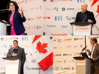
Call for Speakers: Join Canada’s National Geomatics Event in Calgary & Share Your Insights
Are you passionate about the world of geomatics and want to make a difference in the industry? We invite you…
Ten Years Later: Interview with Wendy MacIsaac one of Canada’s Top Surveyors
Ten years ago, GoGeomatics interviewed Wendy MacIsaac of Midwest Surveys Inc. in Calgary, Alberta, about her career and being a…
Research & Education: Tim Webster on Applied Geomatics Research Group (AGRG)
The AGRG, Applied Geomatics Research Group, was formally founded in 2000 by COGS (College of Geographic Sciences) faculty members who…
The Enduring Legacy of Carleton’s Geomatics and Cartography Research Centre
Like everywhere else, there has been a major transition from paper to digital. This transition has been a driver for…
Introducing OASIS, a New Project by Deploy Solutions
Deploy Solutions is offering a new service to share the insights, research, expertise, and technology from original climate-change software. This…
The ESA Offers Funding for Canadian Space-Related Innovations
The Canadian Space Agency (CSA) has opportunities to get funding for “early-stage” space-related” development programs and research. The ESA (European…
Canadian Geospatial Briefing April 5th: 1. Wolf Research Using GPS and Indigenous Knowledge. 2. Newfoundland Company Takes Lead in Drone Industry. 3. Yellowknife Man Creates Google Earth Alternative. 4. Apple Map’s New 3D Features in Toronto 5. UPEI’s Massive Drone Fleet. 6. Next Generation 911 Service Using GIS.
A study on eastern wolves near Georgian Bay is taking a unique approach by braiding western scientific techniques together with…
Nick Kellett to present research findings at GeoIgnite 2022
Examining three years of work to combat climate change Since he started appearing at the GeoIgnite conference in 2020, Nick…
Canadian Geospatial Briefing Nov 15: 1. UK and Canada Space Agencies Sign MOU on Joint Activities; 2. Canadian Flood Maps; 3. Bell and ESRI Canada: Integrated Smart City Ecosystems; 4. Government of Canada Supports Canadian Satellite-Based Emissions Detection System; 5. ‘What3Words’ App in Search & Rescue
UK and Canada Space agencies sign MOU on joint activities and information sharing The UK Space Agency and the Canadian Space Agency have signed…