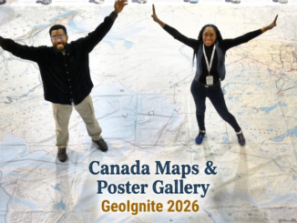
||||
Technology

Canadian Geospatial Briefing May 2nd: 1. RCGS releases map in solidarity with Ukraine. 2. YVR launches its digital twin 3. Kraken’s Robotics as a Service (RaaS) contract with the Royal Canadian Navy. 4. 19th-century atlas of PEI

RCGS (Royal Canadian Geographical Society) releases a new map in solidarity with Ukraine. The Royal Canadian Geographical Society produced this map to show the distribution of people from Ukraine across provinces of Canada. Each colour […]

|||
Technology

Canadian Geospatial Briefing April 18th: 1. Esri Canada program director’s sudden passing; 2. Kanien’kĂ©ha mapping project; 3. Indigenous People’s Atlas of Canada; 4. Vernon floodplain maps; 5. Grassland mapping project

Esri Canada’s Program Director killed in small plane crash on March 21st John Bacon, Program Director in Esri Canada’s Geospatial Infrastructure Department passed away on March 21st after a small airplane crashed near the Brantford […]

|||
Technology

Canadian Geospatial Briefing Nov 29: 1. Mapping Canada’s carbon landscape; 2. Satellite images of Flood in BC; 3. Royal Canadian Geographical Society awards; 4. High-speed internet for rural communities by asset-mapping; 5. Plant health beyond the naked eye

Mapping Canada’s carbon landascape WWF-Canada has conducted new research with the lead of McMaster University’s Remote Sensing Lab scientists to measure the stored amount of carbon in Canada’s landscape. The findings show that stored carbon […]