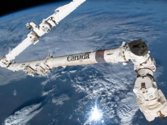
• facebook
  • Twitter
  • Linkedin
  • Youtube
  • Linkedin Group
  • Post a Job
  • Post an Ad
  • Post an Event
  • Post a Directory Listing
  • Post a Press Release
  • Media Kit
  • My Account
  • Login
GoGeomatics
  • MAGAZINE
    • BIM & GIS
    • Community
    • Conference news
    • Earth Observation
    • Education & Careers
    • GEOAI
    • Announcements
    • Reality Capture & Lidar
    • Science
    • Technology
  • Directories
    • ASSOCIATION
    • INDUSTRY
    • EDUCATION
    • Open Data
  • EVENTS
    • GeoIgnite Events
    • Events Calendar
    • GoGeomatics Meetups
  • Services
    • Advertising
    • Marketing
    • Post a Job
    • Post an Ad
    • Post an Event
    • Post a Press Release
    • Post a Directory Listing
    • Media Kit
    • Web Design
  • Find a Job
  • Volunteer
    • Start a GoGeomatics Group
    • Editors & Writers Group
  • About Us
    • About Us
    • Contact Us
    • Frequently Asked Questions
  • Videos
Homesatellite technology

satellite technology

BIM & GIS

International Geospatial Digest – November 3rd, 2025

3 November 2025 Volunteer Editors and Group Writers | aerospace collaboration

NASA’s SWOT Satellite Reveals the Most Detailed Maps of Earth’s Seafloor Yet Pakistan Enters a New Space Era with the Launch of Its First Hyperspectral Satellite Human Judgment Remains Central in the Era of Geospatial […]

Stephane Germain
Earth Observation

Building a Global Leader from Canada: GHGSat’s Stéphane Germain on Climate Data, Infrastructure, and Innovation

25 September 2025 Anusuya Datta | business

This interview is part of our GoGeomatics series on Canada’s infrastructure moment and its impact on the geospatial/Earth Observation industry. From its first satellite launch in 2016 to its recent acceptance into the International Charter […]

Digest Aug 25
Community

International Geospatial Digest – August 25, 2025

25 August 2025 Volunteer Editors and Group Writers | AI for geospatial

NOAA Upheaval Raises Concerns as U.S. Nears Peak Hurricane Season India’s Private Space Industry to Launch 12-Satellite EO Network Under PPP What’s Next for Landsat and Civilian Earth Observation Mapping the Future: Google AlphaEarth Foundations […]

Earth Observation

GHGSat Becomes First Canadian Company to Join the International Charter: Space and Major Disasters as a Data Contributor

24 July 2025 GoGeomatics Canada | Canadian Innovation Leadership

Montreal-headquartered GHGSat, the global leader in emissions monitoring technology, has become the first Canadian company to join the International Charter: Space and Major Disasters as a data contributor, providing its data as part of a […]

Conference news

How Space Can Help Canada in an Uncertain World

2 June 2025 Benedicta Antwi Boasiako | Brian Gallant

Space is no longer just about exploration — it’s about security, resilience, and economic sovereignty. In a powerful keynote at GeoIgnite 2025, Brian Gallant, CEO of Space Canada and former Premier of New Brunswick, made […]

Earth Observation

Canada’s Commercial Space Sector Faces Major Hurdles, New Report Warns

22 May 2025 Anusuya Datta | anchor customer model

Canada was one of the world’s earliest spacefaring nations, but it now faces a crucial choice: modernize how it engages with private space companies or risk falling behind in the rapidly evolving global space economy. […]

GEOINT
Conference news

Watch the Video: Shaping the Future of GEOINT in Canada at GeoIgnite 2025

30 April 2025 GoGeomatics Canada | Canadian Geospatial Industry

As the global landscape continues to evolve, Geospatial Intelligence (GEOINT) is becoming an essential tool for informed decision-making in defense, security, urban planning, climate resilience, and disaster response. At GeoIgnite 2025 the spotlight will be […]

|
Technology

Canadian Geospatial Digest for August 15, 2022

15 August 2022 GoGeomatics Canada | alberta

Apple Maps is Coming to Your City this Summer, Satellites show World’s Largest Beaver Dam, Who lives in Canada’s Hottest Urban Centres, Western University Investigates Storm Apple Maps is Driving, and Walking, Through Canadian Cities […]

Posts pagination

1 2 »

Events

Notice
There are no upcoming events.

View All Events

Services

  • Post a Job
  • Post an Ad
  • Post an Event
  • Post a Directory Listing
  • Post a Press Release
  • Media Kit
  • My Account
  • Login

Jobs

Post a Job
  • Canada Maps and Poster Gallery Volunteer Leads — GeoIgnite 2026
    remote
  • GIS & Data Analytics Lead
    Beaumont, AB
  • Lead Surveyor, Projects/Arpenteur-géomètre principal, projets; arpenteuse-géomètre principale, projets
    North Bay, Thunder Bay
  • Senior GIS Developer
    Calgary, AB
View All Jobs
  • Directories
    • Associations Directory
    • Industry Directory
    • Education Programs
    • Open Data
  • Volunteer
    • Start a GoGeomatics Group
    • Editors & Writers Group
  • About Us
    • GoGeomatics Media Kit
    • Who We Are
    • Contact Us
    • FAQ’s
    • Advertising
    • Marketing
  • Subscribe
GoGeomatics
GoGeomatics is the largest and most popular communications hub promoting the Canadian geospatial community. The business was incorporated in 2011. GoGeomatics hosts over 100 fun, free, location technology networking events each year in cities across Canada.

© 2025 GoGeomatics

  • facebook
  • Twitter
  • Linkedin
  • Youtube
  • Linkedin Group