search
CANMAP, and SHIFTing gears at COGS
At the end of last month, John Wian hosted the Annual General Meeting (AGM) of the CANMAP Research Institute in…
Event Recap: The 2017 Canadian Surveyors Conference in Ottawa
On March 1st and 2nd land surveyor professionals, as well as industry exhibitors, headed to Ottawa for the 2017 Canadian…
The Open Geospatial Consortium (OGC): proposed GeoRSS Community Standard
The Open Geospatial Consortium (OGC®) is requesting public comment on the proposed GeoRSS Community Standard. First available in 2006, GeoRSS…
QGIS: Performing Viewshed Analysis on Archaeological Sites
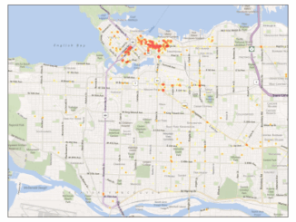
In 1927 a Vancouver bylaw was enacted that limited the height of buildings to a maximum of six stories in…
New GoGeomatics Group in Thunder Bay, Ontario
GoGeomatics is excited to introduce the Thunder Bay GoGeomatics group as the newest grass roots effort by local geospatial professionals,…
COGS NSCC students use Geomatics to explore the history of Black Loyalists & Joggins Fossil Cliff
NSCC students make major impact in two small communities with huge historical significance Students at Nova Scotia Community College’s Centre…
My COGS GIS Education, Part II
In my first article, I introduced the how and why I chose to attend COGS from the fall of 2014…
CCA Ottawa Conference: “150 Years of Cartography: Past, Present and Future”
The 42nd Annual Conference of the Canadian Cartographic Association “150 Years of Cartography: Past, Present and Future” Location: Carleton University,…
Nominations for GIS Science Award: GIScience Study Group CAG – ACG
GIScience Excellence Award Offered and adjudicated by the GIScience Study Group Annual nominations are due by midnight of 15 April…
Toronto & Calgary: Federal Floodplain Mapping Workshop March 28th & 30th
The Federal Floodplain Mapping Guidelines workshop, hosted by Canadian Water Resources Association (CWRA) on behalf of the Government of Canada,…
My COGS GIS Education
What About COGS The Centre of Geographic Sciences (COGS) is one of the best colleges in Canada for learning GIS. …
Top Ten Climate Change Maps and GIS Applications
Awareness for climate change has been steadily increasing ever since the Green Revolution in the 1960s. There is a plethora…