• facebook
  • Twitter
  • Linkedin
  • Youtube
  • Linkedin Group
  • Post a Job
  • Post an Ad
  • Post an Event
  • Post a Directory Listing
  • Post a Press Release
  • Media Kit
  • My Account
  • Login
GoGeomatics
  • MAGAZINE
    • BIM & GIS
    • Community
    • Conference news
    • Earth Observation
    • Education & Careers
    • GEOAI
    • Announcements
    • Reality Capture & Lidar
    • Science
    • Technology
  • Directories
    • ASSOCIATION
    • INDUSTRY
    • EDUCATION
    • Open Data
  • EVENTS
    • GeoIgnite Events
    • Events Calendar
    • GoGeomatics Meetups
  • Services
    • Advertising
    • Marketing
    • Post a Job
    • Post an Ad
    • Post an Event
    • Post a Press Release
    • Post a Directory Listing
    • Media Kit
    • Web Design
  • Find a Job
  • Volunteer
    • Start a GoGeomatics Group
    • Editors & Writers Group
  • About Us
    • About Us
    • Contact Us
    • Frequently Asked Questions
  • Videos
Homeunderground utilities

underground utilities

Technology

Unlocking the Future of Utility Mapping: Join Us at GoGeomatics 2024 for the Latest in SUE and Geospatial Innovation

21 August 2024 Peter Srajer | AI

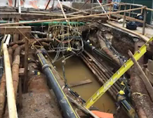
The Challenge of Inaccurate Utility Information When working with public and private infrastructure projects we may encounter unexpected costs and delays due to inaccurate or incomplete utility drawings. The responsibility for providing accurate utility information […]

Technology

International Geospatial Digest for August 19, 2024

19 August 2024 Volunteer Editors and Group Writers | agricultural planning

UZMA signed agreements with government authorities and organizations to enhance Malaysian geospatial services. UniSQ use geospatial data to help better agricultural planning in Vietnam. Details maps and forecasts for tropical storm Ernesto. 1st vegetation map […]

Community

New SUE Focus at 2024 Geomatics Expo

13 August 2024 GoGeomatics Expo | 3D modelling

Subsurface Utility Engineering Advances: building on the interest and engagement from the successful 2023 expo, the 2024 National Canadian Geomatics Expo will feature an expanded track dedicated to Subsurface Utilities Engineering (SUE). This program encompasses […]

Community

Reveal Presents Building Unified Utility Models for Major Civil Infrastructure Projects: SUMSF 2023

30 June 2023 GoGeomatics Canada | Archaeology GIS

Reveal’s CEO and founder, Sam Wiffen, held a livestream presentation on Tuesday, May 16, during SUMSF 2023. The topic of the presentation was, “Building Unified Utility Models for Major Civil Infrastructure Projects. Reveal is a […]

Community

3-D Line Locating joins the GoGeomatics Expo

25 May 2023 GoGeomatics Canada | 3D Line Locating

GoGeomatics Expo Welcomes: 3-D Line Locating, Your Damage Prevention Specialists. 3-D Line Locating has been providing Industry-advanced Damage Prevention services throughout Western Canada for almost 30 years. 3-D Line Locating has established a list of proven […]

|
Technology

Canadian Utility Locators Level Up with PointMan Software: Now Critical Part of LMI Certification Program

25 October 2022 GoGeomatics Canada | Canada

The flagship product of ProStar, called PointMan, has now become part of the LMI (Locate Management Institute) of Canada Certification Program for Professional Utility Locators. LMI of Canada is internationally recognized for its education, training, […]

|||||
Technology

Canadian Geospatial Digest for August 1, 2022

1 August 2022 GoGeomatics Canada | 2D

Endangered BC Heritage Site Digitally Preserved by University Professors Edelweiss Village, a heritage site in British Columbia (BC), is the birthplace of mountaineering culture in Canada. The village is being sold for $2.3 million.  The […]

||||||
Technology

NYC’s Underground Infrastructure Interoperability is discussed at SUMSF

22 June 2022 GoGeomatics Canada | Alan Leidner

The UNUM project shows the benefits of infrastructure collaborations. At a March 23, 2022, SUMSF live stream presentation, participants were able to hear about the UNUM project and NYC’s approach to underground infrastructure interoperability. The […]

Events

Notice
There are no upcoming events.

View All Events

Services

  • Post a Job
  • Post an Ad
  • Post an Event
  • Post a Directory Listing
  • Post a Press Release
  • Media Kit
  • My Account
  • Login

Jobs

Post a Job
  • Canada Maps and Poster Gallery Volunteer Leads — GeoIgnite 2026
    remote
  • GIS & Data Analytics Lead
    Beaumont, AB
  • Lead Surveyor, Projects/Arpenteur-géomètre principal, projets; arpenteuse-géomètre principale, projets
    North Bay, Thunder Bay
  • Senior GIS Developer
    Calgary, AB
View All Jobs
  • Directories
    • Associations Directory
    • Industry Directory
    • Education Programs
    • Open Data
  • Volunteer
    • Start a GoGeomatics Group
    • Editors & Writers Group
  • About Us
    • GoGeomatics Media Kit
    • Who We Are
    • Contact Us
    • FAQ’s
    • Advertising
    • Marketing
  • Subscribe
GoGeomatics
GoGeomatics is the largest and most popular communications hub promoting the Canadian geospatial community. The business was incorporated in 2011. GoGeomatics hosts over 100 fun, free, location technology networking events each year in cities across Canada.

© 2025 GoGeomatics

  • facebook
  • Twitter
  • Linkedin
  • Youtube
  • Linkedin Group