In the dynamic landscape of technology, the integration of robust tools becomes a pivotal factor in driving innovation and efficiency across various industries. One noteworthy development is the strategic collaboration between Esri, a global leader in location intelligence, and prominent Software providers such as Microsoft, Autodesk, Salesforce, and Maximo. These collaborations not only streamline the workflow but also elevate the competencies of professionals across various fields.
Microsoft PowerBI and Esri ArcGIS: A Dynamic Duo for Data Visualization
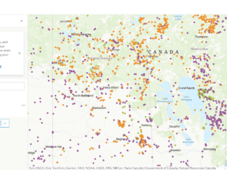
ArcGIS Maps for Power BI enables spatial analysis, helping users understand relationships and patterns by mapping relevant locations. The tool facilitates the creation of heat maps, data clustering, drive time analysis, and pattern identification. This collaboration provides powerful mapping, analysis, and insight capabilities, allowing users to create compelling data stories. Hence, the organizations can leverage the full potential of their data for enhanced reporting and strategic planning.
Learn more about the Microsoft Power BI and Esri ArcGIS integration here.
Esri and Microsoft Unlock Spatial Analytics Integration in Microsoft Fabric
Esri and Microsoft integration brings spatial analytics capabilities from Esri’s ArcGIS software into Microsoft’s Fabric, a unified analytics platform. This integration, set to be available in Q2 2024, aims to meet the increasing demand for spatial analytics. The joint offering will help data scientists, engineers, analysts, and executives by providing direct access to sophisticated spatial analytics tools and a comprehensive library of curated spatial data within the Microsoft Fabric environment. Also, this will change how professionals work with data, enabling users to uncover valuable geospatial insights and accelerate time to insights.
Learn more about the Microsoft Fabric and Esri ArcGIS integration here.
Salesforce and Esri: Transforming Customer Relationship Management with Location Intelligence
Salesforce has chosen Esri’s ArcGIS Platform as a crucial component of Salesforce Maps, integrating the power of location intelligence into global business operations. This collaboration allows organizations to leverage Esri’s leading mapping technology and location services, enhancing their ability to visualize and navigate vast amounts of customer relationship management (CRM) data.
By utilizing Esri basemaps, Salesforce Maps enables businesses to uncover opportunities, visualize sales prospects, and optimize customer visits. This integration provides access to authoritative global datasets, including demographic, weather, business, and behavioral information. Salesforce Maps users can seamlessly incorporate high-quality authoritative data from their ArcGIS Online account, enabling intelligent location-based analytics and the integration of ArcGIS geospatial analytics within Salesforce. This results into a comprehensive view of data, allowing businesses to make informed decisions and drive customer engagement.
Explore the Esri and Salesforce partnership here.
Autodesk and Esri: Bridging GIS and BIM for AEC Professionals
In the architecture, engineering, and construction (AEC) sectors, the integration of Esri’s ArcGIS Basemaps and Living Atlas of the World layers into Autodesk’s product suite provides AEC experts with rich, authoritative geospatial reference data and a unique approach to digital transformation. Architects, engineers, planners, and contractors will have the ability to design in the real world by using this combination (GIS and BIM) that promotes more interconnected, resilient, and sustainable cities and infrastructure.
Discover more about the Esri and Autodesk partnership here.
Esri and IBM Maximo: A Strategic Integration for Asset Management
The collaboration between Esri and IBM Maximo brings location intelligence to asset management. By integrating GIS capabilities into the Maximo environment, organizations gain a spatial perspective on their assets, enabling better decision-making, optimized maintenance, and improved operational efficiency. This integration extends the value of Maximo by providing a holistic understanding of asset data in the context of geography.
Learn about the integration of Esri and IBM Maximo here.
Conclusion
The integration of Esri tools with leading SaaS environments marks a significant leap forward in the way organizations harness the power of location intelligence. From visualizing data in spatial contexts to transforming customer relationship management, enhancing AEC workflows, and optimizing asset management, these partnerships create a comprehensive and unified ecosystem. As technology continues to advance, the collaboration between Esri and these SaaS giants paves the way for a more interconnected, data-driven future across diverse industries. Embracing these integrations is not just about combining tools; it’s about unlocking the full potential of data to drive innovation, efficiency, and sustainable solutions.
Refrences:
https://powerbi.microsoft.com/en-ca/power-bi-esri-arcgis/
https://www.geoconnexion.com/news/esri-integrates-with-microsoft-fabric-to-deliver-leading-spatial-analytics-capabilities
https://www.esri.com/en-us/about/partners/our-partners/strategic-alliances/salesforce
https://www.esri.com/about/newsroom/announcements/esris-arcgis-basemaps-and-arcgis-living-atlas-data-to-be-integrated-into-autodesk-software-environment/
https://www.esri.com/content/dam/esrisites/sitecore-archive/Files/Pdfs/library/fliers/pdfs/esri-ibm-maximo.pdf


Be the first to comment