
On Monday, March 9th, we launched the National Geospatial Capability Survey. The goal was simple: to move beyond the usual marketing brochures and get a real, unfiltered look at where our sector actually stands.
In less than a week, the response has been strong indeed. While I’m saving the full data analysis for my opening keynote at GeoIgnite 2026 on May 12th, the written comments are too interesting to keep under wraps. They paint a picture of a sector that is incredibly capable, fiercely patriotic, but deeply frustrated by a lack of strategic recognition. The survey remains open to practitioners across government, industry, and academia, with full results to be presented at GeoIgnite on May 12. The responses below are anonymous.

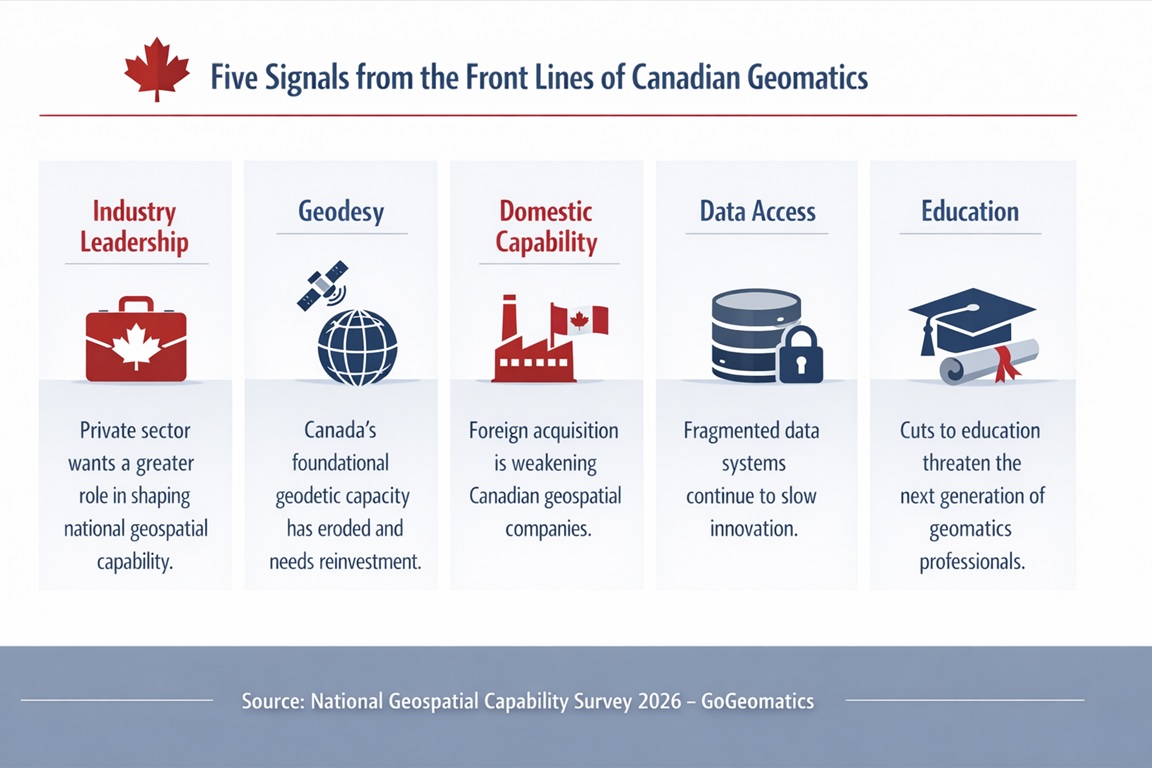
1. The “Lone Torch” Problem
“Developing the follow-on generations of practitioners is critical, but we can’t rely on government employees alone to carry the torch. Industry has to be acknowledged as willing and very capable.”
There is a hunger for industry to lead. We need to move toward a model where the private sector isn’t just a service provider, but a primary architect of Canada’s geospatial future.
2. The Geodesy Crisis
“The importance of geodesy is highly underestimated… In the 1990s, the Canadian Geodetic Survey was a leading force in the world. Due to cuts, we fell behind… Geodesy is the foundation of modern society and finally should be recognized as a basic and necessary strategic investment.”
Without investment in these “invisible” systems, our major infrastructure projects and digital twins will lack the precision they need to function.
3. Breaking the Data Silos
“In the North, we have a major issue with data not being made public… organizations are worried about losing funding if they make their data available to the public. This needs to stop as it is hamstringing everybody else.”
Data hoarding—often driven by fear—is stalling progress. We need a national strategy that incentivizes transparency and rewards collaboration.
4. The Education and Literacy Gap
“Governments are cutting educational budgets across the country… Decisions are made based on government priorities and if they don’t see the argument for why we need these programs, it makes it easier for decision-makers to cut them.”
THE CONVERSATION IS HAPPENING.
ARE YOU IN THE ROOM?
The data is in. The friction points are clear. Now we need to define the path forward.
Join us to help shape the strategy for Canada’s geospatial infrastructure.
May 11: Open & Free Leadership Forum (Discussion)
May 12: GeoIgnite Keynote & Full Survey Reveal (Strategy & Roadmap)


Be the first to comment