
The Challenge of Inaccurate Utility Information
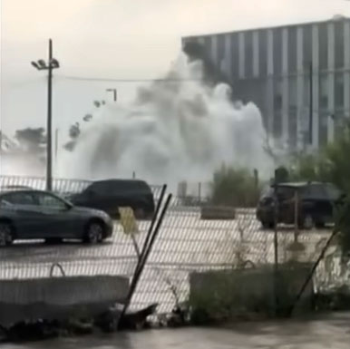
When working with public and private infrastructure projects we may encounter unexpected costs and delays due to inaccurate or incomplete utility drawings. The responsibility for providing accurate utility information is passed around from utility to owner to consultant to contractor. It is a problem that is not unique; it is common throughout North America and the world. We do not have accurate and reliable utility records showing the exact location of our underground utility infrastructure, and this information is crucial for increasing efficiency, reducing costs, and improving safety on construction projects. Examples of this problem are evident every day, and it is time to come up with solutions.
The Consequences of Inadequate Utility Records
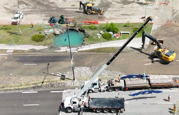
A lack of reliable information on the location of underground utilities can result in costly conflicts, damages, delays, utility service disruptions, redesigns, claims and even injuries and lost lives during construction activities. While the location of subsurface utilities might be found on plans and records, experience has often shown that the utility locations are not exactly as recorded, or the records do not fully account for the buried utility systems. An engineering practice known as Subsurface Utility Engineering (SUE) has proven to be a welcome solution to providing this much-needed underground utility information.
Introducing Subsurface Utility Engineering (SUE)
SUE is an effective means of verifying and mapping the location of existing underground utilities. Collecting data from all available sources enables professionals to provide clients with the most complete information available. This includes employing a combination of geophysical methods, civil engineering, survey mapping, electromagnetic, ground penetrating radar (GPR) and non-destructive excavation technologies. SUE is a critical part of the design process for new and existing infrastructure projects that saves clients time and cost by helping to eliminate unexpected utility conflicts and unnecessary relocations while enhancing safety during construction.
The Benefits of SUE in Infrastructure Projects
The main goal of any utility investigation is to mitigate the risk associated with encountering unknown utilities at the time of construction. This includes risk to personal safety, to the project schedule, to the project budget and more. The key to mitigating that risk is to gather a sufficient level of information such that the engineer designing the project can feel confident that there is a low probability of encountering problems in the field
Innovative Approaches in SUE and Geospatial Integration
The goal of the GoGeomatics SUE program is to explore the new and innovative methods that are now bringing geospatial and SUE together. From the integration of digital collections systems, high precision GNSS, global correction services and the use of AI to process and make sense of the massive datasets we are getting it is important to understand what has been historically collected, what and how we are collecting now and what we will be doing in the next few years, We are pulling together some of the most innovative ideas and processes to leverage geospatial and SUE technologies. Join us at GoGeomatics 2024 to see where we go.


Thank you to our sponsors!
Platinum Sponsor

Bronze Sponsors


Event & Media Sponsors


Be the first to comment