$150 million Russian satellite to launch by 2025

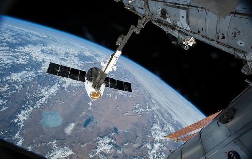
Russia’s Research and Production Association of Machine-Building has won a contract with Russia’s State Space Corporation Roscosmos to build a new Earth’s remote sensing satellite based of the existing Kondor-FKA space vehicle. The new Kondor-FKA-M is slated for launch from Vostochny spaceport by 2025; it is part of a series of small Earth remote sensing satellites developed for Russia’s Defence Ministry.
Deimos Imagery awarded multi-million dollar contract
Urthecast and its subsidiary Deimos Imagery have been awarded a European contract through a consortium led by Airbus Defence, Planet, IGN-France and space4environment. Deimos Imagery will provide a large set of Earth Observation products and services to the European Commission and European Space Agency, including cloud-free, high-resolution imagery of six million square kilometers over 39 European countries. The data will be available to institutional users and serve a wide range of applications, including monitoring of coastal zones and risk and protected areas, and the update of Land Parcel Identification Systems.
Canada’s own Will Cadell Writes Goeospatial Analytics will eat the world
The software revolution is making it easier to move, access and use data, which means a wider commercial adoption of geospatial technology. It’s easier than ever to make and sell products that capture our changing world—but do those products support actual business needs? Will Cadell says that the “future of geospatial tech might be an email alert, a report, a graph or an ordered list.” Ultimately geospatial data can deliver huge value to the services we use everyday, from Uber to banking, and the faster businesses get on board the faster they will reap the benefits of GIS.
Abu Dhabi to set up smart geospatial centre

Esri user conference 2018. (Trade Arabia)
Abu Dhabi Smart Solutions and Services Authority recently announced the establishment of the Smart Geospatial Contact Centre at the end of the International ESRI User Conference. The Centre will focus on machine learning technology, Big Data and Artificial Intelligence through GIS technology. Thanks to the goal of modernizing the procedures of the Abu Dhabi Government Contact Centre, the Abu Dhabi Government will be the first in the world to provide a platform which integrates data with geospatial infrastructure. The Centre will also mark Abu Dhabi’s collaboration with ESRI on GIS.
Smart Cities and Championing the use of Geospatial Data
Singapore is promoting greater use of geospatial information and technology by signing a memorandum of understanding (MOU) at the World Cities Summit 2018. As part of the agreement the Singapore Land Authority (SLA) will provide expertise and consulting services in geospatial information and technology to the World Bank, facilitating the development of geospatial infrastructure and projects in partner cities. According to SLA chief executive, Tan Boon Khai: “Globally, we are also seeing increased geospatial interest, propelled by the greater need for locational intelligence in building smarter cities as well as improving urban and environmental management.”
Continental Mapping gets $570 million NGA contract
Sun Prairie’s Continental Mapping Consultants Inc. has been awarded two 10-year contracts with the National Geospatial-Intelligence Agency (NGA) for global geomatics elevation and aeronautical mapping. Continental Mapping has developed software tools to aid the collection and production of aeronautical product creation, and successfully performed global High Resolution Terrain geospatial data collection for almost a decade worldwide. These contracts will allow Continental Mapping to expand their geospatial production and innovation centres, the better to provide value to the Defence community, and strengthen the U.S. through geospatial intelligence.
First geospatial industry centre in Southeast Asia launches in Singapore

Developed by Singapore Land Authority, Southeast Asia’s first geospatial centre GeoWorks supports 22 geotech startups. GeoWorks will provide the startups with open data and expertise from established companies. As well as collaborating with international organizations like the United States drone management platform AirMap, the centre will aim to boost business from retail, real estate and logistics sectors. GeoWorks is one of 13 initiatives under the Singapore geospatial Masterplan focused on enhancing government policy-making and connecting businesses with solution-providers.


Be the first to comment