The conference theme, 150 years of Canadian Geomatics
Atlantic Canada’s premier geomatics conference and trade show to be held in St. John’s 23-24 November 2017 
St. John’s, NL (5 October2017) – In November 2017 Newfoundland and Labrador will host GEOMATICS ATLANTIC, Atlantic Canada’s premier geomatics conference and trade show. This will be the thirty-third year for the event, but only the sixth time it has been held in Newfoundland and Labrador. For that reason the Newfoundland and Labrador branch of the Canadian Institute of Geomatics (CIG-NL) is making every effort to showcase Newfoundland and Labrador’s geomatics community to the rest of Atlantic Canada, and Atlantic Canada’s geomatics community to the world. For those who wish to learn more at the conference or showcase their geomatics work by exhibiting, the deadline for “early bird” registration is Friday, October 6.
“Newfoundland and Labrador’s geomatics community contributes a great deal to the health, safety and prosperity of the people of this province, the country and the world,” says Des Power, Chair of CIG-NL. “Our geomatics scientists are involved in environmental remediation, climate change science, advanced health care and the wellbeing of all Canadian citizens. We’re incredibly proud of that and want to share their stories.” 
GEOMATICS ATLANTIC 2017 is supported by Mount-Pearl-based environmental data provider Compusult, spatial analytics leader ESRI Canada and the Atlantic Canada Opportunities Agency (ACOA). ACOA is contributing $10,000 in funding to enable CIG-NL to host Geomatics Atlantic 2017 in St. John’s, NL.
“This conference is an excellent way to profile Atlantic Canada’s geomatics community and share information on local expertise in innovative areas such as remote sensing, underwater and aerial vehicles,” says Nick Whalen, Member of Parliament for St. John’s East, on behalf of the Honorable Navdeep Bains, Minister of Innovation, Science and Economic Development and Minister responsible for ACOA. “The Government of Canada’s investment in this conference ties in with our Innovation and Skills Plan, which is focused on creating growing, innovative businesses with global reach, good jobs for all Canadians, and a thriving middle class.”
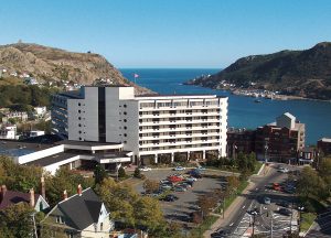
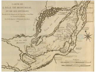
The event will be held at the Sheraton Hotel in St. John’s, NL. Through four half-day conference sessions, some thirty presenters will provide insights into the use of geomatics for understanding health, environmental impact, marine and coastal issues, etc.; and the use of geomatics for managing risk; the use of remote sensing data in geomatics; and the use of manned and unmanned underwater and aerial vehicles to gather data. The conference theme, 150 years of Canadian Geomatics, provides the focus of each session’s opening keynote presentation.
Keynote speakers include Prashant Shukle, Director General, Canada Centre for Mapping and Earth Observation, who will provide an overview of the history of geomatics in Canada, and Sam Lieff of Planet, who will address the future of geomatics in Canada and new applications being developed by his company. A more detailed agenda will be available on the conference website (https://www.geomaticsatlantic2017.com/) in the near future.
GEOMATICS ATLANTIC 2017 is organized by the CIG-NL. Founded in 1882, the Canadian Institute of Geomatics is a registered non-profit scientific and technical association dedicated to advancing the development of geomatics sciences in Canada (http://cig-acsg.ca/). CIG is represented across Canada by one or more branches in each province. CIG-NL represents the geomatics community in the province of Newfoundland and Labrador. Proceeds from Geomatics Atlantic 2017 will support CIG-NL’s ongoing initiatives on behalf of the geomatics community in Newfoundland and Labrador.
For additional information or clarification please contact:
Desmond Power
Chair, Organizing Committee
Geomatics Atlantic 2017
Phone: 709-864-8353
E-mail: [email protected]


Be the first to comment