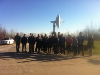
GIS Day Ottawa RADARSAT Tour
First off, HAPPY GIS DAY! Twitter was having a hayday with #GISDay tweets, and LinkedIn became a geospatial frenzy. What did you do for GIS Day? GoGeomatics Canada was happy to host our second annual […]
The International Energy Agency (IEA) in its World Energy Outlook 2012 is projecting that by 2020 the U.S. will surpas Saudi Arabia as the world’s largest oil producer. US oil and gas production, driven by […]
The Mid-Atantic Solar Energy Industries Association (MSEIA) and the Pennsylvania Solar Energy Industries Association (PASEIA) recently commissioned Clean Power Research to do a study released as The Value of Distributed Solar Electric Generation to New […]
Under current legislation, Québec must reduce its greenhouse gas (GHG) emissions by 20 percent below 1990 levels by 2020. The new government is expected at the very least to respect that goal or even increase […]
The Department of Energy’s (DoE) Quadrennial Technology Review 2011 has some very interesting statistics about energy use by buildings and DoE’s priorities in meeting the Adminstration’s goal of improving the energy efficiency of commercial and […]
The essence of this article is: preparing a thick border around polygons for display on ArcGIS Online (but also in ArcMap); note I am using what is now – Nov 2012 – referred to as […]
Construction on the first utility-scale concentrating solar power plants (CSP) in Africa has been announced. The plants will have a combined capacity of 150 MW. The output from the plants will be purchased by Eskom. […]
According to a major new study [Nature Climate Change 2, 780–788 (2012)] the EU, the U.S. and the major developing countries allocate two thirds of their public R&D budget to energy-supply technologies, but as was identified […]