• facebook
  • Twitter
  • Linkedin
  • Youtube
  • Linkedin Group
  • Post a Job
  • Post an Ad
  • Post an Event
  • Post a Directory Listing
  • Post a Press Release
  • Media Kit
  • My Account
  • Login
GoGeomatics
  • MAGAZINE
    • BIM & GIS
    • Community
    • Conference news
    • Earth Observation
    • Education & Careers
    • GEOAI
    • Announcements
    • Reality Capture & Lidar
    • Science
    • Technology
    • Between the Poles
  • Directories
    • ASSOCIATION
    • INDUSTRY
    • EDUCATION
    • Open Data
  • EVENTS
    • GeoIgnite Events
    • Events Calendar
    • GoGeomatics Meetups
  • Services
    • Advertising
    • Marketing
    • Post a Job
    • Post an Ad
    • Post an Event
    • Post a Press Release
    • Post a Directory Listing
    • Media Kit
    • Web Design
  • Find a Job
  • Volunteer
    • Start a GoGeomatics Group
    • Editors & Writers Group
  • About Us
    • About Us
    • Contact Us
    • Frequently Asked Questions
  • Videos
Home2013April

Month: April 2013

No Picture
Education & Careers

The Death of Cartography and the Rise of the Machines

22 April 2013 Andrew Raal | analysis

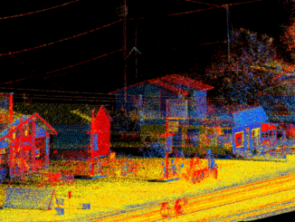
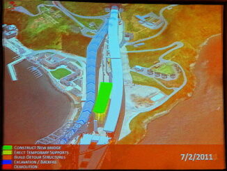
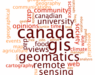
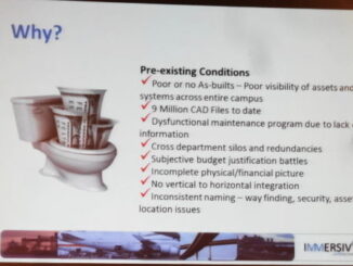
This article explores how technology has influenced map making and how cartography requirements have changed, and what skill sets one needs to make the modern map. Cartography: Back in the mid 1980’ in geology departments […]

Community

Gearing up for the Canadian National Surveyors’ Conference 2013

20 April 2013 ACLS | 2013

We can’t wait to go to the exciting seminars that are happening at the upcoming National Surveyors’ Conference 2013 (NSC 2013) in gorgeous Niagara Falls! Do you share our interest in cool new technologies? Then […]

Between the Poles – The Geoff Zeiss Archives

Using GIS to avoid nesting geese on the University of Waterloo campus

19 April 2013 Geoff Zeiss

It’s nesting season in Southern Ontario.   Geese are notoriously territorial about their nests, so finding a way across the campus at the Univerity of Waterloo (where the Blackberry was originally developed)  that avoids goose […]

3D Visualization

SPAR 2013: Integrated geospatial, LiDAR and design datasets for large infrastructure construction projects

19 April 2013 Geoff Zeiss

Kevin Gilson, of the Project Visualization group at Parsons Brinckerhoff (PB), gave an overview of how PB manages 3D+ datasets in support of design and construction for large infrastructure projects such as the San Francisco-Oakland […]

|||||||||||||||||||||||||||||||||||
Community

Who is Winning Canadian Geomatics Hearts and Minds on Twitter?

19 April 2013 GoGeomatics Canada | 2012

Who is Listening to you on Twitter? If you or your business aren’t on Twitter you might not even realize there is a Canadian geomatics conversation going on in the Twitter-verse.  GoGeomatics Canada is on […]

3D Visualization

SPAR 2013: BIM + GIS based facilities management at Denver International Airport

17 April 2013 Geoff Zeiss

At SPAR 2013 Dennis Rodriguez, Project Manager at Denver International Airport (DIA), and Daniel Stonecipher of Immersiv, gave a fascinating presentation on how they combined a BIM-based design and construction process with GIS  to create […]

Asset management

SPAR 2013: Integrated geospatially-enabled asset management at the Utah Department of Transportation

17 April 2013 Geoff Zeiss

The Utah Department of Transportation (UDOT) is responsible for about $30 billion in assets including pavement, bridges, signs, culverts and signals.  At SPAR 2013  Stan Burns, Asset Management Director at UDOT gave an overview of […]

3D Visualization

SPAR 2013: Digital highways require integrated engineering and geospatial data

16 April 2013 Geoff Zeiss

At SPAR 2013 I had the opportunity to hear very forward looking presentations by Ron Singh, Chief of Surveys/Geometronics Manager at the Oregon Department of Transportation.  What Ron sees in the future and what motivates […]

Posts pagination

« 1 2 3 4 »

Events

Feb 24
All day

Digital Leadership Day Federal

Feb 24
February 24 - February 26

Government Innovation Week – Federal

Feb 24
5:30 pm - 7:30 pm

GoGeomatics Kelowna February Social

Feb 24
5:30 pm - 7:30 pm

Kelowna Mural Map – User Feedback & Networking Social

Feb 24
5:30 pm - 8:00 pm

GoGeomatics Kootenays Meetup — Trail, BC

View Calendar

View All Events

Services

  • Post a Job
  • Post an Ad
  • Post an Event
  • Post a Directory Listing
  • Post a Press Release
  • Media Kit
  • My Account
  • Login

Jobs

Post a Job
  • Volunteer Editorial Contributor – Be Part of Canada’s Geomatics Story
    Remote
  • Junior Geomatics Field Technician – Technical Surveys
    Montréal, QC
  • GIS Specialist
    Amherst, Nova Scotia
  • Precast Structural BIM Specialist
    Calgary, Alberta
View All Jobs
  • Directories
    • Associations Directory
    • Industry Directory
    • Education Programs
    • Open Data
  • Volunteer
    • Start a GoGeomatics Group
    • Editors & Writers Group
  • About Us
    • GoGeomatics Media Kit
    • Who We Are
    • Contact Us
    • FAQ’s
    • Advertising
    • Marketing
  • Subscribe
GoGeomatics
GoGeomatics is the largest and most popular communications hub promoting the Canadian geospatial community. The business was incorporated in 2011. GoGeomatics hosts over 100 fun, free, location technology networking events each year in cities across Canada.

© 2026 GoGeomatics

  • facebook
  • Twitter
  • Linkedin
  • Youtube
  • Linkedin Group