Between the Poles – The Geoff Zeiss Archives
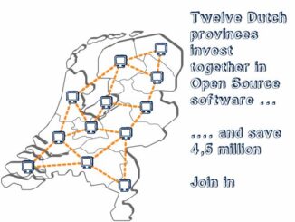
Open standards open source projects for sharing geodata among provinces saves €4.5 million
In 2006 the 12 provinces of the Netherlands developed Flamingo, software for managing and viewing geographic maps. They plan to publish a second tool, called CDS (Central Data and Service environment) based around INSPIRE standards. […]