Between the Poles – The Geoff Zeiss Archives
Comparison of metrics and trends for commercial airline accidents and underground utility damage
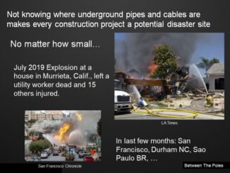
Underground utility infrastructure represents a substantial risk to workers and the public. Most damage to underground infrastructure is the result of construction excavation, recent examples include Murrieta CA, Durham NC, and San Francisco CA. But […]