• facebook
  • Twitter
  • Linkedin
  • Youtube
  • Linkedin Group
  • Post a Job
  • Post an Ad
  • Post an Event
  • Post a Directory Listing
  • Post a Press Release
  • Media Kit
  • My Account
  • Login
GoGeomatics
  • MAGAZINE
    • BIM & GIS
    • Community
    • Conference news
    • Earth Observation
    • Education & Careers
    • GEOAI
    • Announcements
    • Reality Capture & Lidar
    • Science
    • Technology
    • Between the Poles
  • Directories
    • ASSOCIATION
    • INDUSTRY
    • EDUCATION
    • Open Data
  • EVENTS
    • GeoIgnite Events
    • Events Calendar
    • GoGeomatics Meetups
  • Services
    • Advertising
    • Marketing
    • Post a Job
    • Post an Ad
    • Post an Event
    • Post a Press Release
    • Post a Directory Listing
    • Media Kit
    • Web Design
  • Find a Job
  • Volunteer
    • Start a GoGeomatics Group
    • Editors & Writers Group
  • About Us
    • About Us
    • Contact Us
    • Frequently Asked Questions
  • Videos
Home2021

Year: 2021

|
Community

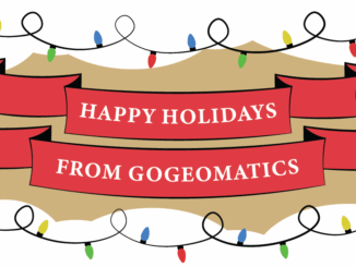
Holiday Wishes & Happy New Year from the GoGeomatics Canada Team

9 December 2021 Jon Murphy | Best Wishes

From all of us at GoGeomatics Canada we are wishing you the best for 2021. Whatever is beautiful. Whatever is meaningful. Whatever brings you happiness. May it be yours this holiday season and throughout the […]

Newsmakers & Press Releases

Geoselec, solutions designed for aerial photo accessibility

9 December 2021 Genevieve Grenier | Canada

QUEBEC – 2021-12-08 | Formerly known as La Géomathèque, Geoselec is launching its full range of specialized services and technological solutions. Geoselec stands as the number one player in Canada regarding the scanning of historical […]

Between the Poles – The Geoff Zeiss Archives

Announcing Subsurface Utility Mapping Strategy Forum (SUMSF), Mar 22-23, 2022

6 December 2021 Geoff Zeiss

The Subsurface Utility Mapping Strategy Forum (SUMSF), Mar 22-23, 2022 is a virtual conference that brings together individuals and organizations to share information about and contribute to improving the mapping of underground infrastructure. This is […]

Between the Poles – The Geoff Zeiss Archives

Identifying areas of high risk vegetation encroachment on power lines from satellite imagery

6 December 2021 Geoff Zeiss

Vegetation is a significant source of outages for many utilities. In some regions from one quarter to one half of all outages can be ascribed to vegetation. Vegetation encroachment initiated the massive North American Northeastern […]

||
Technology

International Geospatial Briefing Dec 6: 1. GPR Painting New Pictures of the Past; 2. Satellite Imagery to Support Clean Water for All; 3. Summer Heat and Environmental Inequality in Albuquerque; 4. Remote Sensing Keeping an Eye on Deforestation; 5. Educating a Skilled Geospatial Workforce in Somalia; 6. Announcing The Virtual Subsurface Utility Mapping Strategy Forum Conference

6 December 2021 GoGeomatics Canada | Archaeology GIS

Ground Penetrating Radar Providing New Insights for Archaeologists New applications of ground penetrating radar (GPR) are allowing archaeologists to gain deeper insights into ancient settlements. A team with the national park service has used GPR […]

ChallengerMapBC||||
Community

British Columbia Challenger Map

3 December 2021 Tanya Tejassvi | 3d models

See B.C. in all its 3D glory as giant Challenger Relief Map returns to PNE after 23 years The Challenger Relief Map of British Columbia is a monumental, hand built 80-by-76 foot topographic map of […]

|
Other

Call for Geospatial Workshops, Instructors & Trainers

2 December 2021 GoGeomatics Canada | Canada

GoGeomatics is looking for experienced trainers and educators who are interested in sharing their expertise with the community as well as organizations that currently offer specialised training to work with us. Our new online Training […]

|
Technology

Detecting Land Deformation Related to Hydraulic Fracturing

2 December 2021 Alexander Coster | earthquakes

Fracking in North America The link between hydraulic fracturing, or fracking, and earthquakes has been well-established in studies throughout North America. An increase in pore-fluid pressure and/or a change in the state of stress may […]

Posts pagination

« 1 2 3 … 36 »

Events

Mar 31
March 31 - April 1

Geo Connect Asia 2026

Mar 31
8:00 am - 6:00 pm

Kootenays GoGeomatics Meetup in Nelson BC

Apr 13
5:30 pm - 7:30 pm

GoGeomatics Regina Meetup

Apr 21
6:00 pm - 8:00 pm

Calgary GoGeomatics April Social

Apr 22
April 22 - April 23

11th Annual Digitalization & AI in Energy Canada Conference

View Calendar

View All Events

Services

  • Post a Job
  • Post an Ad
  • Post an Event
  • Post a Directory Listing
  • Post a Press Release
  • Media Kit
  • My Account
  • Login

Jobs

Post a Job
  • Operations Spatial Data Assistant (Contract)
    Vaughan
  • GIS Analyst
    Saint John, New Brunswick
  • GIS Student Intern
    Elmsdale, Nova Scotia
  • Canada Impact+ Research Chair – Professor (Or Associate Professor)
    Lethbridge, Alberta
View All Jobs
  • Directories
    • Associations Directory
    • Industry Directory
    • Education Programs
    • Open Data
  • Volunteer
    • Start a GoGeomatics Group
    • Editors & Writers Group
  • About Us
    • GoGeomatics Media Kit
    • Who We Are
    • Contact Us
    • FAQ’s
    • Advertising
    • Marketing
  • Subscribe
GoGeomatics
GoGeomatics is the largest and most popular communications hub promoting the Canadian geospatial community. The business was incorporated in 2011. GoGeomatics hosts over 100 fun, free, location technology networking events each year in cities across Canada.

© 2026 GoGeomatics

  • facebook
  • Twitter
  • Linkedin
  • Youtube
  • Linkedin Group