Newsmakers & Press Releases
World Geospatial Industry Council releases a Report on Spatial Digital Twins – Trends and Opportunities
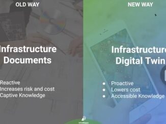
Key Highlights of the Report Recent advances in technology and reduction in costs of sensory devices for data collection have created an uplift in interest, application, and breadth of Digital Twin use-cases. Broader adoption of […]