
Have you ever felt lost when someone started talking about precision agriculture?

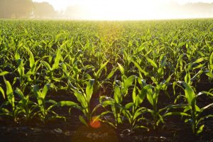
When people think about a GIS intensive environment, they probably imagine a bustling office where the inhabitants are using technology (i.e. their computers) to enhance their clients or customers lives. It is not surprising then, that most of us often do not often associate GIS with farming. Using technology to grasp the utilization of a vast amount of crop land actually makes sense because technology is constantly being used to enhance every aspect of our lives.
In the most simplistic terms, it is the way that location technology (i.e. Geographic Information Systems & geomatics) is applied in farming practices.
How does it work?
Precision agriculture has only emerged in the last half century but it has provided farming communities with the management and organizational skills that they require to better manage their land. It allows them to better navigate the delicate balance of using harmful resources in the least damaging way, as well as distributing necessary resources in the exact quantities required by the soil to maximize output and minimize input. Thus, it creates a system which is more environmentally friendly and sustainable than previous practices.
Technological advancements are often critiqued as being harmful for the environment, precision agriculture may actually be one of the few that is actually saving the environment as the amount of pesticides are reduced (by variable rate application, see below) which means less nitrates are leaked into the nearest water body. In addition, it allows farmers to better manage their water resources by only giving each plant the exact amount of hydration required for optimal fruition of crops, which reduces the usage of this most valuable resource. Knowing the full extent of their land also makes it easier for them to plan how they will plant their crops – ensuring that seeds are placed at the right distance from other seeds to give them space to grow, while ensuring that they are spread equally throughout the land to ensure that environment resources that are available are not wasted.

How are farmers using GIS?
The use of GPS and GIS together allows for real time data collection that acquires an accurate position. This means that farmers can use devices to map where exactly the resources of that farm will be used to increase the resource use as well as increase its efficiency. This is known as farm planning and is used to organize land plots and what they will be used for. GPS has also given rise to field mapping which is a system for computer aided field data collection that takes several factors into account such as inventory of crop types, elevation levels, field boundaries, nearby roads, irrigation systems, etc. This informative data allows the farmer to make informed decisions for the future of the farm that takes several details into account.
Soil Sampling
For example, soil sampling is an example of a more specific agricultural test aimed at figuring out details about the soil found such as nutrient content, composition of the soil, pH level of the soil, etc.
If the farmer can map out where the instances of less fertile soil exists then they can treat the soil as needed as well as figure out what is causing the malnutrition in the soil. Tractor guidance devices are used to allow the personnel driving the tractor to do so in perfectly parallel lines and even spaces, making overlaps or missed blind spots less likely.
Crop Scouting
Crop scouting is where the factors such as pest control, insect control, weed infestations, and crop performance are used to make decisions about that specific patch of land and whether or not using pesticides would be a financially sound decision. For example, if the strawberry patch is found to be in excellent condition without the use of pesticides (as the amount of pests are few and far in between) then it would be economically more

beneficial to not use pesticide at all. On the other hand, if insects are eating holes into at least half of the strawberry supply then pesticides must be used.
Variable Rate Application
Variable rate application is where specific materials are mapped out and the rate of the application of that material is specific to the needs of that area. It is similar to field mapping and farm planning but it is conducted on the specific need of the land by accessing its needs specifically. This detection of depletion or abundance of that specific material can be identified by map based or sensor based products depending on what is available to the farmer. These materials can then be spread around the field by crop dusters or aircraft sprayers.

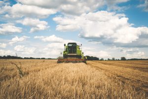
Yield Mapping
Yield mapping is collecting information on the output crops and measuring their content. This is a technique to show which areas produce the driest or moistest crops or which areas produce the biggest or smallest crop and so forth. Simply stated, it is a method to measure crop yield.
Location Technology and Farming
Hopefully, the next time, someone at your workplace or in your personal life alludes to precision agriculture; you will no longer feel like ‘a deer in headlights’ but rather be comfortable in your own skin because you will know what they are referring to. It is a good life rule to follow: do not ever allow convoluted vernacular to intimidate you.
There are many more ways in which precision agriculture can be used to enhance life and to learn more feel free to click on the links below:
Official U.S. government information about the Global Positioning System (GPS)
History of Precision Agriculture from Delmar Cengage Learning
Technology Quarterly: The Future of Agriculture by The Economist
Precision Farming: Key Technologies and Concepts by CEMA
Precision Agriculture: Using Predictive Weather Analytics to Feed Future Generations by IBM Research


Be the first to comment