The Best GIS Education in Canada
In 1960 Canada brought the first GIS to use. We can thank Dr. Roger Tomlinson for this genesis. He called the first true GIS, The Canada Geographic Information System. GIS is now an indispensable tool the […]
To celebrate the launch of the new website we are hosting get-togethers in Toronto, Ottawa, St Catharines. These free parties are hosted by the GoGeomatics Canada groups for their respective regions. Please visit their groups […]
It looks as though the Canadian federal government, through NRCAN, is going to take a long hard and very expensive look at the Canadian geomatics industry. They have issued a request for proposals (RFP) for […]
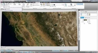
On the Autodesk Labs site, you can find a new free technology preview, Project Basejump, that enables AutoCAD Map 3D and AutoCAD Civil 3D users to access Microsoft Bing web mapping service (WMS) maps including […]
GoGeomatics is continuing the exploration of careers in surveying by interviewing Thomas Hoppe, the founder of 43 Degrees North – Surveying and Mapping Solutions. 43 Degrees North is situated in Cobourg Ontario in picturesque Northumberland County along the north shore of Lake Ontario is a professional Land Surveying and Geomatics company in Ontario Canada. They provide a variety of geo-referenced solutions from boundary surveys, aerial photography ground support, pre-engineering surveys, construction layout, and survey training with an emphasis on GPS applications and technology […]

We had the opportunity to talk with Mike Strutt about surveying and his career. Mike is one of the most experienced surveyors in Canada . began his survey career in 1974 and managed his first GPS project in 1987 while a field officer with the Geodetic Survey of Canada. Prior to joining Topcon where he now manages RTN Services, Support & Training, Mike spent in excess of 11 years and 10,000 hours delivering instruction on the use of GPS for surveying and mapping.
If you’re thinking about getting into surveying or just more about what a surveyor does this is a must read. […]
Mark Volz of Ergon Energy gave a presentation at AU that described how Ergon Energy has integrated enterprise resource planning (ERP), GIS, and design systems around a single point of truth and provides web-based access. […]
At AU I made time to attend an excellent presentation by Lou Ball, who has been in the utility business for over 20 years, on migrating data from CAD drawing files (typically DWGs) to GIS. […]