The essence of this article is: preparing a thick border around polygons for display on ArcGIS Online (but also in ArcMap); note I am using what is now – Nov 2012 – referred to as ArcGIS Online Personal, rather than ArcGIS Online for Organizations. The trick, is to have those thick borders only inside the polygons; traditional cartographic borders are drawn inside and outside polygons. I got the basic idea from Esri’s Liz Sarow, and wanted to try it on my own. Here’s an example:
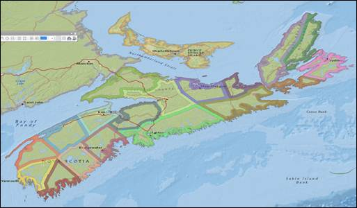
Figure 1: Thick (5 km) borders around inside of each NS County (ArcMap)
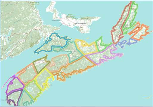
Figure 2: Thick (5 km) borders around inside of each NS County (ArcGIS Online)
Original data has extraneous-to-us lines inside each county.
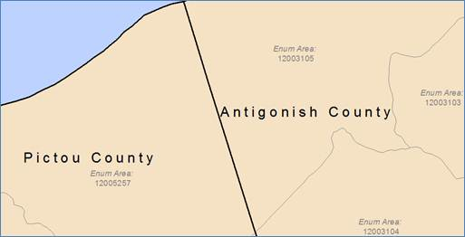
Figure 3: original county data has interior lines (ArcMap)
Note that ArcGIS Online allows data upload in a number of formats, but not as file Geodatabase Feature Classes.
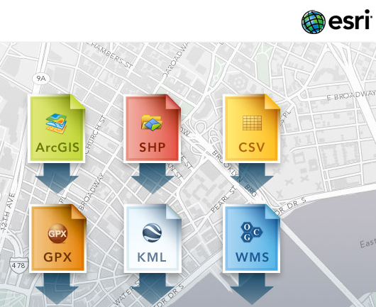
Figure 4: possible data formats available for uploading to ArcGIS Online
The ArcMap model (1) dissolves interior lines; (2) buffers inwards; (3) erases interior of each county; (4) converts to shapefile.
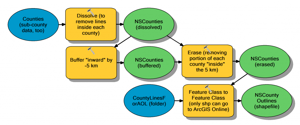
Figure 5: modelbuilder to dissolve, buffer inward, erase interior, & convert to shapefile (ArcMap)
The buffer distance of -5 km works for this map by “buffering inward”; in Liz’s example, I suspect she used a value (for much larger regions of the USA) such as 10 or 12 miles. This value must be jigged for each unique situation.
So, process data in ArcMap to get just the lines of interest (could also generalise, too); buffer inward; erase inside of polygons; convert to shapefile; upload to ArcGIS Online; prepare any symbology; publish your map!
You can click this temporary link to see the online version: http://bit.ly/RuVcNF


Be the first to comment