
- Department of National Defence Invests in Sovereign Launch Capabilities and Canadian Space Industry
- Inline Group Acquires Challenger Geomatics
- Arctic Infrastructure Initiative Announced
- Natural Resources Canada Updates the Canada Flood Map Inventory
- New Natural Hazard Data Platform Fills a Key Gap in the Canadian Insurance Industry
- A Geospatial Success Story: Studying Geospatial Data Science at the University of Waterloo
Department of National Defence Invests in Sovereign Launch Capabilities and Canadian Space Industry
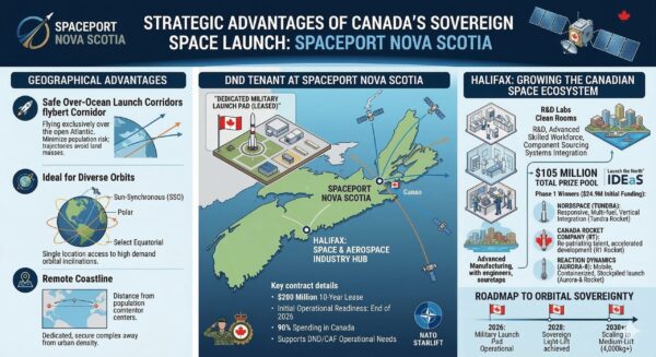
The Department of National Defence is investing $200 million in a Nova Scotia spaceport, taking a key step towards a fully sovereign Canadian space sector. The spaceport will be in a highly-strategic location, with proximity to the Atlantic and access to ideal orbital inclinations.
This investment is also accompanied by a $24.9 million dollar investment in three Canadian aerospace startups: NordSpace, Reaction Dynamics, and Canada Rocket Company. This investment is part of the Launch the North initiative and seeks to stimulate innovation in the Canadian space industry and the development of Canadian launch vehicles.
Read more here.
Inline Group Acquires Challenger Geomatics
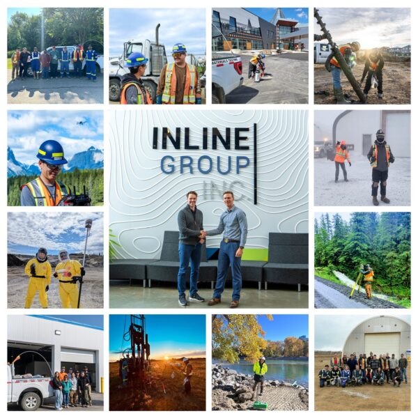
Civil engineering field services firm Inline Group has recently acquired land surveying, geomatics and geospatial firm Challenger Geomatics. The acquisition will mean a significant geographic expansion for Inline, with the ability to now serve clients across Western Canada and the North, and an expansion in capabilities and services provided for both companies.
Read more here.
Arctic Infrastructure Initiative Announced
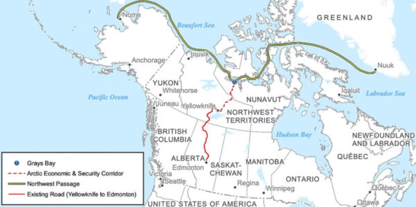
Over $40 billion in investments in Arctic infrastructure projects has recently been announced by the Carney government, with the intention of strengthening Arctic sovereignty claims and facilitating the extraction of mineral and energy resources in the far north.
One of these proposed projects is the Grays Bay Road and Port project, a road that will link Yellowknife to a new deepwater port in Nunavut along important Arctic shipping routes. These projects will not only strengthen Canada’s claims in the north, but stimulate economic development and GIS technologies will undoubtedly play a key role in their planning and execution.
Read more here.
Natural Resources Canada Updates the Canada Flood Map Inventory
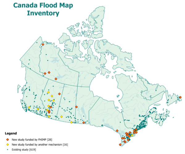
Natural Resources Canada has released a new set of updates to the Canada Flood Map Inventory. This update includes 110 updates to existing studies and the addition of 44 new studies, including 28 studies funded by the Flood Hazard Identification and Mapping Program (FHIMP).
Read more here.
New Natural Hazard Data Platform Fills a Key Gap in the Canadian Insurance Industry
The Institute for Catastrophic Loss Reduction (ICLR) has recently launched Catview, an online Google-Maps based platform for natural hazard data. This platform is intended for users in the property and casualty insurance industry and combines data and maps about earthquakes, wildfire, landslides, and extreme weather events in a single, easy to use interface.
The platform fills a key gap in the Canadian insurance industry. Canadian natural hazard data can be difficult to find and use. The Government of Canada has good data, but it can be hard to find the right data, hard to download, and not usable by companies as many lack GIS personnel. Catview fills this gap by consolidating information, and providing it in a format that is easily digestible for those unfamiliar with GIS.
Read more here.
A Geospatial Success Story: Studying Geospatial Data Science at the University of Waterloo

Aujas, a graduate from the University of Waterloo’s Geospatial Data Science program, shares how he has launched a successful career in the geospatial industry thanks to the university’s co-op program. During his co-op terms he had the chance to work in remote sensing and geospatial analysis, water and waste management, IT, and engineering for both the public and private sectors. His extensive experience meant he graduated ready for the workforce and now works for the City of Oshawa as an Asset Management Data Analyst.
Read more here.


Be the first to comment