MDA to Build 17 Satellites to Enhance Globalstar’s LEO Constellation

According to MDA’s announcement on Feb 24th, this company is the prime contractor for Globalstar Inc.’s new Low Earth Orbit (LEO) satellites. Globalstar provides Mobile Satellite Services such as customizable satellite IoT solutions for individuals and businesses globally. Rocket Lab USA, another innovative satellite company, will be MDA’s partner on this contract.
The contract comprises the design, manufacture, assembly and test of 17 satellites. The satellites made by MDA incorporate with Globalstar’s existing constellation. It will be ensured that the services for Globalstar customers will continue.
MDA will manufacture Globalstar’s satellites and direct the payload and integration development. Rocket Lab USA will guide the spacecraft bus development.
Read more here
Image: MDA logo (CNW Group/MDA Inc.)
Drone Delivery Canada Updates:
- Drone Delivery Canada announces management change
Steve Magirias was appointed as the new Chief Executive Officer of Drone Delivery Canada., effective February 22, 2022. He has more than two decades of experience working with both established and entrepreneurial companies.
Michael Zahra, the previous Chief Executive Officer of the Company stays on the Advisory Board to provide insight and support to different projects.
Read more here
- Drone Delivery Canada provides an update on new Canary drone testing

DDC published the current ongoing testing of Canary drone which includes a flight controller tuning to fly in semi-autonomous flight modes and refining onboard avionics, payload and communications systems. Also, the update represented the next testing steps such as full autonomous missions and expanding the flight envelope.
Read more here
Image: DDC drone (CNW Group/Drone Delivery Canada Corp.)
Volcanic eruptions, floods, and daily ice, crop monitoring highlight need for RADARSAT imaging program
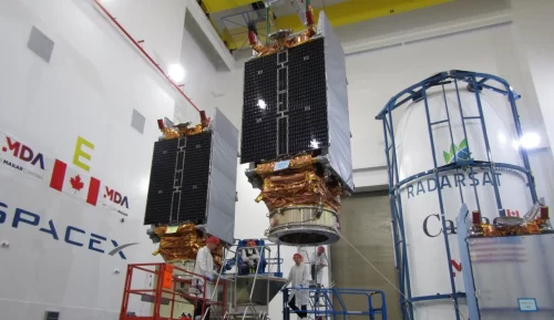
SAR (Synthetic Aperture Radar) allows the various RADARSAT platforms to take precise images of each point on the Earth, with exact ground track repetition every 24 days for RADARSAT-2 and every four days for RADARSAT Constellation. These images are more helpful in evaluating circumstances in parts of the world that have been destroyed by natural disasters in the immediate aftermath especially when air travel is not possible.

In natural disaster events, including the extreme drought, fires and severe flooding that impacted British Columbia in Canada, the Canadian Space Agency’s Executive Director, Space Exploitation, Guennadi Kroupnik believes that RADARSAT Constellation and RADARSAT-2 were crucial in supporting teams to create maps of the impacted area for search, rescue, recovery and relief operations.
Read more here
Image: RASARSAT during payload integration work – Via CSA
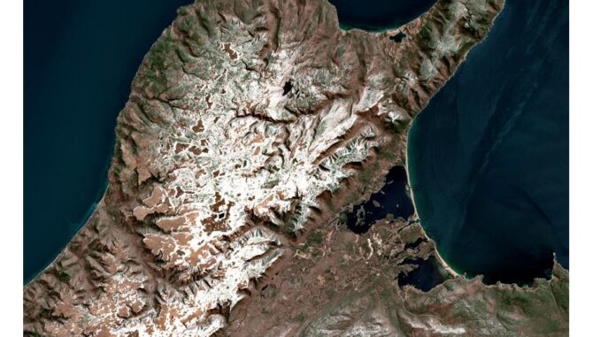
People delighted when Cape Breton Highlands of Nova Scotia satellite image looks like adorable kitty
Last week, Canadian Space Agency posted a funny geomatics post on Twitter, satellite image of Cape Breton Highlands in Nova Scotia and a cute cat in a relaxed position.

European Space Agency’s Copernicus Sentinel-2 satellite captured the original photo in April 2021. It was processed by Lost Art Cartography artist Marcel Morin.
Image: A Kitty and map of Northern Cape Breton Island, Nova Scotia
Check out the credit and full description of this satellite image HERE
— Canadian Space Agency (@csa_asc) February 23, 2022
Read more here


Be the first to comment