- BC First Nations adopts indigenous names for Protected Areas Maps
- Canada’s National Cycling Map
- City of Ottawa 3D geospatial endeavors
- Canada’s Electric Vehicle supply chain mapped
- Alberta’s declining health care services mapped
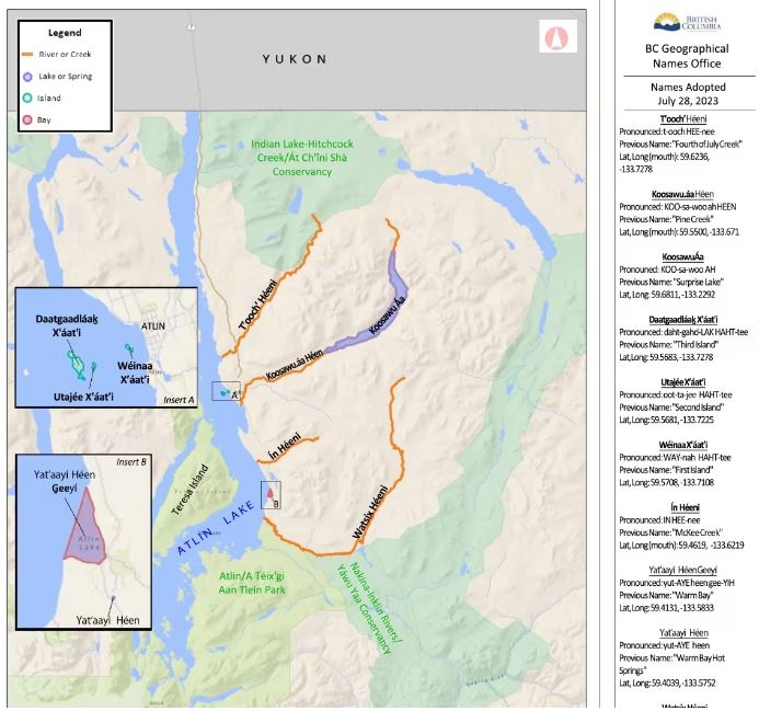
BC First Nations adopts indigenous names for protected areas maps
As Canada moves towards truth and reconciliation with First Nations, maps play a big part in these education efforts. Recently, 2 maps created by the Tsawout and Taku River Tlingit First Nations for their protected areas use indigenous names for places. In addition, The Taku River Tlingit names of 13 places will be added to BC issued provincial maps. Read More on the Tsawout and Taku River Tlingit.

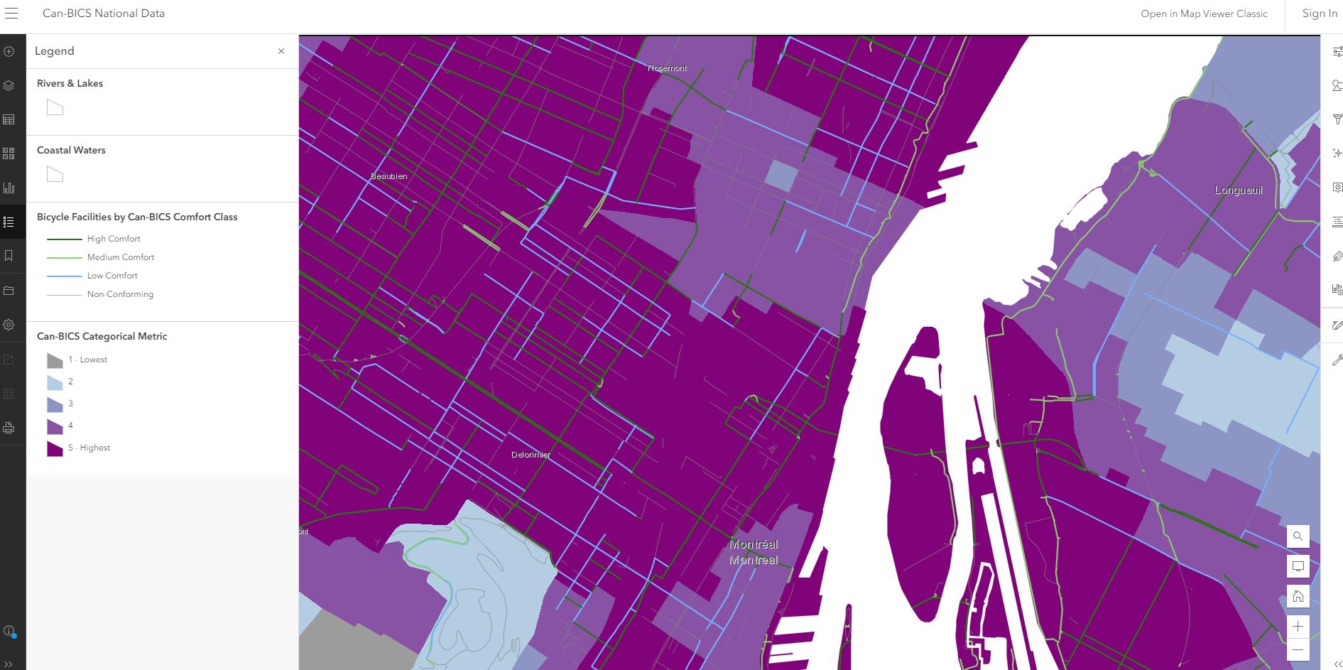
Canada’s national cycling map
Many cities across Canada have seen more bike paths and cycling infrastructure added over the last decade. In an effort to create consistencies across cycling infrastructure, researchers from Simon Fraser University have put together Canada’s 1st cycling map which visually reflects the Canadian Bikeway Comfort and Safety Classification system. Read More and check out the map.

City of Ottawa 3D geospatial endeavors
Supporting the city of Ottawa’s 3-decade official plan, planers and staff from the city have turned towards a developing a transformational digital twin. Built upon ESRI’s ArcGIS, photogrammetric and LiDAR data, tools such as a zone builder can be created. Such tools enable increased collaboration between planners and developers. Read More.

Canada’s electric vehicle supply chain mapped
What goes into an electric Vehicle? As Canada position’s itself to become a leader in the EV industry, an interactive map that visualizes all of related activities has been created. This aims to increase collaboration between companies and provide a broad picture if there are any gaps in the supply chain. Read More and check out the map.

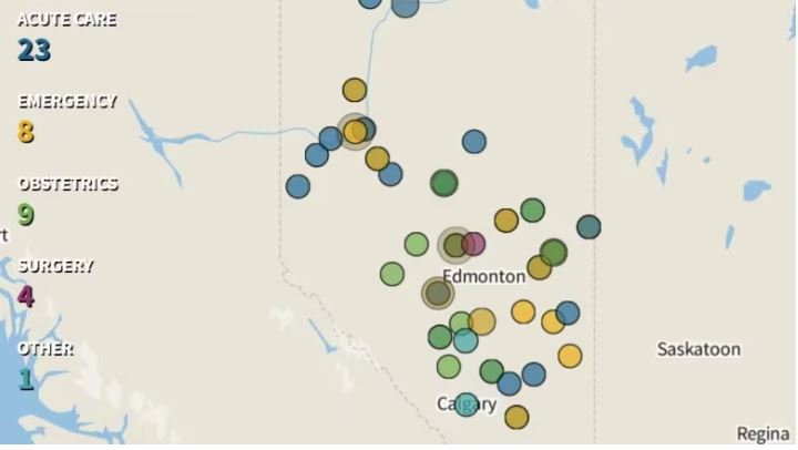
Alberta’s declining health care services mapped
Creating maps is a way to visualize information that needs to be acted upon. In this map, each disruption in health care services appear as a dot. These dots also flicker reflecting services that are intermittent in nature. Combining them all together on a map creates a call to action. Read More


Be the first to comment