-
Mississauga’s daunting climate data raises concerns
-
LiDAR technology tested on the real-world light rail system
-
Premier’s award for Fleming college graduate
-
Utilize new NRC risk assessment algorithms to safely navigate the Arctic voyage
-
The Royal Canadian geographic society presented 16 awards
Mississauga’s daunting climate data raises concerns
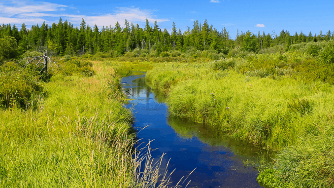
It is no secret that Canada is warming up alongside the rest of the planet. An organization that works hard to conserve and improve the environment, Credit Valley Conservation (CVC), has recently developed a story map that places an emphasis on the climate data regarding ecosystem health in the Credit River watershed.
The story map depicts how the winter has warmed up swiftly along with the general warming trends in Canada. There is a 2.5-degree Celsius average minimum temperature increase.

Additionally, Credit River Watershed is experiencing an alarming increase in precipitation levels, up to 13 percent in wintertime, which is falling as rain rather than snow. As a result of this change, there is a constant danger that nutrients will wash away with the sediment in streams. Read More
LiDAR technology tested on the real-world light rail system
Demand for Li DAR technology has never been higher. A Canadian start-up Lux Modus has successfully tested its Li DAR technology which was built for pipeline construction in the past. The technology was put to test on the light rail system in Calgary to collect some 3D real-world datasets.
The Calgary Li DAR trial was carried out utilizing an omnidirectional laser sensor system which was set up on trains, platforms, and tracks thanks to the opportunity provided by Calgary’s Living Labs.
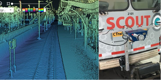
Utilizing the technology to collect and store vast amounts of data during the trial including high-quality 3D images has also assisted the team in exploring additional use cases that may arise in the future, such as the upkeep of railway infrastructure and the ability to monitor platform and track shift over time with an accuracy of just a few centimeters.
Lux Modus is prepared to offer an affordable and user-friendly 3D platform for data collection, processing, and producing 3D maps by using its AV (autonomous vehicle) mapping technology. Read More
Premier’s award for Fleming college graduate
In recognition of his services to the industry, Fleming College alumnus Steve DeRoy was given a Premier’s Award in the technology category on November 28 in Toronto. In 1998, DeRoy completed the training for cartographic specialists in geographic information systems (GIS).
Along with technological partners like Google, Esri Canada, Mapbox, NASA, and the Canadian Space Agency, he founded the Indigenous Mapping collaborative in 2014.
He is also a founding member of the Firelight organization, which assists Indigenous people with technical assistance and community-based research. Read More
Utilize new NRC risk assessment algorithms to safely navigate the Arctic voyage
Who would have imagined that there would be occasions when a ship might navigate the Arctic Passage? The number of polar travelers is rising as the ice season gets milder each year as a result of climate change. A reliable and complicated navigation system is necessary for the accurate assessment of routes, safety risks, and rapidly changing weather occurrences.
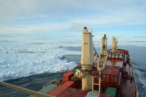
The Canadian Arctic Shipping Risk Assessment System (CASRAS), was created by the National Research Council of Canada (NRC) in partnership with the Canadian Coast Guard (CCG), Transport Canada (TC), Department of National Defense (DND), Government of the Northwest Territories, Environment and Climate Change Canada’s Canadian Ice Service, the shipping industry, and non-governmental organizations, supports color-coded maps giving an idea on current and future ice condition and aids in reducing the risk of hitting an iceberg.
CASRAS comes with 80 or more datasets which include historical and present ice conditions data, a 2-day high-resolution ice forecast, and many more features. NRC continuously updates the system using new data from researchers and teammates. CASRAS will continuously mature as internet availability get better in the Arctic region. Read More
The Royal Canadian geographic society presented 16 awards
The Royal Canadian Geographical Society has honored 16 people who best represent the Society’s mission to “improve public understanding of Canada among Canadians and the world.”
Awards have been given to those with exceptional performance in the fields of geography, education, science, and exploration as well as for volunteering to help Society. Read More



Be the first to comment