- The Alberta team’s research map shows the health impact of climate change
- By 2100 Lower Mainland will lie below annual flood levels
- The AutoATES map to assess avalanche risks
- There will be Canadian National Space Council: Federal government announces
- Canadians are finding it hard to get flood insurance due to rising flood risks
- Québec’s new building footprints will be added to the Community Map
- BigGeo Research receives historic Mitacs at University of Calgary
The Alberta team’s research map shows the health impact of climate change
University of Alberta research team has created a map that shows how different areas and communities in Edmonton neighborhood are affected due to climate change. This ongoing project explores different health conditions and vulnerability to various climate hazards.
Along with respiratory disorders, mental health issues, cardiovascular disease, and dementia, there is another factor to consider, such as demographics in various locations, because socioeconomic level and age play a significant part in determining if someone is at risk.
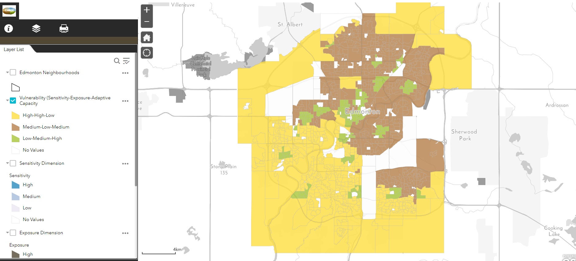
This map clearly demonstrates risk and adaptivity domains with high, medium, and low levels. Each level is color-coded to show its effect in the Edmonton neighborhood. Read more here.
By 2100 Lower Mainland will lie below annual flood levels
Climate Central, a non-profit group consisting of scientists and communicators based in Princeton, New Jersey, has estimated that 325,000 people in Canada will live on land falling into annual flood risk zones by 2100. According to the new map project nearly all of Richmond, Delta and large portion of Surrey will most likely be at the highest risk.
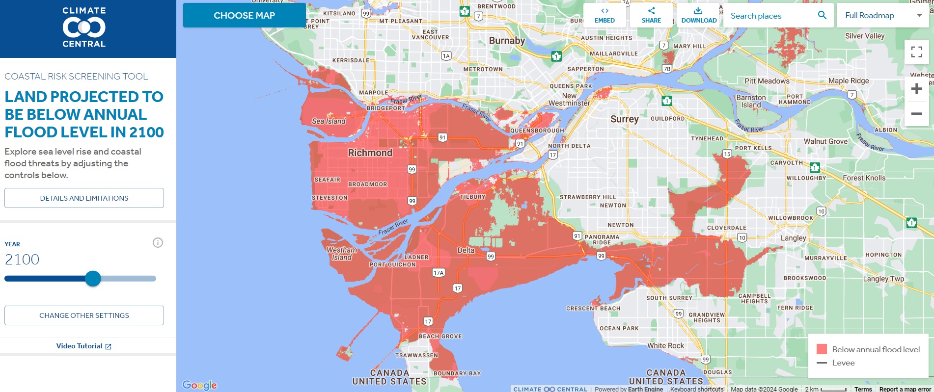
At current conditions, the area south of Vancouver is highly susceptible to coastal flooding. This threat is evolving over time and will have major consequences by the end of century. Sea levels are projected to rise up to 0.5 meters by 2050 and one meter by 2100 along the B.C. coast. Read more here.
The AutoATES map to assess avalanche risks
A new mapping tool called Automated Avalanche Terrain Exposure Scale map, or AutoATES map is coming handy to outdoor enthusiasts to make better decisions related to their trips into avalanche terrain in Kananaskis Country and get a clear idea of avalanche hazards.
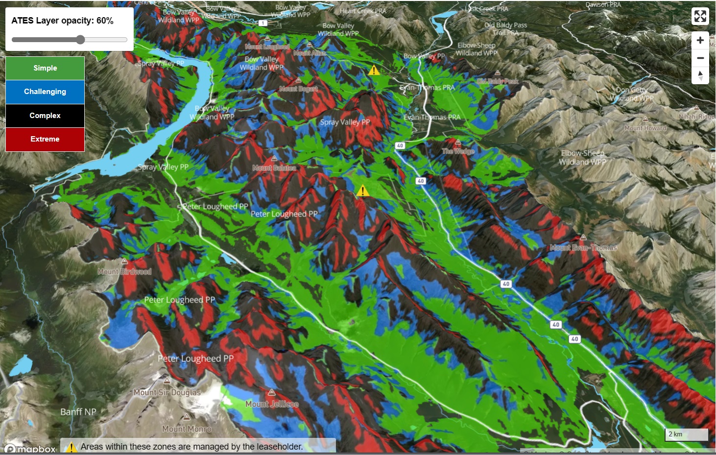
This current map is an easy-to-use interactive computer-generated topographic map that shows avalanche risk levels ranging from minimal danger to severe hazards. It uses geospatial models to determine avalanche risks based on slope angle, avalanche runout, terrain traps, and forest density.
The map is based on a modified version of the Avalanche Terrain Exposure Scale (ATES), which was developed by Parks Canada staff in the early 2000s. The scale was originally designed with three terrain classes: simple, tough, and complex. The scale’s original developers, Parks Canada Banff field unit rescuer Grant Statham and Cam Campbell of Alpine Solutions Avalanche Services, released a second version in 2023. The upgraded version includes two additional classes: non-avalanche and extreme terrains.
The automated mapping initiative brings together avalanche experts and authorities from across Canada and around the world. Read more here.
There will be Canadian National Space Council: Federal government announces
The Canadian space sector is granted an extra boost from the federal government, both in terms of money and goal setting. The federal government also announced the creation of a National Space Council, which will be the first of its kind whole-of-government approach to space exploration, technological advancement, and research. The space sector is now a quickly growing, highly strategic, and competitive sector, and there is a crucial need to realize its role in Canadians’ lives, as well as our economy and national security.
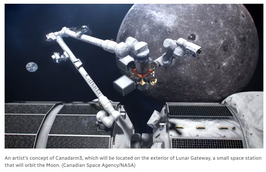
Additionally, “STEM positions contribute to two-thirds of the space sector’s jobs. These are well-paying, solid professional fields for Canadians. Hence, the space sector will contribute around $2.8 billion to the Canadian economy,” said the CEO of Space Canada. Read more here.
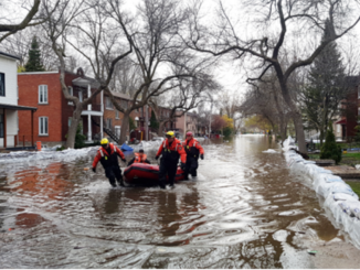
Why Canadians are finding it hard to get flood insurance?
Out of all provinces, Quebec is finding it hard to get flood insurance. According to the survey, Quebec has the most properties disqualified for flood insurance, followed by Ontario and British Columbia.

At this point, Canada lacks an accurate map of flood risk. According to research, the majority of homes in the top 10% of flood risk are located in Quebec. About 200 homes in his ward are at risk of flooding are not covered by flood insurance. And it most likely that people might not get the coverage by default because they fall in flood risk zone.
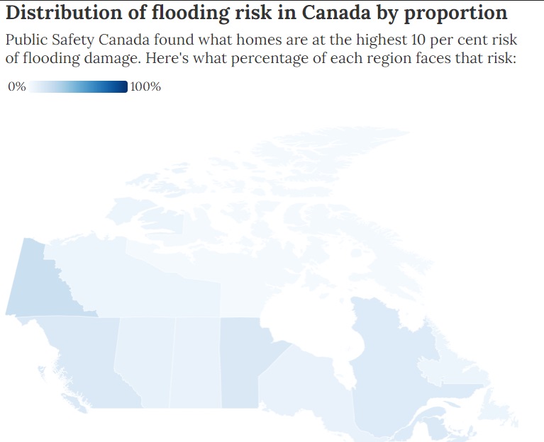
Homeowners in high-risk areas cannot even obtain mortgages for their properties without flood insurance, let alone fix their homes. Creditors, on the other hand, prioritize home insurance in order to protect the mortgage. Read more here.
Québec’s new building footprints will be added to the Community Map
The recently released building footprint dataset layer from the province of Quebec will be included in Canada’s community map. This new building footprint layer was developed in collaboration with Natural Resources Canada and generated automatically from readily available LiDAR data. It includes building polygons for most of southern and eastern Quebec.
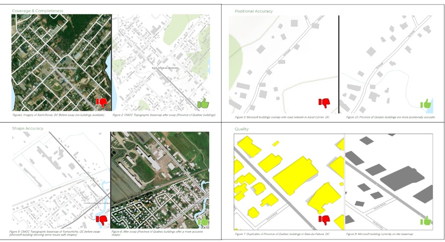
Because the goal of the Community Map of Canada is to feature accurate, authoritative, and up-to-date community data, as well as to engage and empower communities to contribute data for autonomous community representation, the GIS analysts who represent Québec on the basemap went over each of their communities, comparing the new building layer to previous data sources. Read more here.
BigGeo Research Initiative receives historic Mitacs at University of Calgary
The University of Calgary, Faculty of Science has been awarded the largest funding grant ever by Mitacs, a national not-for-profit that fosters innovation and economic growth. Professor Dr. Faramarz Samavati of the University of Calgary received funds for research in support of their collaboration with BigGeo, a technology business. Together, they are transforming the scale of the geospatial data landscape by utilizing BigGeo’s Volumetric Discrete Global Grid System. BigGeo simplifies geospatial data processing and allows for quick and flexible data consumption by bridging the gap between raw data, its analysis and representation. Read more here.



Be the first to comment