- Laurier Professor Charts Northern Ice Roads
- Montreal Launches Interactive Construction Site Map
- University of Waterloo Students Investigate Noise Pollution Near Airport
- Geosapiens Unveils Nationwide Flood Maps
- Mapping the Decline of Glaciers in Western Canada
Laurier Professor Charts Northern Ice Roads
A Laurier professor pioneers the mapping of northern ice roads, crucial lifelines in remote Canadian regions. Utilizing geospatial technology and satellite imagery, the project aims to improve the accuracy and efficiency of ice road mapping. By documenting these seasonal transportation routes, researchers enhance safety and accessibility for communities reliant on ice roads during winter. This initiative highlights the transformative impact of geospatial tools in supporting infrastructure development and resilience in Canada’s northern regions. To learn more, click here.
Montreal Launches Interactive Construction Site Map
Montreal has launched a new online map showcasing construction sites across the city. The interactive map provides real-time information on construction projects, helping residents and commuters navigate urban development. With detailed project descriptions and timelines, this geospatial tool enhances transparency and public engagement in construction activities. To read more, click here.

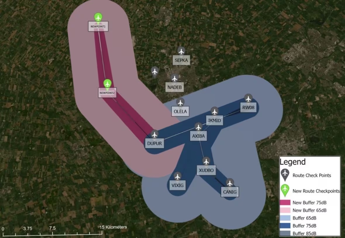
University of Waterloo Students Investigate Noise Pollution Near Airport
University of Waterloo students conducting research on noise pollution near the Region of Waterloo International Airport. Utilizing geospatial technology and field observations, the study investigates the impact of aircraft noise on nearby communities. Through sound monitoring and data analysis, students aim to assess noise levels, identify affected areas, and propose mitigation strategies. To learn more, click here.

Geosapiens Unveils Nationwide Flood Maps
Geosapiens unveils a groundbreaking flood model with nationwide coverage, marking a technological milestone for Canada. Leveraging advanced geospatial analytics, the model provides comprehensive flood risk assessment nationwide. As impacts of climate change lead to higher flood risk in many Canadian communities, this important work by Geosapiens offers valuable insights into flood-prone areas, aiding in disaster preparedness and risk mitigation efforts. This innovative solution underscores the transformative potential of geospatial technology in addressing critical challenges such as flood management on a national scale. To read more, click here.
Mapping the Decline of Glaciers in Western Canada
A new study from UNBC explores the alarming trend of glacier loss in western Canada, driven by climate change. Scientists employ satellite imagery and remote sensing techniques to monitor the rapid retreat of glaciers in the region. The article highlights the cascading impacts of glacier loss on water resources, ecosystems, and sea level rise. By leveraging geospatial technology, researchers gain crucial insights into the extent and pace of glacial decline, emphasizing the urgency of climate action to mitigate the far-reaching consequences. To read more, click here.


Be the first to comment