Community
International Geospatial Digest – April 27, 2026
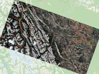
Geodesy moves into everyday workflows Cool Cities Lab turn urban heat data into real decisions The limits of satellite flood monitoring Using geospatial data to guide emergency blood deployment Brazil and FAO simplify access to […]