- Remote First Nation Community Getting High-Quality Digital Twin
- Exploring and Mapping the Environmental Stressors around Wood Buffalo National Park
- New Flood Mapping for Climate Resilience in Edmonton
- The Watersheds of New Brunswick – In Subway Form
- Neighbourhood Tool Looks at Health in Canadian Cities
- The Fastest-Growing Tech Hubs in North America
Remote First Nation Community Getting High-Quality Digital Twin
Frog Lake First Nation embraces drone mapping technology to document and preserve culturally significant sites. Collaborating with spatial mapping experts, the First Nation community employs drones to capture high-resolution images and 3D models of areas with historical and spiritual significance. This geospatial initiative contributes to cultural preservation efforts, aiding in documenting and safeguarding sacred sites. Drone mapping underscores the intersection of technology and cultural heritage, providing an innovative means to protect and transmit ancestral knowledge for future generations. Read the story.
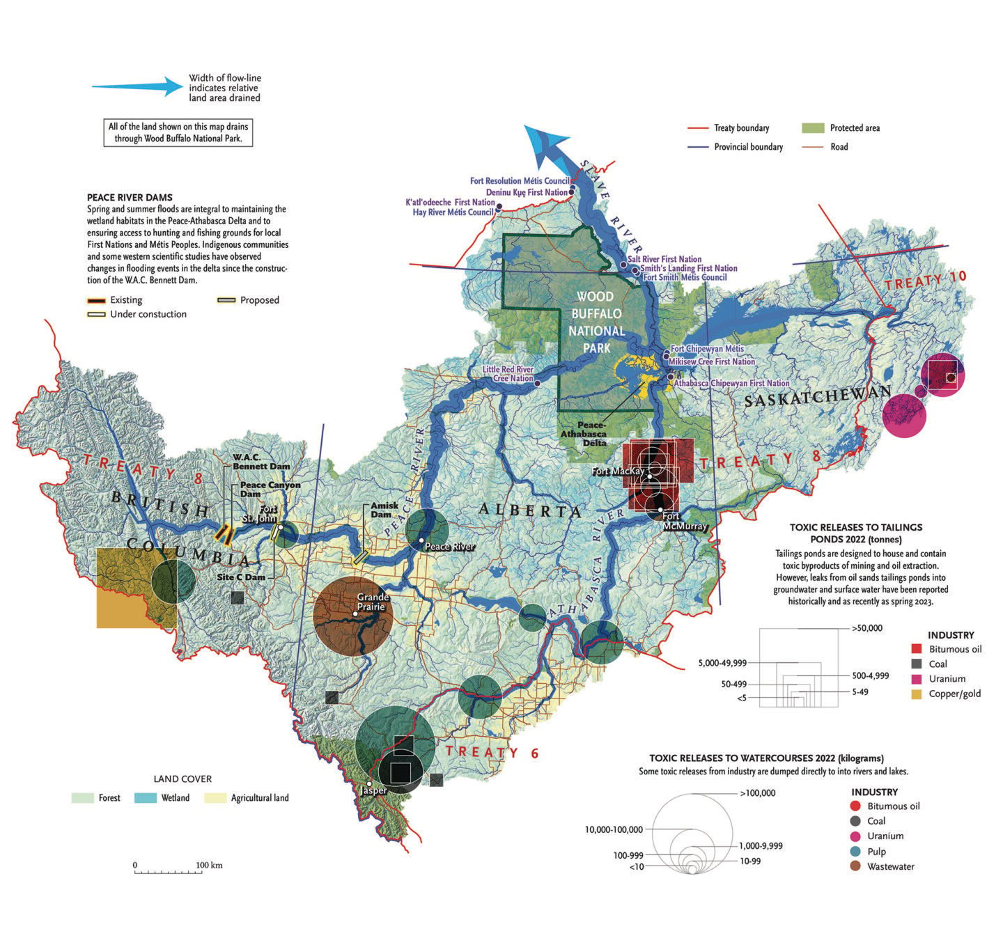
Exploring and Mapping the Environmental Stressors around Wood Buffalo National Park
Canadian Geographic delves into the unique ecosystem of Wood Buffalo National Park, a UNESCO World Heritage Site and the largest national park in North America. This comprehensive article explores the park’s diverse flora and fauna, including the iconic wood bison and whooping crane, and the threats they face from surrounding industrial activity. With rich storytelling and exquisite maps, the piece captures the ecological significance of the park and the challenges it faces, such as wildfires and industrial development. It serves as a compelling exploration of this natural treasure and the need for its conservation. Read the story.

New Flood Mapping for Climate Resilience in Edmonton
Alberta unveils draft flood maps to enhance resilience against climate-related risks. The maps, a critical component of the provincial flood mapping program, aim to provide accurate and accessible information on flood-prone areas. With a focus on the North Saskatchewan River in the Edmonton area, the maps incorporate climate projections to anticipate future risks. This initiative, part of Alberta’s commitment to proactive flood mitigation, empowers communities, decision-makers, and residents with valuable geospatial data to navigate and prepare for potential flooding events in the face of changing climatic conditions. Read the story. View the maps.
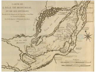
The Watersheds of New Brunswick – In Subway Form
A Mount Allison University student in New Brunswick creates an innovative watershed map to enhance understanding and environmental awareness. The project combines data visualization with user-friendly features, allowing residents to explore the watershed’s intricate details. The map is an educational tool that provides insights into water quality, ecosystems, and potential impacts on aquatic life. This geospatial initiative fosters community engagement and underscores the importance of technology in empowering individuals to connect with and contribute to environmental conservation efforts. Read the story.

New Neighbourhood Tool Looks at Health in Canadian Cities
In Montreal, the McGill University Health Centre has introduced an interactive tool allowing residents to explore environmental factors affecting health in specific neighbourhoods. The tool, accessible online, provides insights into air quality, noise, and green spaces. Developed by researchers, this geospatial initiative facilitates informed decision-making for residents, urban planners, and health professionals. Empowering communities with localized environmental data, the tool aims to enhance awareness, encourage sustainable urban development, and contribute to public health improvements by fostering a deeper understanding of the environmental determinants of health. Read the story. View the application.
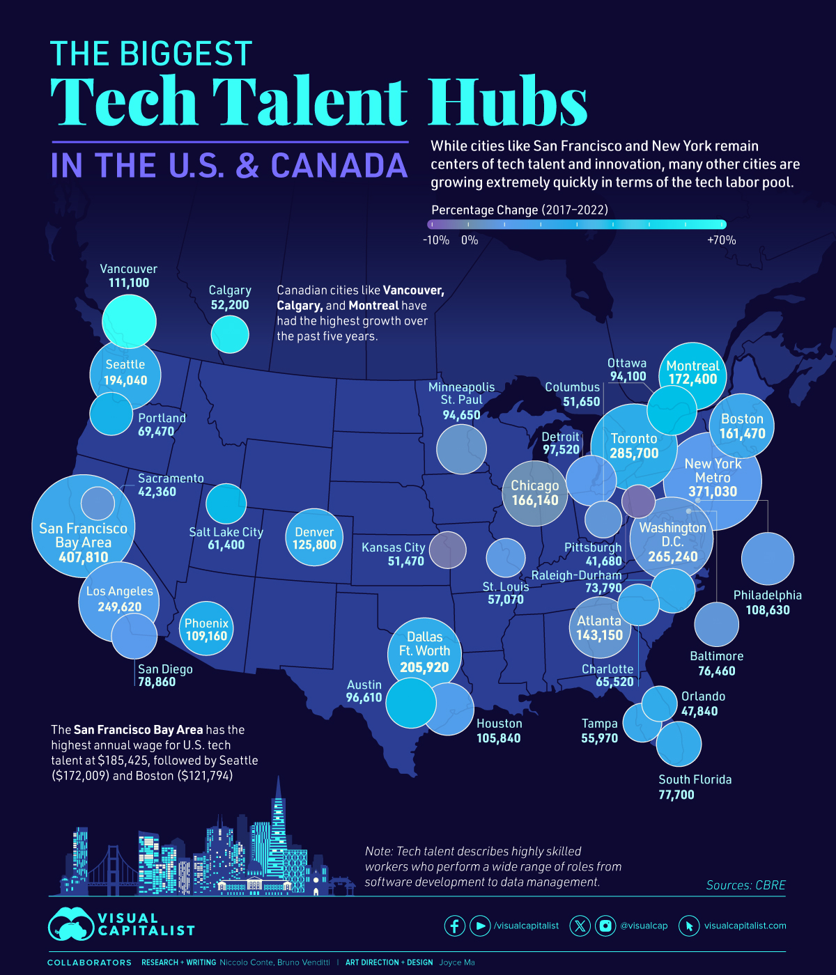
The Fastest-Growing Tech Hubs in North America
Visual Capitalist unveils an insightful map highlighting the biggest tech talent hubs in the United States and Canada. The map provides a comprehensive overview of key cities fostering innovation and technology development. With data on tech employment, job growth, and concentration of tech talent, the infographic showcases the dynamic tech ecosystems. This resource is a valuable tool for businesses, professionals, and policymakers seeking to understand and navigate the vibrant landscape of technology hubs across North America. Of particular note is that some Canadian cities are among North America’s fastest-growing tech hubs. See the map and story here.


Be the first to comment