
- Award-Winning Calgary Innovation by UCalgary Researcher for Revolutionary 3D Mapping Technology
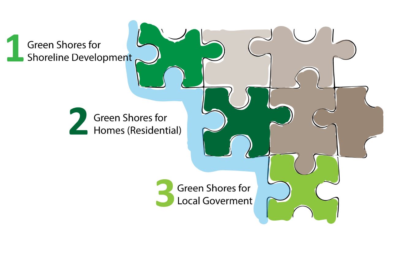
- Coastal Risk Map Shows Your Neighborhood Vulnerability
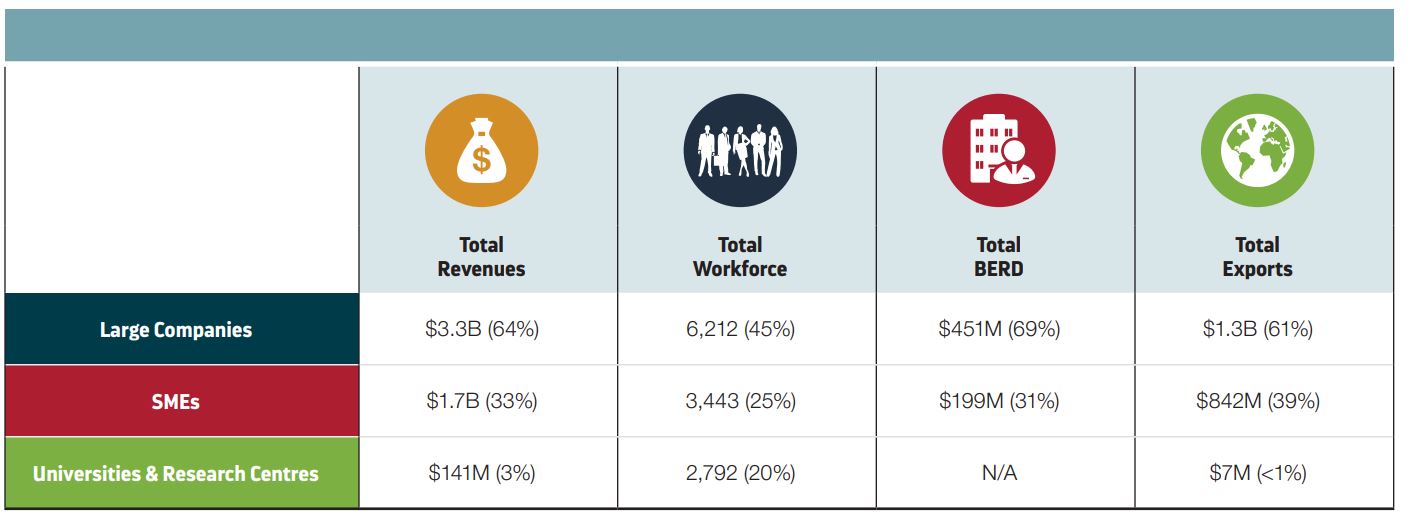
- What You Should Know about Canada’s Space Sector
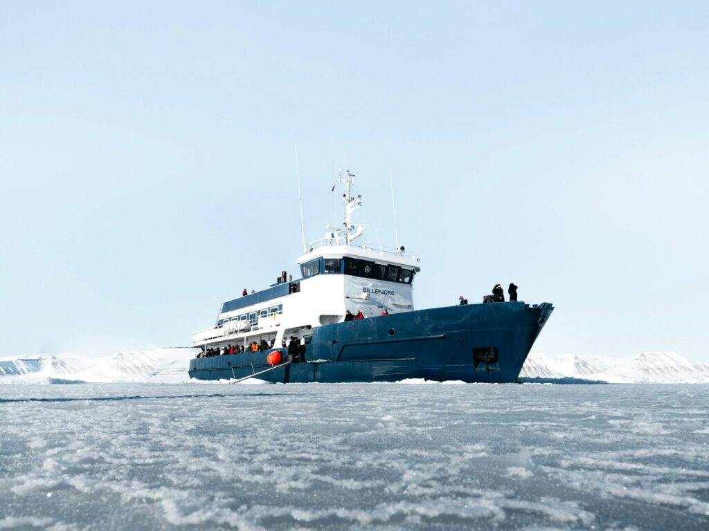
- Arctic Shipping Firms Ask Decision-makers to Invest in Infrastructure and Mapping and Data Tools
- SpaceBound: Canadian Space Companies Outline What’s Needed
- Summerside Pauses Flood-Plain Mapping Update
Award-Winning Calgary Innovation by UCalgary Researcher for Revolutionary 3D Mapping Technology
Faramarz Samavati, a computer science professor at University of Calgary, has been honored with the Mitacs Innovation Award for his two decades of work in a made-in-Canada digital earth system. His work focuses on developing the Discrete Global Grid System (DGGS), a fundamentally new way to model the Earth that avoids the distortions inherent in traditional flat-map GIS tools. In partnership with Calgary software studio Vivid Theory and startup BigGeo, the technology is now being commercialized. The DGGS provides ultra-fast, high-resolution geospatial search and supports applications such as agriculture, climate resilience, drone path planning and industrial routing, while preserving Canadian data sovereignty. Read more here.
Coastal Risk Map Shows Your Neighborhood Vulnerability
Are you living along the Sunshine Coast in B.C.? You might want to check out the region’s new coastal-risk maps. They show which neighbourhoods are most exposed to erosion and flooding today, and how things could change with 0.5 m, 1 m, or even 2 m of sea-level rise. The maps break down vulnerable shorelines, highlight at-risk properties, and offer guidance for future building and planning. if you’re looking for resilience options, the Green Shores program is a great place to start. Read more here.
What You Should Know about Canada’s Space Sector
The latest Canadian Space Agency (CSA) report shows the sector is growing, innovating, and creating tons of new opportunities. Canadian space companies are expanding globally, developing new tech, and supporting a stronger workforce, especially in areas like robotics, Earth observation, satellites, and AI. The industry is also becoming more research-driven, with more companies building next-gen space tools and partnering internationally. At the same time, Canada still faces challenges like talent shortages and a shifting global market. If you’re interested in where the future of Canada’s space economy is headed, this report offers a great overview of the momentum building across the country. Read more here.
Arctic Shipping Firms Ask Decision-makers to Invest in Infrastructure and Mapping and Data Tools
Shipping companies operating in Canada’s Arctic are calling on the federal government for better maritime infrastructure, including advanced mapping, ice-breaker support, and spill-response capability, so they can safely expand operations in the region amid growing traffic. They argue that enhanced resources will help maintain supply lines to remote communities, support the resource sector, and build a secure Arctic shipping corridor for the coming decades. Read more here.
SpaceBound: Canadian Space Companies Outline What’s Needed
Canadian space companies at the SpaceBound conference say they’re ready to expand globally if the federal government steps up with clearer strategy and stronger support. They urged Ottawa to refresh the national space strategy, increase long-term investment, and use economic diplomacy to help Canadian technologies break into global markets. Companies also stressed aligning space spending with national needs like Arctic connectivity, Earth observation and security, and doubling down on areas where Canada already leads, such as robotics and satellite communications. Read more here.

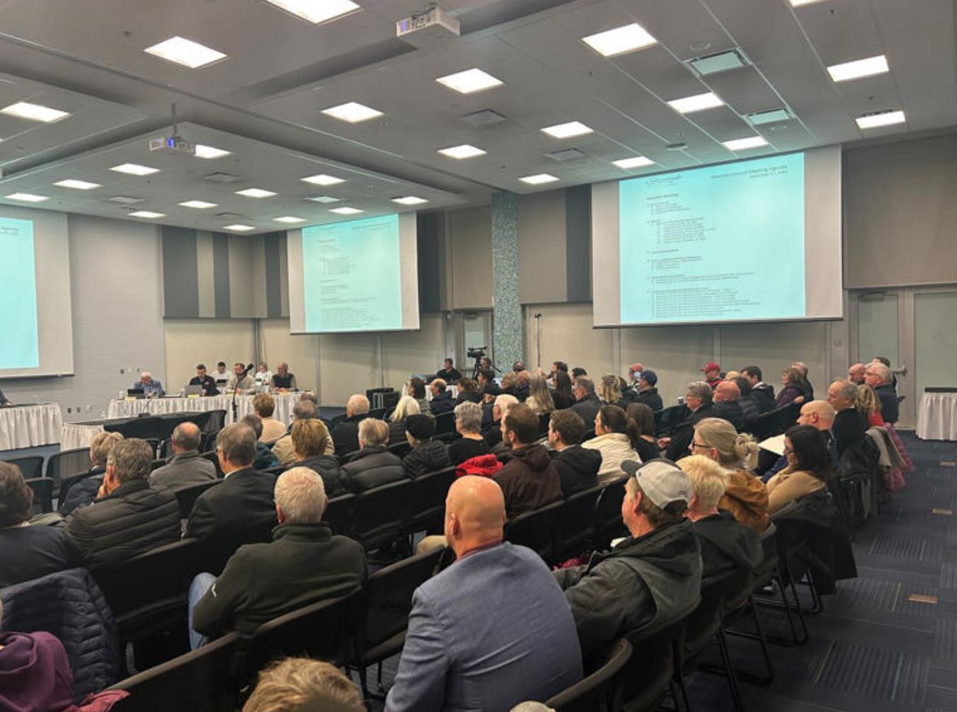
Summerside Pauses Flood-Plain Mapping Update
In Summerside, at the council’s regular monthly meeting, a large crowd showed up to voice concerns about a proposed bylaw change tied to updated flood-plain mapping. Many residents worried the new maps could hurt property values or increase insurance premiums. After hearing those concerns, council voted to reject the proposed update. The decision highlights the tension between the need for accurate, climate-driven flood forecasting and the financial impact such designations can have on homeowners. Although long-term flood risks remain, the city will pause the update and continue consulting with residents before moving forward. Read more here.


Be the first to comment