- Mapping the Semá:th X̱ó:tsa (Sumas Lake) after 2021 BC Floods.
- Mapping the health of Canada’s lakes.
- Canadian Geospatial Startups Revolutionizing the Industry.
- Google Maps and inaccurate routes.
- Nova Scotia plans flood plain mapping by 2026.
- New maps show how climate change might reshape our planet’s biomes.
Mapping the Semá:th X̱ó:tsa (Sumas Lake) region following the BC floods of 2021
After the catastrophic floods that impacted southern BC and Washington state in 2021, a team at Raincoast Conservation Foundation went to the former Sumas Lake area in the Fraser Valley to assess the water quality. A total of 11 surface water sites and 4 groundwater sites were used to collect water samples. The report reveals poor habitat quality for fish in the Fraser Valley, highlighting our inability to safeguard these waters for the future. A map was created using Sentinel-2 Imagery to show the overlap between the 2021 floodwaters and the historic Semá:th X̱ó:tsa. The map also included sampling site locations, which were used for contaminant analysis.
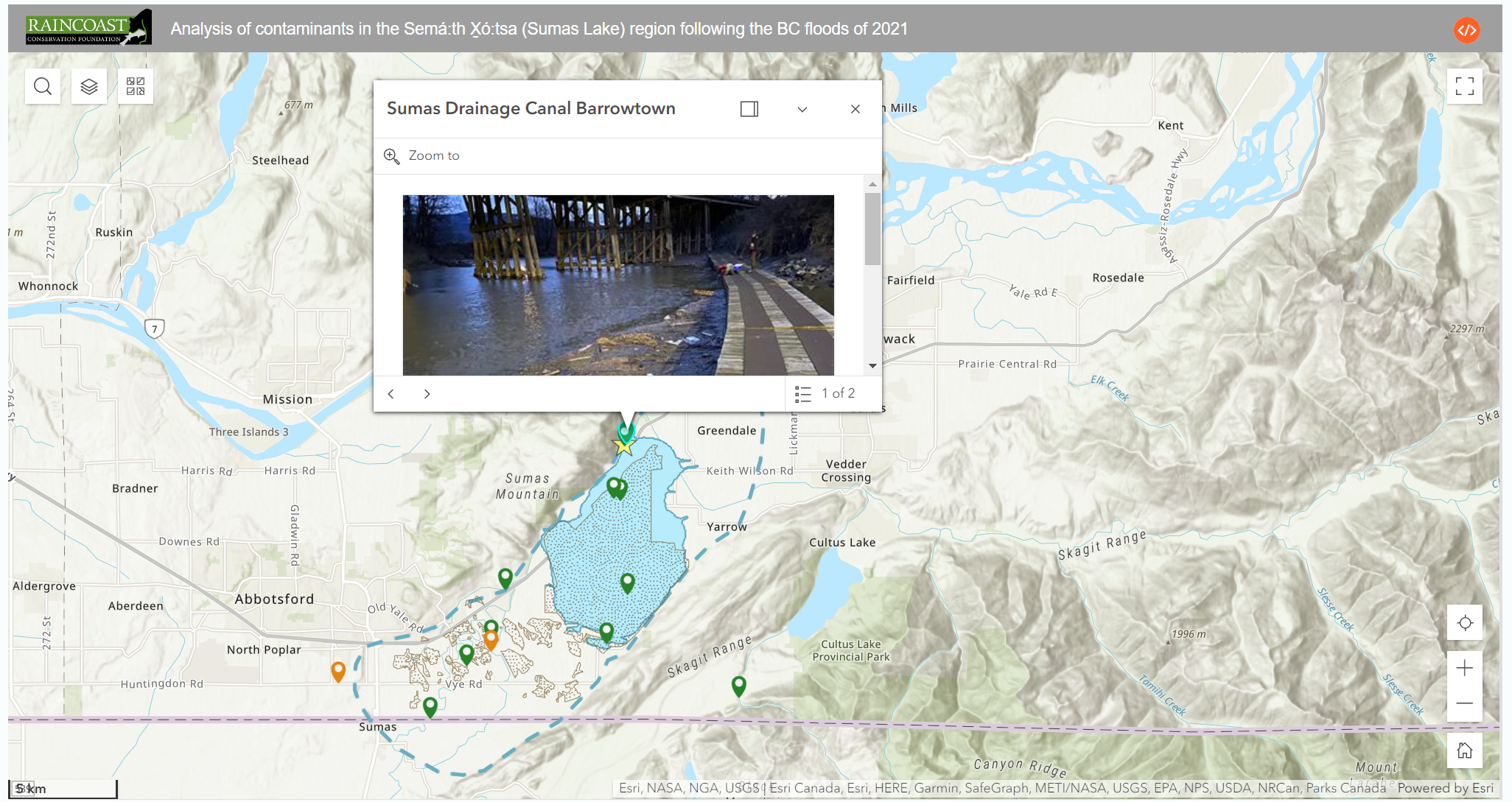
Map showing the surface water and groundwater testing sites. Source: Raincoast Conservation Foundation
Article can be viewed here
Mapping the health of Canada’s lakes
Canada has over 900,000 lakes, which are essential sources of water for our population; however, climate change, invasive species, pollution, farming, urbanization, and industrialization are threatening their health and ecosystem services. A team of biologists at Université de Montréal examined 659 lakes in 12 ecozones in southern Canada. They created a map displaying Canada’s lake conditions with lighter colours showing regions that are more problematic.
The map shows the following lake health by region:
- Eastern Canada – high recreational activity.
- Quebec and Nova Scotia – a mix of high recreational use, altered ecology and a moderate threat level.
- Southern Ontario – lakes face significant changes, threats and extensive usage.
- Western Canada – threat to lakes posed by agriculture and urbanization is greater than the threat posed by low recreational use.
- Southern Manitoba – lakes have undergone very little alteration.
- Southern Saskatchewan – high threat level and alteration.
- Northern Canada – recreational use is minimal and lake alteration is low.
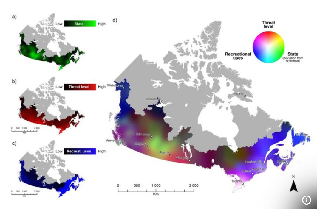
Map showing lake health in Canada. Source: UDEMNOUVELLES
Article can be viewed here
Which Canadian Geospatial Startups are Revolutionizing the Industry Today?
An article from the Canadian Venture lists 15 Canadian Geospatial Startups from various industries such as e-commerce, aerospace, construction and natural resource management. A list of all startups can be viewed here.
Article can be viewed here
Google Maps and inaccurate routes
Drivers keep going the wrong way down this Ottawa street. Google Maps is to blame
A one-way street in Ottawa is not recognized by Google Maps and drivers are often directed to go in the opposite direction when using the navigation tool.
Article can be viewed here
Non-existent trail removed from Google Maps after another rescue in Vancouver’s North Shore mountains
After the second rescue in only a few months a non-existent trail in Vancouver’s North Shore mountains has been removed from the Google Maps app. BC Search and Rescue has been concerned about the steep and dangerous trail for some time. They say that Google Maps should not be used for hiking and suggest apps that are more accurate such as AllTrails, Gaia or Strava.
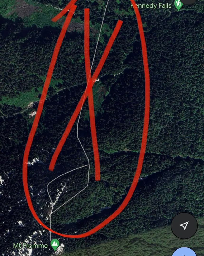
The fake trail that was on Google Maps. Source: Google Maps
Article can be viewed here
After July floods took 4 lives, Nova Scotia plans flood plain mapping by 2026
Following the flooding in July, emergency managers in Nova Scotia realized the need for detailed flood plain maps and have established a plan to create them by 2026. LiDAR and other data sources will be used to create maps that display the amount of potential water accumulation in various regions during coastal and inland flooding. The maps will consider various factors such as water flows, tides, precipitation, and surveys of structures like bridges and culverts, along with existing data on river depth and coastal basins.
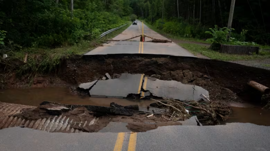
Flooding that caused a washed-out roadway occurred in Nova Scotia in July 2023. Source: Darren Calabrese/The Canadian Press.
Article can be viewed here
New maps show how climate change might reshape our planet’s biomes
According to a recent study, climate change will cause significant changes to plant and animal life worldwide, resulting in a shift in biomes by the end of the century. The study used climate models and historical data from over 170,000 meteorological stations dating back to 1901 to map these changes. This study suggests that while temperatures will rise globally, the largest increase will occur in higher latitudes.
Northern and mountainous regions of Canada will undergo significant changes. The climate zones in southern Ontario and Quebec will expand into the northern territories and western provinces, having a major impact on insect infestations and wildfire seasons. Coastal temperatures in British Columbia could extend further inland, and some parts of the province may experience a Mediterranean climate during summer.
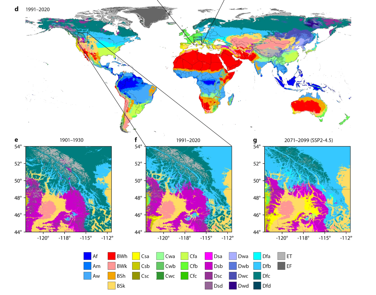
Map showing Köppen-Geiger for 1901–2099 for Western Canada based on constrained CMIP6 projections. Source: Scientific Data.
Article can be viewed here



Be the first to comment