
- Vancouver-Based URSA Project Models Urban Resilience to Shape Climate Policy
- Quebec City First in Canada to Join Google’s Project Green Light
- Canadian Rocket Launches Signal Growth in Space Sector
- Port of Churchill Envisioned as Canada’s Arctic Gateway
- Mapping Salt Pollution Along Lake Ontario’s Urban Shoreline
Vancouver-Based URSA Project Models Urban Resilience to Shape Climate Policy
Research conducted by University Canada West is promoting new urban resilience modelling work to enable cities to prepare for the ongoing and ongoing effects of climate change. The work is being conducted through the Urban Resilience to Social and Environmental Challenges (URSA) Project, implemented under Associate Professor Dr. Abedeh Gholidoust’s direction. The URSA project uses climate hazard data aligned with socio-economic indicators to identify vulnerable populations who can benefit from developing more inclusive or data-informed climate policies. In this way, they build a new structure for demonstrating how urban-scale knowledge can be integrated into national climate adaptation measures and strengthen those efforts.
Read more here.
Quebec City First in Canada to Join Google’s Project Green Light
Quebec City is working with Google to start Project Green Light, a smart pilot project on traffic optimization to reduce vehicle emissions through increased efficiencies in traffic signaling. In combination with Google Maps, the project uses AI to evaluate real-time driving data on traffic flows. The project seeks to make recommendations about optimal traffic timing to reduce idling and congestion. The pilot is part of a larger shift toward data-informed urban mobility across Canada.

Read more here.
Canadian Rocket Launches Signal Growth in Space Sector
Canada has a long history in space technology, and while it has never launched rockets into orbit from its own country, that is about to change as new Canadian companies, such as NordSpace and Reaction Dynamics, are about to start their rocket launches in Newfoundland and Nova Scotia. These companies are focused on developing rockets and launch infrastructures within Canada to create true sovereign access to space. Along with increasing Canada’s space capabilities, there is hope for a growing space economy, new job opportunities, and the retention of aerospace talent in Canada. These companies, combined, represent a significant step forward in enhancing Canada’s relevance in the global space economy, while delivering on Canada’s space strategy and partnerships.
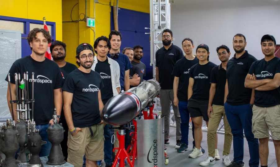
Read more here.
Port of Churchill Envisioned as Canada’s Arctic Gateway
Federal support is being provided for a significant investment in the Port of Churchill, Manitoba, which Premier Wab Kinew hopes will serve as a transformational trade endeavor. Kinew is seeking a $30 billion investment for the port to serve as a strategic gateway, connecting Canada to European, South American, and Arctic markets. Churchill is Canada’s only deep-water Arctic port with rail links, and it has faced economic and infrastructure challenges in the past. It’s not only a major seaport, but it has also seen substantial amounts of shipping redirected elsewhere due to infrastructure difficulties, so it has undergone serious challenges. The new investments, contracts with some shipping companies, and willingness to work closely with Indigenous and local communities to rebuild are all combined with a great plan to rebuild the Port. With this plan, these efforts will provide an economic boost to the regional economy, create jobs, and increase Canadian export capacity through markets that have previously been underutilized.
Read more here.
Mapping Salt Pollution Along Lake Ontario’s Urban Shoreline
Western University Ph.D. student Junwei Zhu is spearheading a research project on the effects of road salt from urban runoff into groundwater discharging directly into Lake Ontario along the Toronto shoreline. Using a combination of electromagnetic imaging and high-accuracy Global Navigation Satellite System (GNSS) technology, Zhu uses better location data to map salt concentrations as he assesses pollution hotspots. This research closes a significant knowledge gap by addressing direct groundwater discharge, which is often overlooked in studies of salt pollution. The research aims to inform municipalities about road salt application policies in order to protect freshwater quality while also informing urbanized centres that may be supporting similar environmental challenges.

Read more here.


Be the first to comment