By Peter Willis (www.making-remote-sense.tumblr.com)
 Considering the speed at which the UAV industry seems to be flying these days, three Remote Sensing students from the Centre of Geographic Sciences (COGS) in Lawrencetown, Nova Scotia decided to embark on an experimental project. The idea was to compare the results of using original photographs (many of them from various means) to create a georeferenced 3D model of Fort Anne in Annapolis Royal, Nova Scotia, to the results of using an Optech Ilris Terrestrial LiDAR scanner for the same structure. In short, a small budget model vs. a big budget model, and the accuracy they produce.
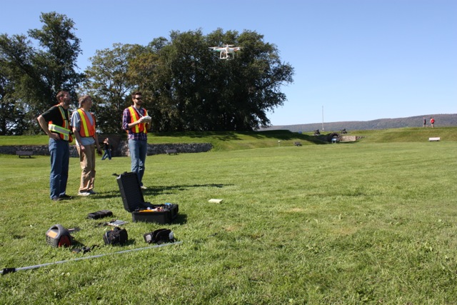
And so students Peter Willis and Garett Gaudet, under the guidance and tutelage of faculty Trevor Milne, Paul Illsley and Jim Norton, set to work to figure out just how they would accomplish the task. For the photogrammetric model, software such as Agisoft’s Photoscan will be used, as well as the open source platforms Python Photogrammetry Toolbox, developed by ATOR (Arc-Team Open Research), and MeshLab, a powerful 3D triangular mesh renderer. The photogrammetric research will consist of much trial and error, and thankfully, COGS is located within 30 minutes of Fort Anne, meaning field excursions can occur fairly regularly, and at minimal cost. Stage one of the process involves acquiring as many photographs as possible from a fixed lens at ground level, pole elevated (14 feet), and aerial using a Phantom DJI Quadcopter. Presently, our testing has indicated that the best time for taking photographs is at mid-day, under completely overcast conditions. These conditions serve to assist the software in determining identical points within the photos. Shadows and uneven lighting hinder this process greatly, making it nearly impossible to identify ‘like points’.


The photos included in the article are a few preliminary shots, and the lesson in how to fly the Phantom DJI to capture the aerials. We look forward to keeping GoGeomatics in the loop about our findings and results.
For comprehensive information about the Phantom DJI Quadcopter, and examples of the results it can produce within Photoscan, please visit the website of Paul Illsley: http://www.paulillsley.com/airphoto/systems/Phantom/


Be the first to comment