
What follow is a list of websites that are hosting online maps of the coronavirus in Canada.
As our community is all about the maps I would be curious as to what you think is the best map in terms of GUI and information presented in a useful manner.
In no particular order:
CTV has a tracking page with stats and a map here
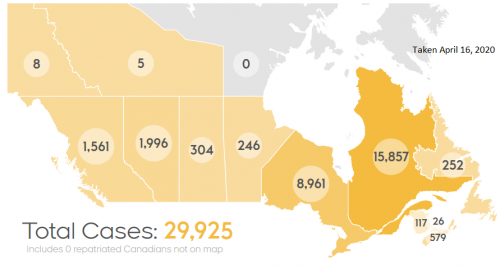
https://www.ctvnews.ca/health/coronavirus/tracking-every-case-of-covid-19-in-canada-1.4852102
Macleans’s has a “Heat” map of the outbreak available
Health Canada has another example of mapping the data here:
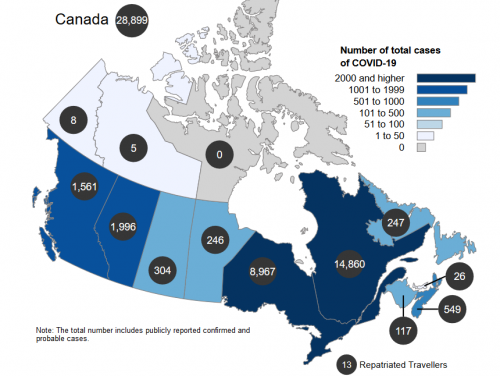
https://www.canada.ca/en/public-health/services/diseases/2019-novel-coronavirus-infection.html


Be the first to comment