pandemic

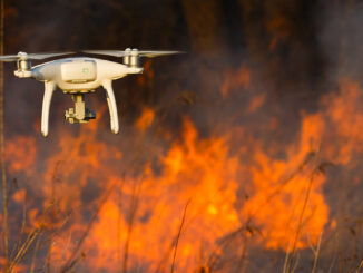
Disaster Management Made Difficult by the Pandemic – Drones to the Rescue!

Natural disasters, to say the least, have jeopardized the livelihood of millions, and the Rohingya refugees in Bangladesh are not…

Code in Place: Free Python course hosted by Stanford University

Last year, almost at the beginning of the COVID-19 pandemic, I attended a Python programming course for almost five weeks.…

The Evolution of Mapping Disease

The current pandemic is highlighting how important GIS is in understanding and interpreting data. History shows the evolution of GIS…

How Location-Based Services Can Help to Locate Mass Social Gatherings

Social Distancing and Illegal Assemblies The coronavirus pandemic is changing our living habits. Social distancing measures have been implemented to…

Results: Pandemic Survey of the Canadian Geospatial Sector

In October of 2020, GoGeomatics Canada conducted a survey of how the Canadian geospatial sector was coping with the global…

Project Pandemic

Canada Mobilizing Maps, Data, and Investigative Journalism for Project Pandemic

Access to information should not be determined by where we live. Project Pandemic is a data co-op and collaboration designed…

COVID-19: Supporting Kamloops, BC businesses using Story Maps

In the middle of March 2020, COVID-19 pandemic leads to social distancing rules in Canada. Public areas such as restaurants…

Your Canadian Geospatial Briefing for June 15th: Canadian Drone delivery solution; City of Montreal open data; Tagged leatherback sea turtles; Endangered Fish in BC

Drone company will convey COVID-19 medical equipment to First Nation Drone Delivery Canada (DDC) will transport COVID-19 medical products using…

GeoIgnite 2020 Online; Canada’s National Geospatial Leadership Conference: An Interview with Jonathan Murphy

GeoIgnite Online 2020: The theme for this year is (no surprise): Leadership In Times of Disruption Next month the Canadian…