
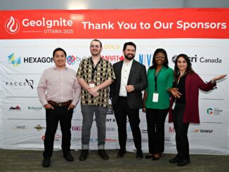
The Fast Pitches session on November 5, 2025 was once again one of the most energetic and unconventional highlights of the GoGeomatics Calgary Expo.
This rapid session challenged presenters to distill their idea, product, or project into a crisp 3-minute pitch, followed by 3 minutes of pointed Q&A from a panel of geo-journalists and seasoned industry experts and additional commentary and questions coming from other experts in the audience.
This year’s judging panel featured Charlie Trimble, Gavin Schrock, and Anusuya Datta, who kept the tempo sharp and the questions focused. Their role was simple but demanding: evaluate each pitch on impact, feasibility, and the ability to communicate a story under serious time pressure.
Summary of 1st Pitch
Company: VEERUM
Product or Service : 3D Visualization Software
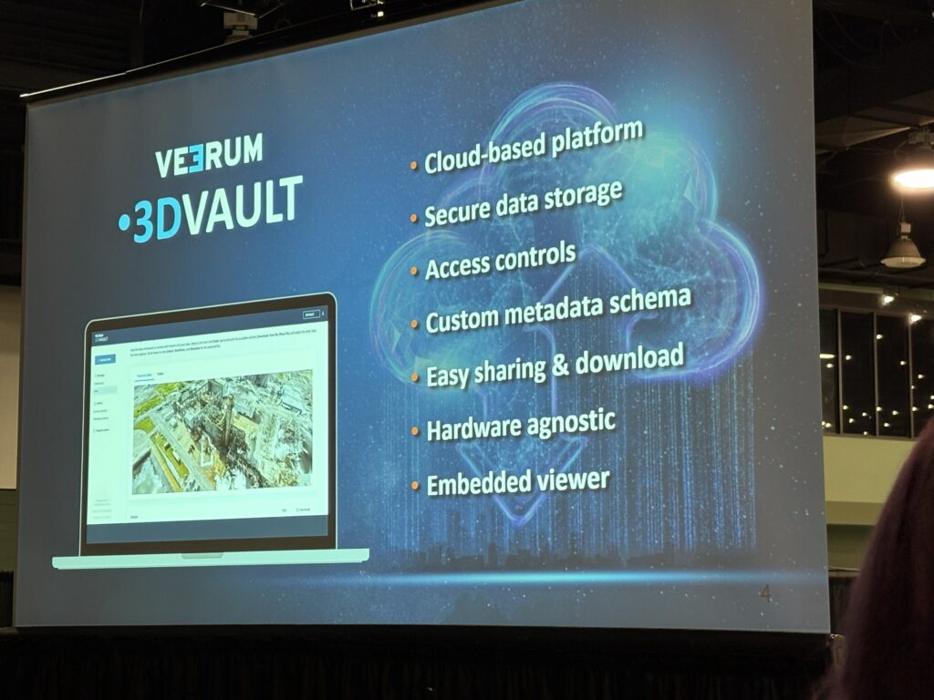
VEERUM is a geospatial technology company offering a cloud service that hosts, visualizes, and utilizes large reality-capture datasets. The platform allows organizations to work with reality capture data directly in a web environment. The platform was launched last year which functions like “Dropbox for reality capture” but designed for massive datasets. It supports open architecture, so data can be integrated however you want. Governments and large organizations use this system to democratize access to 3D and geospatial content. The company’s vision is simple: make reality capture data accessible to everyone, because the value of this data is huge for operational decisions.
Summary of 2nd Pitch
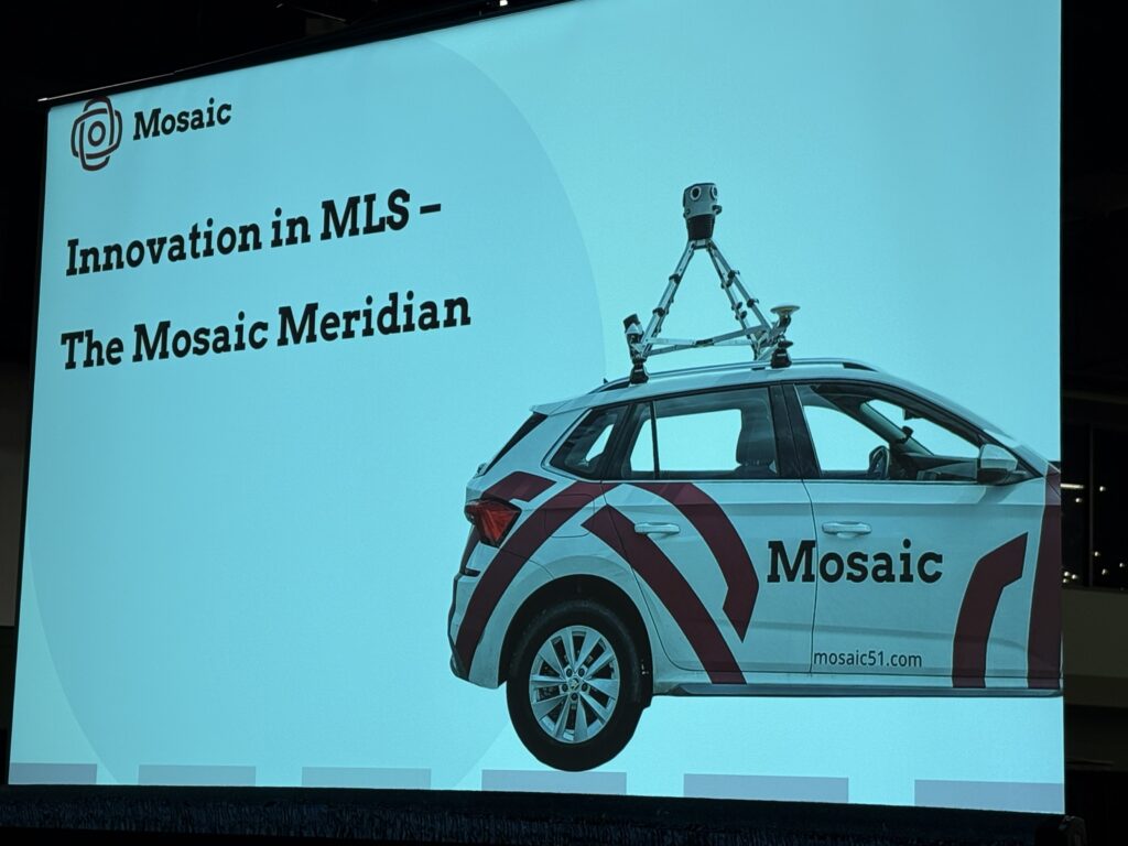
Company: Mosaic51
Product or Service: Phoenix LiDAR + High-Resolution Imaging System
The challenges in today’s reality capture industry:
While technology is advancing quickly, many organizations chase higher point density just for the sake of it. But more points mean heavier datasets, longer processing time, and more complexity.
The company’s belief: capture only as much detail as needed for the use case.
For asset inspection or feature extraction, the priority is alignment and image resolution, not necessarily maximum points. Many people can interpret images, but far fewer can interpret raw LiDAR.
So a seamless, integrated system combining a high-resolution Mosaic AX camera with the Phoenix LiDAR sensor, capable of up to 800,000 pts/sec was created. It mounts easily (about 15 minutes setup). After a full day of capture, you get next-day processed deliverables.
This system was designed for real-world workflows where image clarity helps non-specialists understand the data.
Summary of 3rd Pitch
Company: Sparkgeo
Product or Service: Shopterra
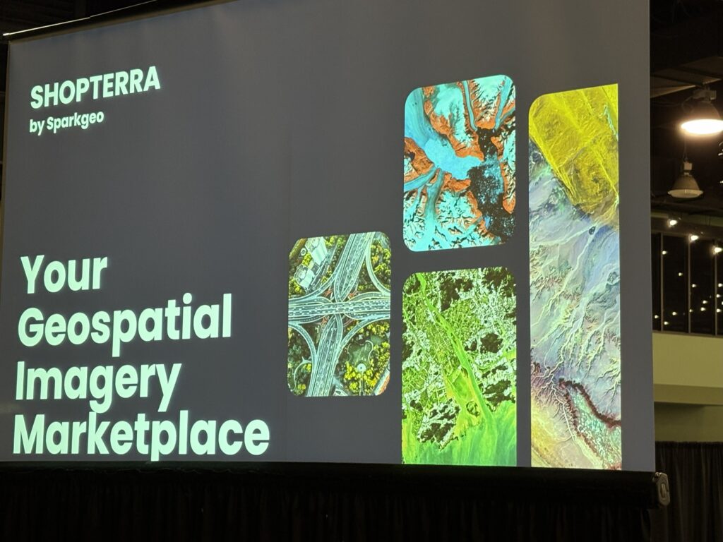
Data is one of the most valuable resources, especially for AI, but most geospatial data sits in silos. Sparkgeo is building the infrastructure that allows geospatial data producers to connect with AI developers.
Shopterra makes data monetizable, accessible, and usable by building a structured marketplace and pipeline. Automation, analytics, and AI are driving enormous demand for Earth observation data, and the amount of data produced is growing.
Shopterra helps organizations store, structure, and distribute their data so it becomes part of the larger geospatial-AI ecosystem. The goal is to unlock new value for both data owners and AI systems that need training data.
Summary of 4th Pitch
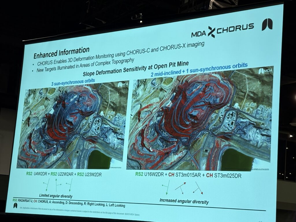
Company: MDA Space
Product or Service: Satellite Constellation for High-Frequency Radar & SAR
MDA is launching a fourth-generation SAR satellite constellation with improved revisit rates and response times. The system includes a new satellite with a high-resolution radar sensor and light enough to task fast (less than an hour).
The constellation flies in a mid-inclination orbit (around 53 degrees), providing access across most populated regions. Once complete, it will image 97 percent of the Earth between 62°N and 62°S.
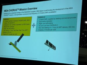
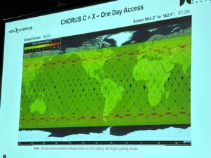
A key feature is combining north–south SAR observations with east–west passes to improve directional information and reduce ambiguities. This provides better insights.
Summary of 5th Pitch
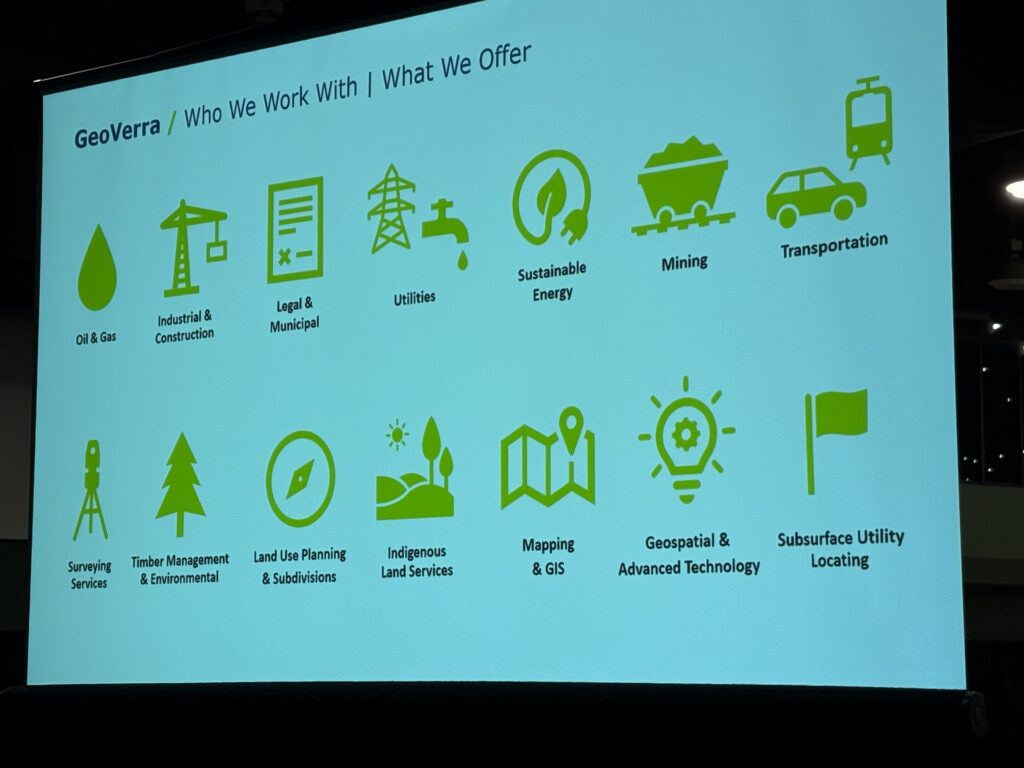
Company: GeoVerra
Product or Service: Real-Time Survey/Inspection Workflow
GeoVerra provides industry-leading reality capture services and integrated digital-twin workflows that cover mobile mapping, wearable mapping systems, UAV & LiDAR, laser scanning, GPR, bathymetric surveying, and more in asset management and operation management .
Their solutions transform complex datasets into actionable models and portals, supported by AI/ML-enhanced detection, classification, and change monitoring.
The aim is to enable clients to move from raw survey data to decision-ready insights faster, more safely and at lower cost than traditional methods.
Summary of 6th Pitch
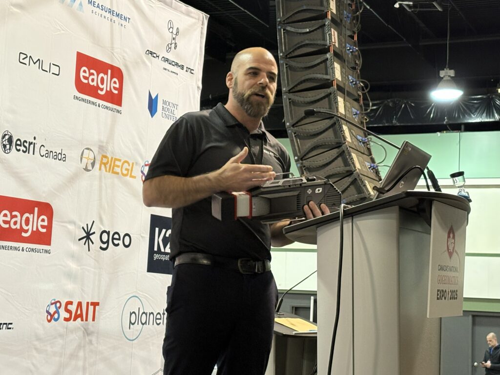
Company: Balko Tech
Product or Service: Drone Mapping + In-House Software
Balko Tech is a manufacturer of UAV-mounted sensors and also the creators of their own.
Their value is combining hardware reliability with in-house software, allowing customers to get accurate results without complicated post-processing. They support integrations with major drone platforms.
The market is competitive, especially with big players, but their strength is reliability, support, and custom modifications for specific industries.
Summary of 7th Pitch
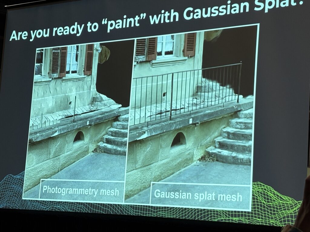
Company: PIX4D
Product or Service: PIX4D software
PIX4D created a new way to reconstruct construction scenes using AI. Traditional photogrammetry requires thousands of images and hours of processing. Their model treats the scene like a collection of “Gaussian splats,” similar to how some AI art models work.
This allows very crisp reconstruction of structures with far fewer images and extremely fast output. For example, 25 minutes of capture can produce a finished, detailed scene.
The goal is to reduce time spent both in the field and in the office, while improving clarity for engineering teams.
Summary of 8th Pitch
Company: Desert Creative Group
Product or Service: Visual Positioning + Field-to-Office Collaboration
Desert Creative Group’s system uses cameras, IMU, and GNSS to create real-time, field-processed point clouds. The operator walks with the system, captures imagery, and receives processed results immediately.
The goal is fast turnaround and strong collaboration between field and office. Visual positioning enables operators to confirm coverage live, reducing rework and improving inspection accuracy.
This technology works in urban, indoor, and remote environments.
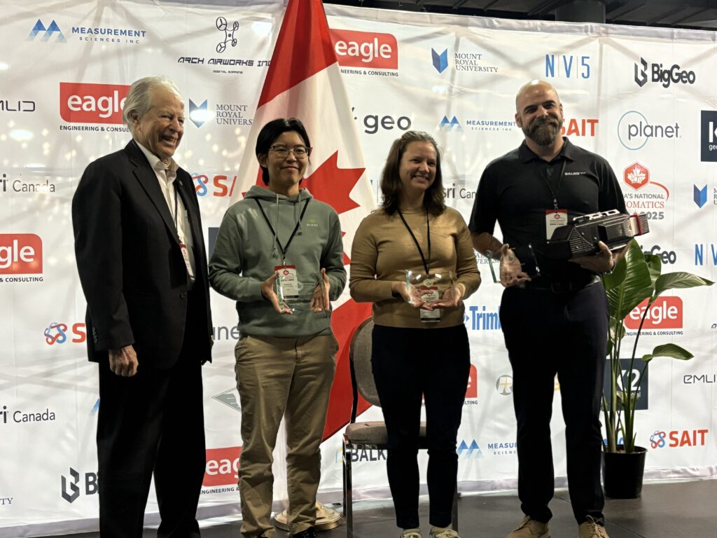
Pitch Highlights:
After dozens of fast, punchy presentations, the judges selected three standout winners whose pitches demonstrated both substance and spark:
Rosana Lin (Pix4D), Peter Bienvenu (Balko), and Janeale Dean (Desert Creative Group).
The session unfiltered a window into emerging ideas across the geospatial sector, delivered with urgency, passion, and just enough mayhem to keep everyone awake.


Be the first to comment