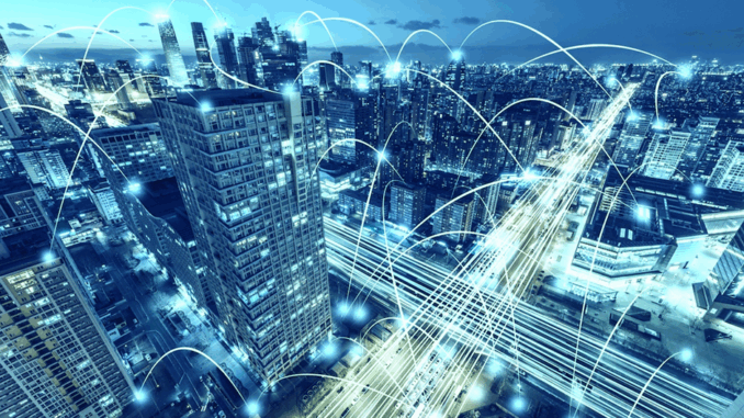
Geospatial artificial intelligence or GeoAI is a type of artificial intelligence or machine learning that is used to model future results. It operates on GIS technology and utilises tools for statistical modelling, computer vision, and simulation (Chiappinelli, 2022, para. 4).
In today’s era, technology is the foundation of a successful mapping organization (Snow, 2020, para. 1). The introduction of new technologies like automation in spatial analysis, artificial intelligence, deep learning etc. have improved the overall productivity of geospatial organizations (Snow, 2020, para. 2). Therefore, the intersection of geospatial technology with AI and location is the most interesting development for mapping modernization (Snow, 2020, para. 5).
Geographic information systems (GIS) and artificial intelligence (AI) have significantly converged during the past 10 years. While GIS is a powerful technology, the enormous data sets and broad range of applications for AI, artificial intelligence offers advanced methodologies for GIS projects. As GIS requires such sophisticated mechanisms to deal with various spatial information, there are two main AI methods widely used in GIS including artificial neural networks and fuzzy logic (Voženílek, 2009, p. 279). Artificial neural networks (ANNs) provide techniques to learn from data and map it further. It consists of neurons and connectors, which looks similar to the neuron structure of a brain. Most of the ANN architectures consist of similar components which include neurons aligned in a row that are called layers. Each neuron in a layer is coupled to every neuron in the layer above it and the layer below it. Moreover, in the spatial phenomenon, ANNs can provide better understanding by modelling the complex systems and offering the flexible tools that learn to recognize patterns and relationships in the data (Voženílek, 2009, p. 280).
The applications of GeoAI are as wide and diverse as our imaginations. Many applications like remote sensing, image classification and object detection using computer vision, improve visual clarity and allow higher zoom levels using super-resolution networks, extract geospatial information from unstructured data using natural language processing, deep learning application for large 3D geospatial datasets etc. and have shown positive trends in GeoAI. Now, let us look at few examples of GeoAI in practice (Goforth, 2020, para. 10).
- For a long time, the retail site planning sector has benefited from demographic and other geographic data. The human mind can only conceptualise roughly 11 possible causal factors at once, according to research. However, machine learning has no limits and thus, it is one of the key factors to offer remarkable advantages for analyses like this. Machine learning allows you to examine as many causal factors as you like, avoiding the need to make assumptions in favour of an equal analysis of all the data to spot patterns you would not have initially thought to look for (Goforth, 2020, para.11).
- GeoAI has been utilised in environmental health to carry out precise and highly resolved modelling of environmental exposures, including measuring exposures that have previously been challenging to collect. For instance, GeoAI techniques are being used to extract built environment aspects (i.e., urban green space or natural environments). Deep learning (convolutional neural networks or CNNs) was applied to WorldView-2 satellite remote sensing images and volunteered geographic information (VGI) to automate map generation for buildings in Nigeria as part of a study intended to address the lack of building maps in developing countries for sustainability goals related to disaster relief and poverty reduction. The built environment might be characterised with high spatiotemporal resolution by scaling these methodologies in future research to analyse larger study areas, undertake population-based research, and include more temporal data (Boulos, Peng, & VoPham, 2019, p. 3).
- The geographical distribution of illnesses has been described and analysed using GeoAI in epidemiology, as well as the influence of location-based determinants on disease outcomes. For instance, using data from the National Center for Health Statistics Natality Files, machine learning (K-means clustering) was used to identify spatiotemporal patterns of gestational age at delivery for 145 million births in more than 3000 US counties from 1971 to 2008 in order to facilitate hypothesis generation related to the aetiology of preterm births (Boulos, Peng, & VoPham, 2019, p. 3).
- In order to transform physical items such as buildings, roads, cars, electronics, plants, animals, and human beings into digitally linked “things”, IoT-powered smart cities primarily rely on the use of sensors. There is a significant quantity of real-time data generated by these IoT sensors installed in cities, most of which are geotagged or geolocated. GeoAI is crucial for processing and deciphering such geographical and real-time massive data, as well as for advancing the concept of smart cities. For example, smart/connected bins with wireless sensors have been used by cities like Barcelona, New York, and Dublin to detect and monitor waste levels in real time (Boulos, Peng, & VoPham, 2019, p. 6).
As mentioned in the above applications, GeoAI has already been implemented for various sectors and it provides time efficient techniques and accurate outcomes in those sectors. However, it has not been fully developed yet in a few areas and hence, there is a need to find more innovative ways in GeoAI for a simpler life. Above all, it is clear that GeoAI is very useful for solving real world problems and therefore, the future of geospatial developments may significantly rely on it.
References
Boulos, M. N., Peng, G., & VoPham, T. (2019). An overview of GeoAI applications in health and healthcare. International Journal of Health Geographics.
Chiappinelli, C. (2022, March 1). What is GeoAI? Discussion its Benifits and Pitfalls. Retrieved from esri.com: https://www.esri.com/about/newsroom/publications/wherenext/think-tank-ongeoai-simulation
Goforth, E. (2020, August 19). GeoAI and You: The Future of GIS, Today – GEO Jobe. Retrieved from https://geo-jobe.com/: https://geo-jobe.com/mapthis/geoai-and-you-the-future-of-gistoday
Snow, S. (2020). Future Impacts of GeoAI on Mapping. Retrieved from esri.com: https://www.esri.com/about/newsroom/arcuser/geoai-for-mapping/
Voženílek, V. (2009). Artificial intelligence and GIS: mutual meeting and passing. International Conference on Intelligent Networking and Collaborative Systems. IEEE.


Be the first to comment