Back as an in-person/hybrid event, this global showcase for geomatics hardware, software, and solutions revealed some interesting trends.
The annual Intergeo exhibition is massive, and the recent event in Essen Germany October 18-20, was nearly back to pre-pandemic attendance levels. I walked the three exhibition halls for three days with GoGeomatics founder and general manager Jonathan Murphy and could not get to every booth.
The state of geomatics solutions development has, if anything, continued to accelerate unabated. A visit to Intergeo is a true geo-geek-heaven experience: there was always something new and intriguing to see and learn about. In years past, most of the larger vendors would make major product announcements at Intergeo, and while they are now tending to spread those out over the year, smaller players and startups find Intergeo to be a prime showcase for their innovations.
Hear are a few items that highlight some key trends in the industry:
Smarter Scan Pucks
There is still a substantial market for large-format scanners and pre-engineered systems, like terrestrial scanners for surveying and mobile mapping systems. But with lidar being added to everything from consumer products to ‘prosumer’ products, UAV, backpacks, etc., a new wave of vendor has risen to provide modular components that just about anyone can attach to just about anything.
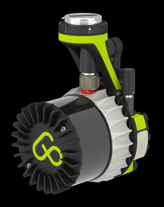
A good example showcased at Intergeo 2022 is the Ap-Lidar-One from aerial-precision. Weighing in at only 590 grams (about 1.3 pounds), at first glance it looks like just another lidar “puck” (that folks could buy and integrate with DIY and open-source software). But instead, it is a powerful SLAM scanner with built in processing; you can export industry standard format files on a data card as soon as you are done scanning.
The sensor is an OUSTER OS1, capable of 1.3M points per second with a +/5cm accuracy at 120m. They offer several mounting options: standard tripod thread, and adapters for most of the popular UAV platforms. We saw numerous vendors offering sensors similar to this, but this one seemed to be quite well developed and ready-to-map for multiple applications.
Our takeaway is that smart modular scanners like this will open up possibilities for mapping from just about any platform. There will be less excuses for not sticking scanners on more vehicles and platforms, to get to the continuous-representation-of-reality dream of ubiquitous digital twinning—or at least a good step in that direction.
Painless As-builts Just a Click Away
There has been a sustained wave of GNSS-based field tools for asset mapping, utilities mapping, and asset management. You can find numerous field mapping applications, like ArcGIS Field Maps, Trimble TerraSync, Zeno Field, Penmap and many more. Running such apps on a tablet or phone that can, for instance, sync up and update enterprise GIS is commonplace for utilities. By adding a GNSS receiver as a peripheral to provide a high precision positions to the field app, enterprises are now able to manage assets precisely and very efficiently.

Yet we have seen some trends in this wave of field asset mapping that perhaps needed more attention. One is that to keeps costs low, many enterprises are buying very-low-cost GNSS receivers that may not perform well in sky-view-challenged areas and high multipath environments. In what might be a penny-wise-and-pound-foolish move, they forget that most utilities are in roadway corridors, that are often lined with GNSS perturbing trees and structures. The other issue we often see is that these field mapping systems, sometimes made up of an amalgam of components, still require user training and take some time to master, especially in evaluating site conditions for GNSS observations.
The founders of the Netherlands firm marXact studied the workflow of utility workers, specifically fiber operators. Once the field installer or maintenance staffer completes the work, getting it mapped by a surveyor was often costly, and a scheduling challenge. The goal of marXact was to develop a workflow that any field staffer could do, with little or no training, no complications with connectivity, map the feature in just a few minutes, and go on to the next site. They looked at the key points of pain for field mapping: poor GNSS performance, complex connections to corrections services, cellular connection issues, cumbersome field software.
Thye developed their own field software, designed primarily with utility applications in mind. Next was to have a purpose-built, high precision GNSS rover manufactured, using an OEM board from one of the major GNSS vendors. In fact, it is the same OEM board found in several survey grade rover systems. It is full constellation and has no-calibration tilt compensation. Next, they sell the system with a bundled cellular data plan and access to an RTK network corrections service. Lastly, but very important, they have live support where users can call in and the support specialist can remotely debug their rover. Another nice touch is the light ring around the rover, that you can set to indicate things like GNSS quality, tilt status, serve as a backlight, and more.
Yes, there are folks who will say that this sort of solution creates “button pushers”. But if the solution is well thought out, those “buttons” equate to a lot of efficiency.
Rounding Out Scanner Portfolios
A popular product in the Riegl booth was their new VZ-600i terrestrial scanner. It has the look and feel of the current batch of terrestrial scanners from other large vendors, including the trend towards larger on-board screens with simplified commands and workflows. But it is also a very powerful machine. You can do a 30 second scan (thsat imcludes images) that yields points at 6mm spacing with 3mm accuracy at 10m and works well for longer ranges of course.The VZ-600i bucks the trend of high-end terrestrial scanners in that it does not do full dome scans. Well, it does not have to. If you really need to scan what is above, then as you move it from one scan station to the next, those features will be captured anyhow. By not having to accommodate full dome scanning, it’s dual heads can deliver high precision rapidly.

Trimble has also added a new high-end scanner to their portfolio, the X12, which was built in cooperation with prominent scanner manufacturer Zoller + Fröhlich. Filling in the range above their popular X7, it can scan at up to 2.18 Million points per second at ranges up to 365m. Range noise is 0.2mm with a density of 0.6mm at 10m. A big plus is the large screen, and simplified commands that make for improved workflows. The X12 drew a lot of attention at the huge Trimble booth (as did their popular coffee bar).
Affordable GNSS Structural Monitoring Sensor
GNSS sensors are very powerful for structural monitoring applications, delivering low-noise timeseries at high rates. Yet they can be a pricey proposition. It was only a matter of time until someone came up with a more affordable sensor, and solar powered to boot.

Netherlands based Basetime B.V., a provider of precision monitoring solutions has developed a solar powered automated monitoring sensor with GNSS and ground-distance-measuring radar. I need to verify the price, but it sounds like the Locator One comes in at under $1,000 per unit. This would certainly send ripples through the precise monitoring community.
Solid State Lidar
Solid state lidar is not entirely new, and there has been a lot of development of numerous such sensors, particularly for vehicular autonomy and robotics. However, many of these are MEMS-based and still have some opto-mechanical components. XenomatiX developed their solution as true solid-state lidar. “The idea was to get the motor out of lidar,” said Karsten Bronowski of XenomatiX. “When you have moving parts, you have wear and tear, the effects of vibration, problems with long term reliability, and with controlling temperature—with true solid state lidar you eliminate these issues.”
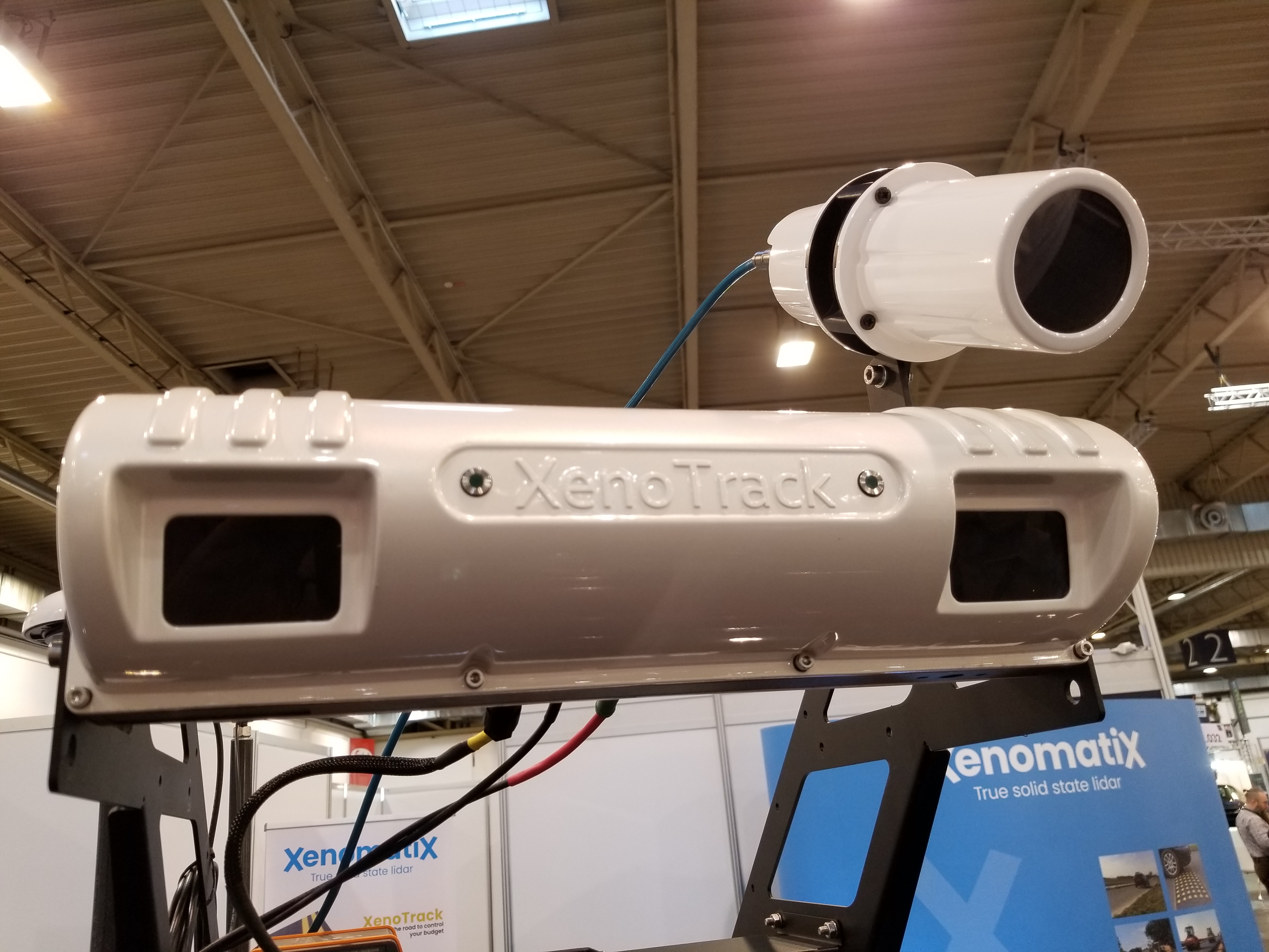
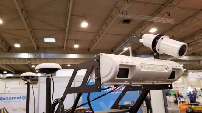
While this was developed for multiple applications, the one on display was vehicle mounted crossbar with dual lidar sensors, that applies triangulation techniques for roadway preview road condition mapping. The precise positioning is achieved with a high-end GNSS/IMU system with dual antennas for heading, and they’ve added some their own proprietary processing to the solution.
A Huge Exhibition
As I mentioned; there were too many exhibits to cover, even over three days. I have a stack of business cards and notes to work through, with far more cool stuff than I have outlined. Some of the solutions we’ll follow up on, and publish some deeper dives and case studies.
There was an exhibitor reception one evening, with many vendors sponsoring food and drink. Stonex hosted a particularly huge bash, that one attendee described as an “Italian themed disco party, with a wall of cases of beer.”
Of course, the question is, why is there no similar event in North America? There are large vendor centric conferences, and some broad reach geospatial events like GeoIgnite and Geo Week, but nothing quite like Intergeo. That should change in 2023, with a planned GoGeomatics Exhibition that will have it’s inaugural event in Calgary in the fall of 2023; with many of the exhibitors at Intergeo expressing interest in participating. Stay tuned; we’ll keep you posted on developments.




Be the first to comment