In this presentation, Calvin Klatt talks about how the U.S. reference system modernization effort will replace the North American Datum of 1983 (NAD83) with a new North American Terrestrial Reference Frame (NATRF2022), and what it means for Canada. Calvin is the Director of the Canadian Geodetic Survey, Surveyor General Branch, NRCan and Chief Geodesist of Canada.
The Canadian Geodetic Survey and the United States National Geodetic Survey have collaborated for over a century to provide the fundamental reference systems for latitude, longitude and height for their respective countries. Together our reference systems have evolved to meet today’s world of GPS and geographical information systems, while supporting legacy datums established using traditional surveying techniques. To meet future needs and the ever-increasing accuracy of GPS, the United States will adopt a new positioning reference, the North American Terrestrial Reference Frame of 2022 (NATRF2022).
Why is the United States adopting NATRF2022?
- Improved compatibility with Global Navigation Satellite Systems (GNSS), such as GPS, is driving this change. The geometric reference frames currently used in Canada and the United States, although compatible with each other, are offset by 2.2 m from the Earth’s geocentre, whereas GNSS are geocentric.
- Real-time decimeter-level accuracies directly from GNSS satellites are expected to be available soon.
- With NATRF2022 as the reference for geospatial information, the offsets between geospatial products (such as maps) and positions obtained directly from GNSS will be minimized.
What it means for Canada?


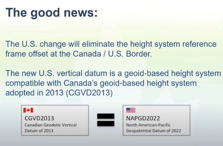
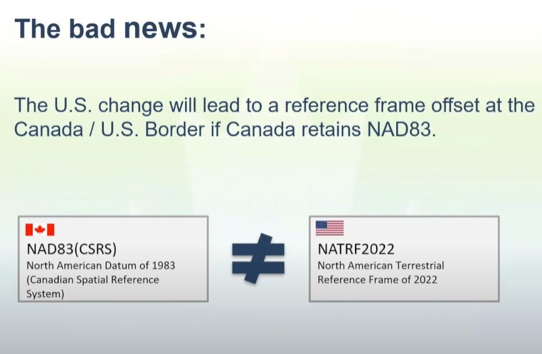
Though this will help eliminate the vertical offset at Canada US border but it will introduce a horizontal coordinate offset of 1.3 to 1.5 meters at the Canada-United States boundary. For example a vehicle in Canada, positioned in NAD83(CSRS) using real-time GPS crosses the border into the United States would experience an offset by over a meter from any features (e.g. roads) tied to NATRF2022, if no transformations are applied.
There are compelling reasons for Canada to follow suit and adopt the NATRF2022 frame as our national standard, while also recognizing that there are challenges in doing so for the geospatial community who could bear most of the costs to make this change. The Canadian Geodetic Survey is working closely with the United States National Geodetic Survey in defining reference frames to ensure they will also be suitable for Canada, and taking steps for providing transformation tools and parameters.
Additional information
- An introductory technical note on NATRF2022 appears in Geomatica.
- The CGRSC website provides more details as well as contact information for CGRSC members
- The United States National Geodetic Survey website is a great source of background information on their modernization plans.
- Publication by NRCAN to know more and also voice your concerns.
GeoIgnite is Canada’s National Geospatial conference hosted by GoGeomatics Canada. GeoIgnite was held online using Zoom between July 22nd to 24th, 2020. This free event showcased Canadian geospatial community and leaders of Canada’s location technology sector. The conference brought together professionals from government and industry for innovative programming and updates on our sector. Every year GeoIgnite is a unique opportunity for the geospatial community in Canada and abroad to learn, share, and engage with one another at our virtual conference.


Be the first to comment