
At GoGeomatics, we believe Canada’s geospatial future belongs to many voices — not just one. From GIS and BIM to Earth Observation, cartography, open source, and user groups, our sector thrives when communities have space to grow and connect.
That’s why co-hosting is now central to our events like GeoIgnite and the GoGeomatics Expo. These aren’t just trade shows – they are shared platforms for the entire ecosystem.
Here’s how it works:
- One big national event in the East and West in a year, run by Canadians for Canadians
- You run your AGM, user conference, or meet-up; we handle logistics and the trade show
- You keep full control of your content
- Shared space, shared costs, lower overhead
- National exposure and access to fresh audiences
- We take care of event marketing, so you gain reach and visibility
We have built this to bring together:
- Government
- Private sector
- Academia
- Nonprofits
- Community groups
Co-located events benefit from greater visibility, deeper collaboration, and stronger momentum. This model works because it’s supported by the communities it serves.
A Spotlight on GeoIgnite 2025
Held in Ottawa, GeoIgnite 2025 brought together professionals from across Canada to explore geospatial, BIM, digital twins, GEOINT, AEC, and AI — with co-hosted programming playing a key role.
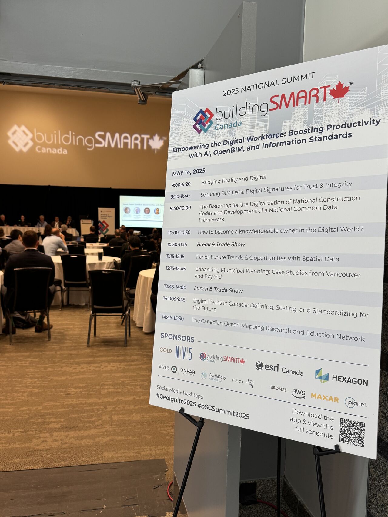 buildingSMART Canada 2025 National Summit: The summit focused on productivity, data interoperability, and digital adoption, with sessions on AI, OpenBIM, and aligning BIM and GIS. By holding the summit within GeoIgnite, it created opportunities for the BIM and geospatial communities to meaningfully connect — strengthening alignment across sectors.
“buildingSMART Canada’s collaboration with GeoIgnite to host the 2025 bSC National Summit alongside Canada’s National Geospatial Leadership Conference highlights a strategic move to unite the historically separate domains of BIM and GIS. BIM and GIS are no longer isolated tools for different experts; they are complementary technologies that, when integrated, enable a full spectrum view of our environments,”By bringing together macro scale geospatial intelligence with micro scale design precision we are championing a holistic approach that improves sustainability, resilience, and the performance of both digital and physical assets. We believe that this year’s co-hosted events further advanced the conversation in Canada and brought value to all attendees.” – Claudia Cozzitorto, CEO, buildingSMART Canada
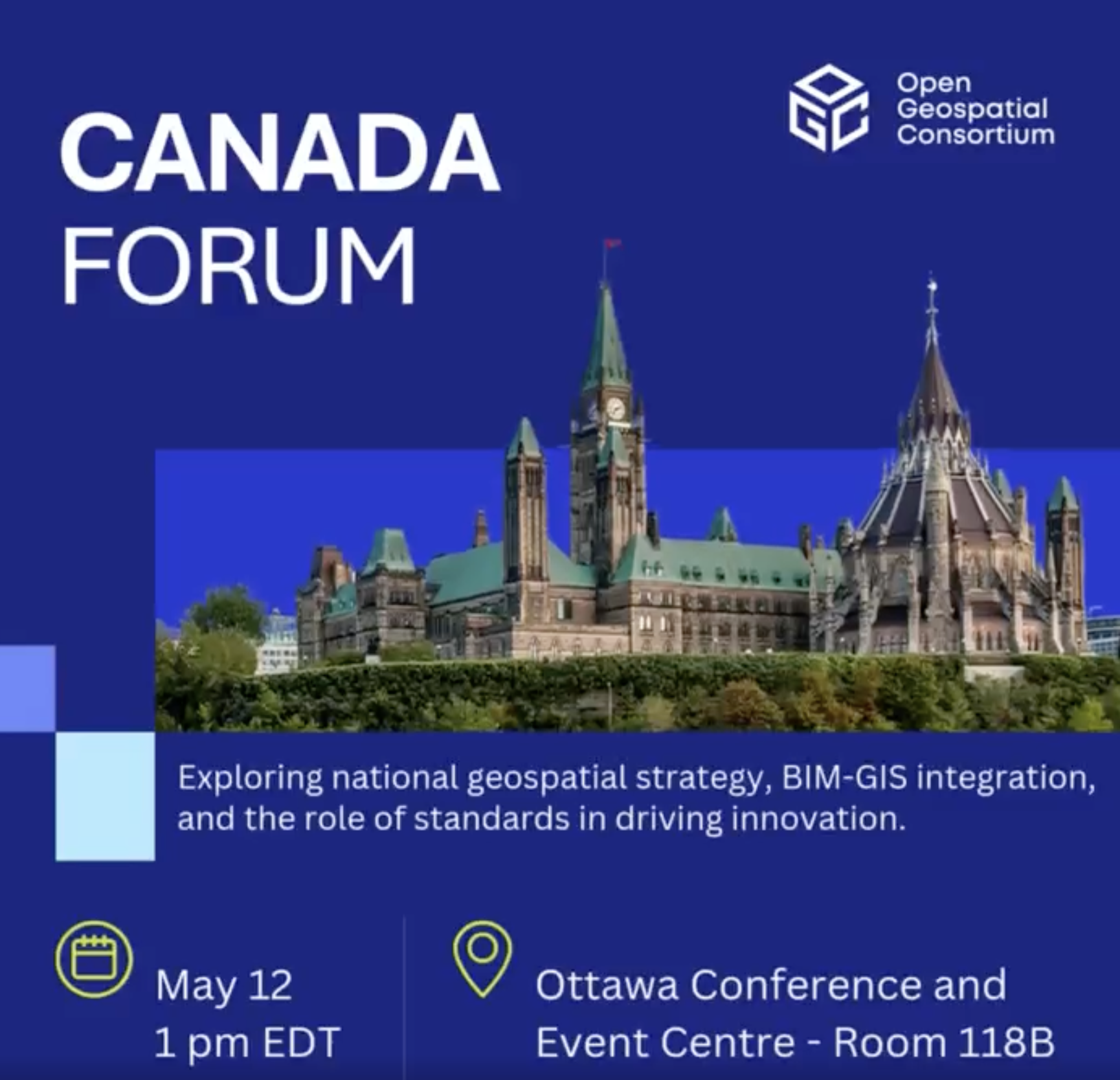
OGC Canada Forum: Hosted by the Open Geospatial Consortium (OGC), this forum brought together leaders from industry, government, academia, and Indigenous organizations to explore key topics such as the Canadian Geospatial Data Infrastructure (CGDI), the integration of BIM with GIS, and the role of open standards in driving interoperability and innovation.
 By embedding the forum within GeoIgnite, participants benefited from both focused technical discussions and broader national networking opportunities.
“We were proud to partner with GeoIgnite 2025 and co-host the OGC Canada Forum — a standout moment for Canada’s geospatial community. As part of the country’s leading geospatial conference, the Forum created space for real dialogue on priorities like Earth observation, digital twins, and Indigenous data sovereignty. The conversations reinforced the value of open standards and interoperability in addressing challenges like climate resilience and smart infrastructure—while also sparking new partnerships and pathways for innovation. Canada continues to play a key leadership role on the global stage, and we’re excited to keep the momentum going.” — Peter Rabley, CEO, OGC
NRCan Hackathon: Building Resilience with GEO.ca: A national student competition run with NRCan’s Centre for Mapping and Earth Observation. Finalists presented their solutions at GeoIgnite using open data from GEO.ca. Participants had one month to build their entries using open data and tools. The top three finalists were awarded tickets to GeoIgnite 2025 and invited to present their solutions. The session also featured an overview of GEO.ca.
“It was an absolute pleasure collaborate with GoGeomatics for the hackathon and to present the GEO.ca hackathon winners at GeoIgnite2025 on behalf of the Canada Centre for Mapping and Earth Observation (Natural Resources Canada). We were amazed by what the post-secondary students produced in only a month and we were delighted to have teams from technical institutes, colleges and universities across Canada. These bright minds give me so much confidence that we can find mitigating solutions to the biggest problems like floods, fires, tornadoes, and earthquakes.” — Jennifer Harju, Manager, GeoDiscovery, Canada Centre for Mapping and Earth Observation, Natural Resources Canada
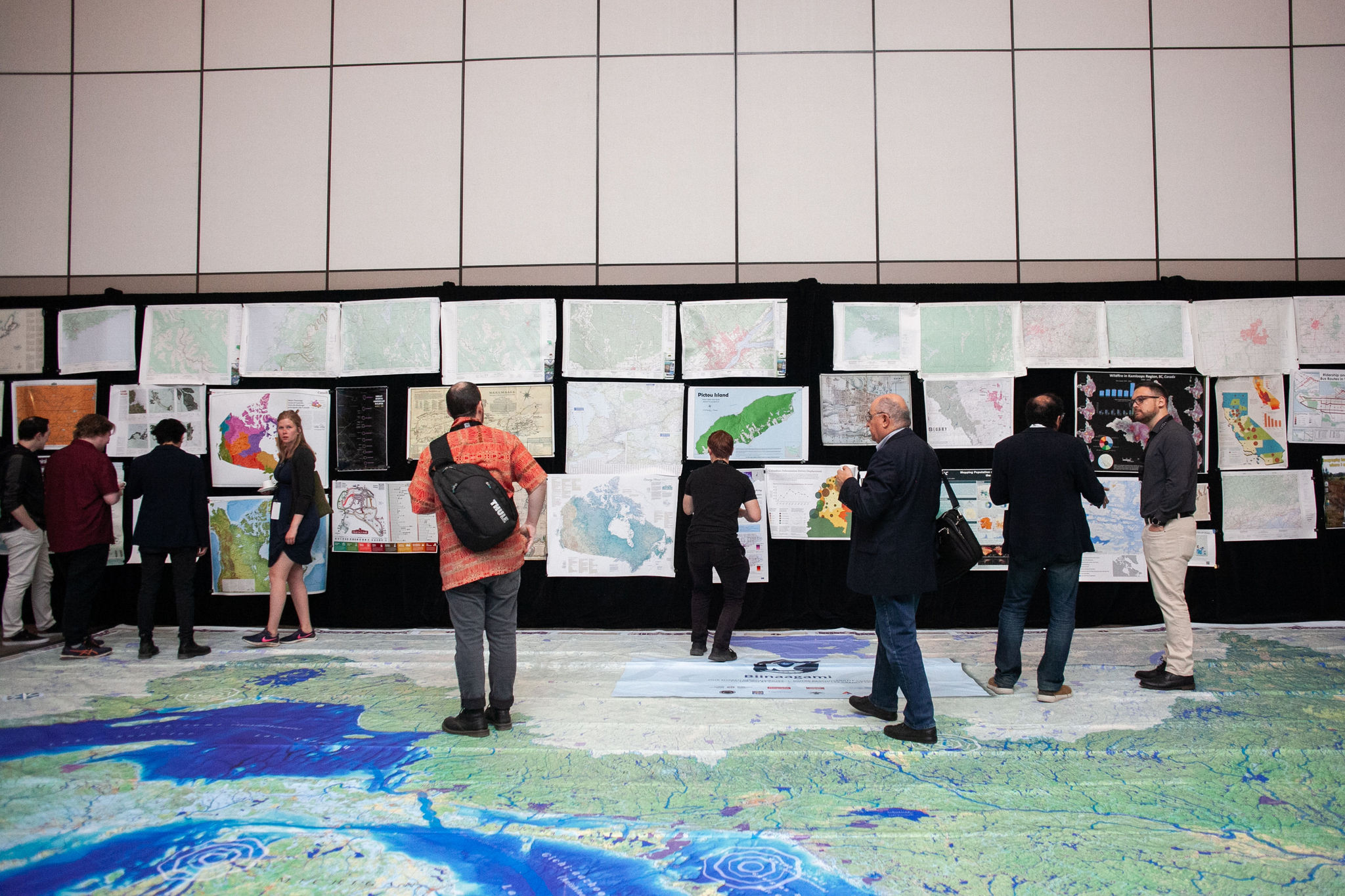 Canada Maps & Poster Gallery: This traveling exhibit returned to GeoIgnite 2025, showcasing outstanding cartographic work from across Canada. Located on the trade show floor, it offered attendees a chance to explore, engage, and be inspired. The gallery is a collaboration between GoGeomatics, the International Map Industry Association (IMIA), and the Canadian Cartographic Association.
“It’s been nice to see how the Canadian Maps Gallery has become an essential component at both Geoignite and the GoGeomatics National Expo. Attendees couldn’t seem to resist the captivating rich collection of cartographic work, and it was truly impressive to see so many professionals from all disciplines of geomatics share a common appreciation of the art of map making. Am looking forward to this year’s map gallery and encourage more people from the Canadian geospatial community to participate.” –Ted Mackinnon, former President, Canadian Cartographic Association (CCA) and chair of the Canada Maps & Poster Gallery Program.
Co-Hosted Programs at GoGeomatics Expo 2024
This wasn’t the first time. This model of collaboration was on full display at the GoGeomatics Expo 2024, where co-hosted programming brought focused communities into the national spotlight — a momentum that carried forward into GeoIgnite 2025.
- buildingSMART Canada 2024 Annual Summit: A recurring partnership that brought leaders from the BIM and digital construction ecosystem together to discuss interoperability, OpenBIM, and Canada’s path to digital transformation in infrastructure.
- OGC Canada Forum: A convening of standards experts, government stakeholders, and private sector voices to advance open geospatial standards and interoperability initiatives in Canada.
- Earth Observation Session: Supported by WGIC, this session explored how EO technologies are addressing urgent issues — from wildfire response to long-term environmental monitoring.
- Reality Capture & Digital Twins Program: Delivered deep insights into the expanding field of reality capture — from LiDAR to photogrammetry. Supported by the CanSLAM Circuit 2024, the session featured results from real-world trials in mobile mapping and SLAM, giving attendees a practical look at the future of geospatial data capture.
- Canada Maps & Poster Gallery: Iin partnership with IMIA and the Canadian Cartographic Association, this traveling exhibit celebrated cartographic excellence from across Canada, showcasing student and professional contributions.
- SUMDEX Program: A long-time partner of GoGeomatics, the Subsurface Utility Mapping Strategy Forum (SUMDEX) continued its tradition of hosting insightful sessions on underground mapping, damage prevention, and the future of utility data infrastructure.
Why Co-Hosting Works
Many user groups and association-led gatherings in Canada are doing great work in their domains. But by joining forces with national events, they can do even more:
- Reach new audiences who might not otherwise engage with their work
- Connect with funders, policymakers, and industry leaders at scale
- Build visibility for their initiatives, reports, standards, or innovations
- Contribute to shaping national conversations from a place of deep expertise
At the same time, national events like GeoIgnite and the GoGeomatics Expo benefit by:
- Showcasing more diverse voices
- Fostering depth in key topic areas
- Offering attendees a richer, more meaningful experience
- Help shape the national conversation around some of the critical issues. People who partner with us get to facilitate the conversation and elevate their stature.
- They get to join the conference advisory committee.
It’s a win-win model, strengthening both niche communities and the wider Canadian geospatial ecosystem.
If your organization is interested in co-hosting a session, forum, or program at a future GoGeomatics event, we’d love to hear from you.
Write to Jonathan Murphy at [email protected]
Or book a meeting: Book time with Jonathan Murphy


Be the first to comment