Young drone cartographer puts record-breaking on the map
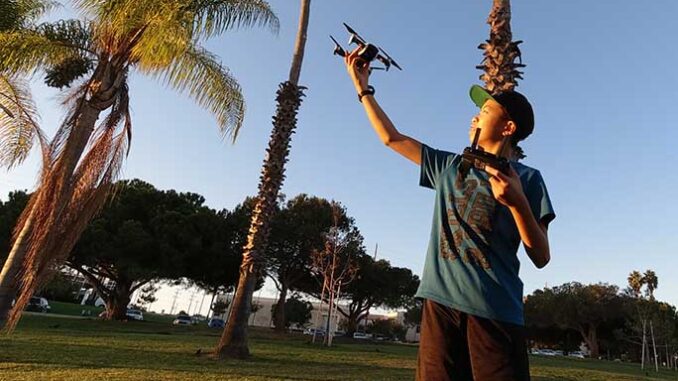
Nathan Lu from the USA is featured as the youngest drone cartographer in Guinness World Records 2021. He was an 11-year old boy when he heard about an online geotagging competition. He took aerial images using his cheap starter drone and digitized his neighbourhood and surrounding areas in Long Beach California, USA.

At the age of 14, as the youngest drone pilot and photographer, Nathan’s photos have been used by a digital mapping service, Soar (USA).
I have discovered that California is such a diverse place with so much to discover. I want to discover the earth with my drone and see it from a new vibrant angle. Just something as simple as taking aerial photos of my house has made me appreciate how special drones are.
Nathan Lu
These opportunities make him dream even bigger to establish his own drone focused tech-based company.
Read more here.
Global impact of COVID-19 on satellite data services market
The important parts of the space industry are Ground support equipment, spacecrafts, and the launch industry. Satellite accelerates communications, remote imaging, broadcast and all essential services for public health and safety and people’s well-being.
Some of the development factors of the global satellite data services market are geospatial imagery analytics big furtherance and high demand for small satellites for earth observation.
Below are some actions of Satellite Industry Association (SIA) member companies in Covid-19 pandemic:
- AT&T gives its video clients free extra content since TVs and movies are always a favourite source of entertainment for people staying at home
- BOEING provided healthcare workers with the first group of 3D-printed face shields.
In post-COVID-19, when the situation is under control, satellite data services market will experience specific changes, since companies and government agencies equip themselves for innovation transition to evaluate quickly and adapt their supplying system.
Read more here.
UgCS Industrial Solutions introduces the drone-integrated metal detection system
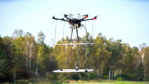
For 3 years we have been experimenting a lot with different metal detectors. Finally, we have found the sensor that works in full compliance with manufacturer estimates: an airborne (lightened) modification of the proven Geonics EM61-MK2 metal detector
Alexey Dobrovolskiy, CTO of SPH Engineering

This new system is capable of finding magnetic and non-magnetic objects in hard to reach or treacherous locations. It could be used for many applications, including UXO search, detection of underground infrastructure and archaeological requirements.
Read more here.
Geo4Dev: Making Geospatial Data And Tools More Accessible For A Better Understanding
The Geospatial Data for Development (Geo4Dev) is a notable collaboration with NGOs, policymakers, academia and private sectors. The establishment of this initiative is considered in December 2020. Present allies of Geo4Dev are the Center for Effective Global Action (CEGA), New Light Technologies (NLT), the International Initiative for Impact Evaluation (3ie), and the World Bank.

The purpose of Geo4Dev is to direct the development of anything needed for performing geospatial analysis such as new data, tools and methods. This analysis will be conducted for various diverse sectors, including agriculture and food security, urbanization, climate change, impact evaluation, humanitarian crisis, and disaster response.
The Chief Scientist of New Light Technologies Inc. (NLT), Ran Goldblatt, believes that Geo4Dev strives for more accessible geospatial data and significantly delivering training and tools to people who want to make a change by using this data.
Read more here.


Be the first to comment